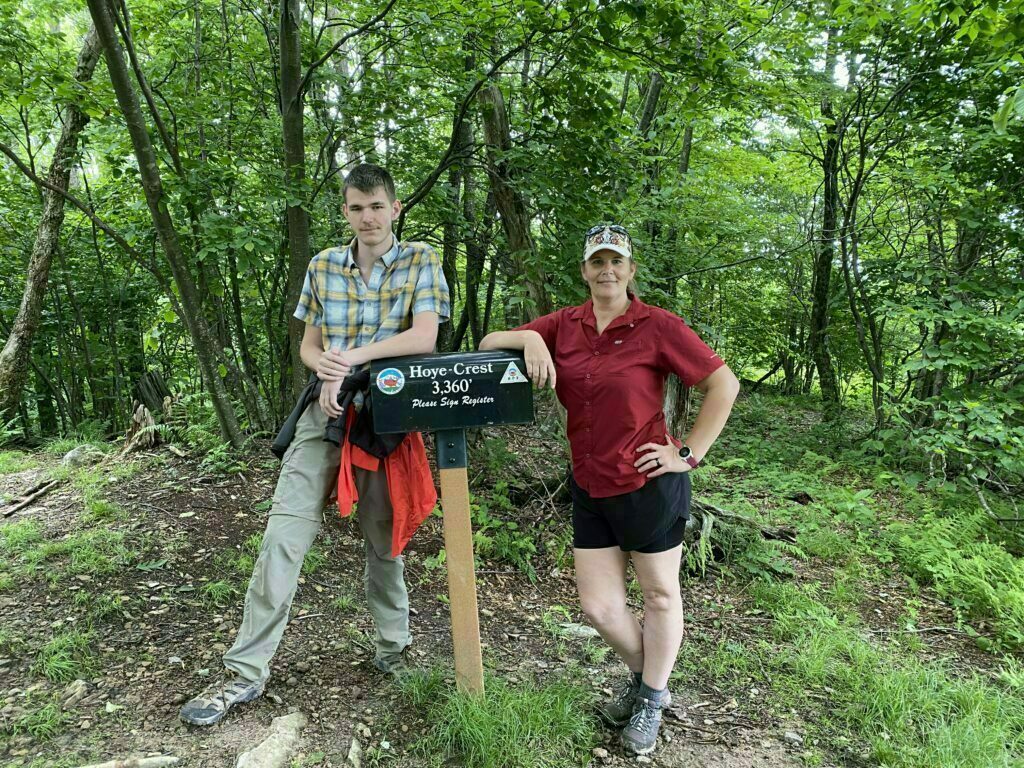
Rising 3,360 feet above sea level sits Hoye Crest on Backbone Mountain; the Maryland Highpoint. The trail is rated as moderate-difficult and is 1 mile, one way. If you are just getting started on your high-point bucket list, this is a pretty easy one to accomplish, for an even easier one, check out West Virginia Highpoint.
Date Visited: June 15, 2021
I decided to knock this puppy out over the summer while I was visiting my Mom. I was excited that both she and my step-dad also wanted to hike it with Bubbanator aka Star Blazer and I.
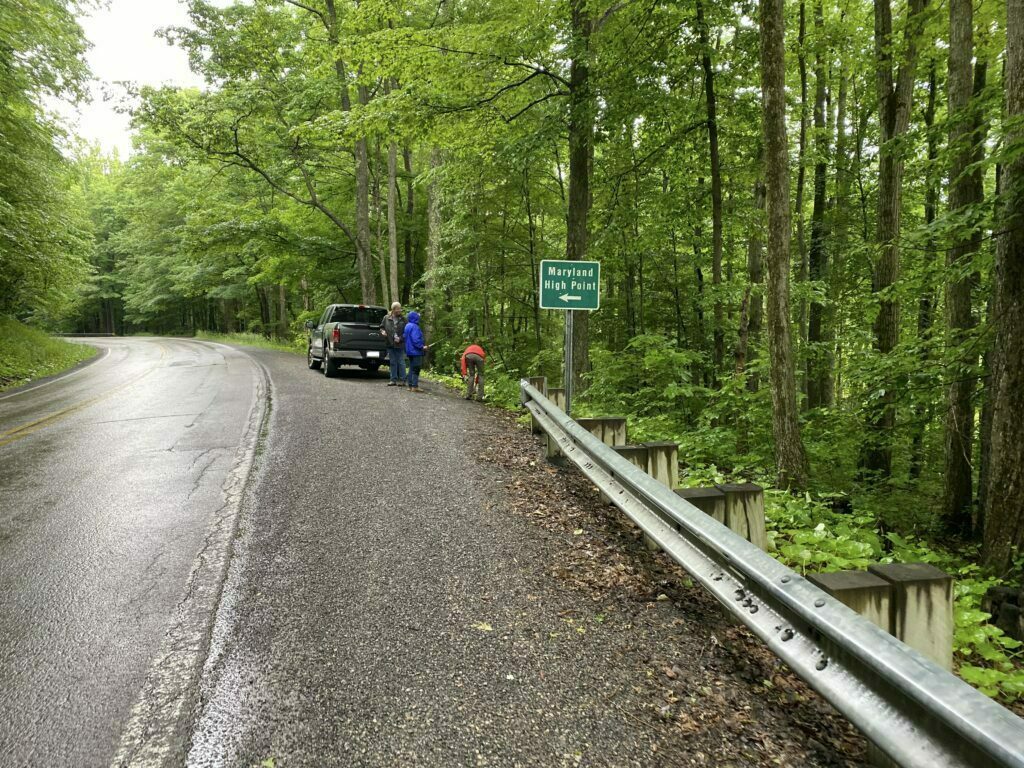
Parking Area for Maryland Highpoint
The parking area is actually along the highway, although I also saw what could be a parking area off of the highway, right before the start of the trail (see my video below for a better understanding). I believe it is part of the logging trail, so may not be legal to park there. Honestly, if that spot really is a parking area, it could only fit 2 cars max and would be hard to get out of. I would not attempt it without a 4WD especially if there is any chance of rain. I would just park along the highway to be safe.

Parking along highway Dirt Parking? (Located off of highway)
Maryland Highpoint Trailhead
Getting to the trailhead is easy. If you park along the highway, the trailhead will be up the hill across the highway from you.
If you park in the dirt lot, it will be directly next to you. =)
Hiking the Trail
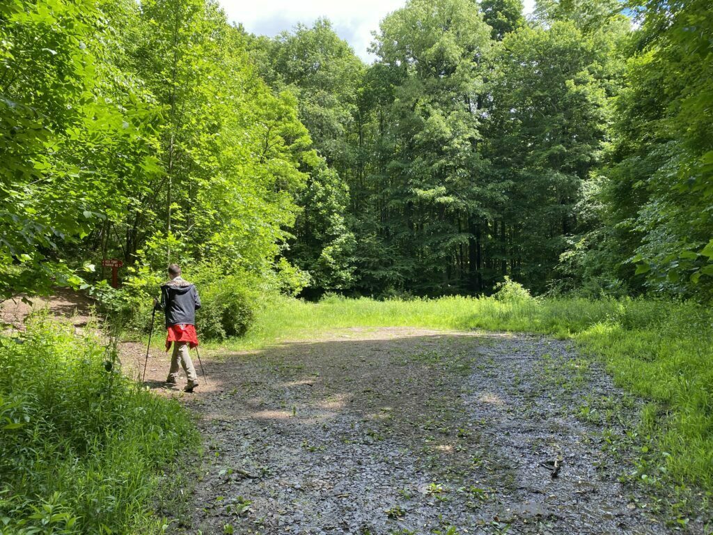
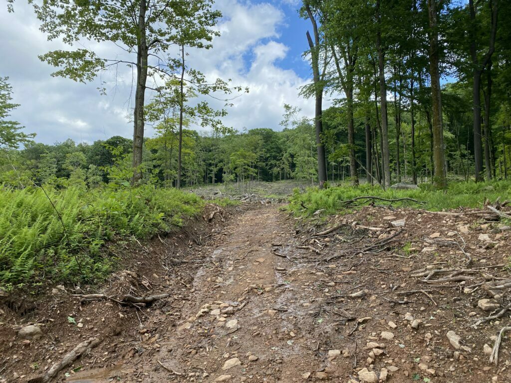
As of the time of my hike, there was a bunch of logging going on in the area and the trail was not marked very well at the beginning, but it’s pretty easy to follow for the most part as the trail for the first half is now a logging road.
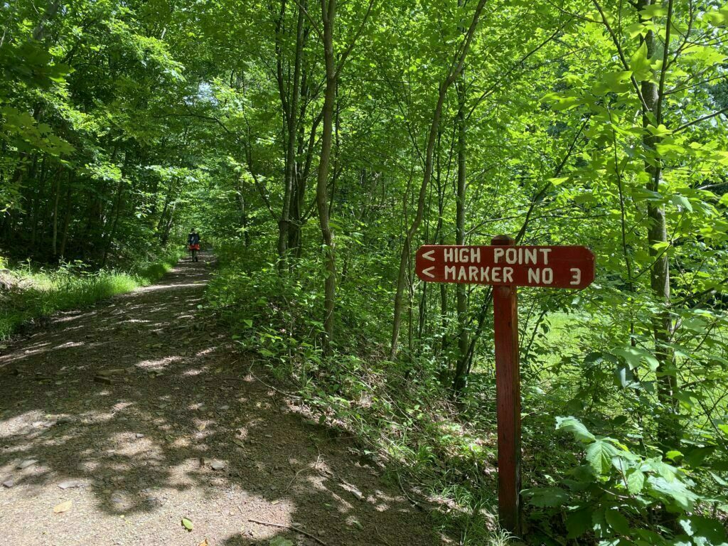
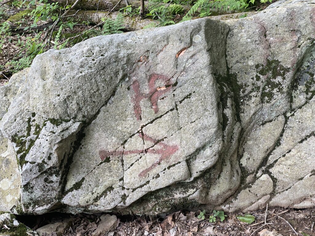
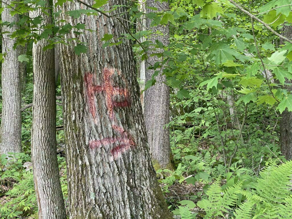
You will come to a split about half-ish way up and here is where you need to pay attention if you accidentally stay left you will end up on private property. You need to make sure to go right. There was an HP with an arrow, but it is almost hidden and can easily be missed.

Once you have passed the split, you will be on a trail in the more traditional sense, surrounded by trees. This is also where the incline becomes more noticeable.

Reaching the top of Maryland’s Highpoint
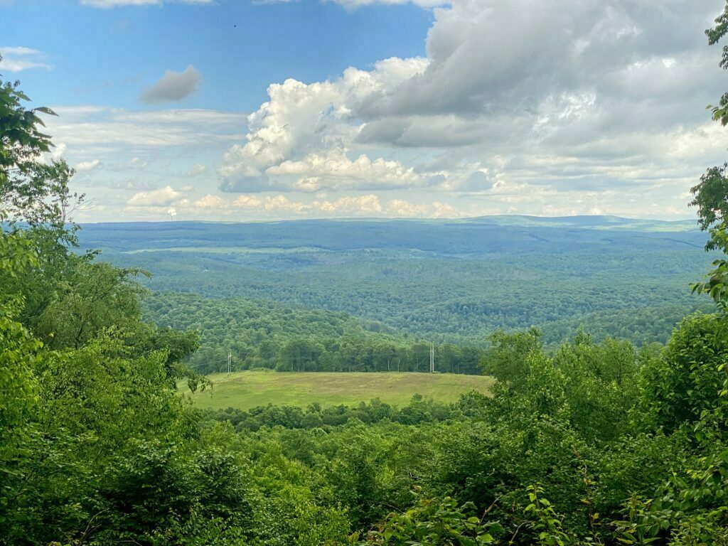
Once you reach the top, you will find picnic tables, benches, a logbook to sign, and a beautiful view.
Blazes along the Maryland Highpoint
If you are looking for traditional blazes to guide you, just know there are none. Instead, look for HP in red painted on trees and rocks.
As we started heading back down it started to rain. Thankfully, we all had our rain jackets with us. Star Blazer took off before the rest of us. I was the last to leave as I wanted to make sure to get plenty of pictures and video.
I eventually caught up with my Mom and Step-Dad on the trail before the logging road. Star Blazer was nowhere in sight so we assumed he must already be back at the truck (he is a fast hiker). However, my phone rang right as we were about to get on the logging trail. It was Star Blazer; Um Mom I think I took a wrong turn. I am turning back and retracing my footsteps as I think I know what happened.
Side note, I am not a runner; I hate running. I especially will never run uphill. That day, I learned I could probably set speed records running uphill, in the rain where everything was muddy and slick. Turns out all it took was my 18-year-old son telling me he took a wrong turn and was alone…in the rain…in the woods….lol.
I sent my parents on ahead to the truck as I went running back up the mountain to find him. He called again, “Mom, I am good, found my mistake”. So I leaned against a tree about halfway up, waiting for him to get to me.
It wasn’t long before I saw his bright red raincoat (another reason we wear bright-colored rain gear while hiking).
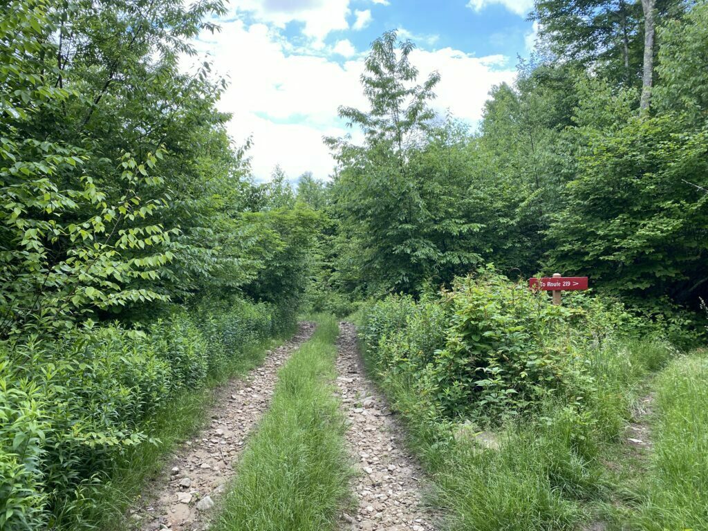
Once he got to me, he said he had somehow missed the sign for Route 219 and instead kept going straight (turns out my Mom almost missed it was well).
Once we got back to the truck. We went over the mistakes and how to avoid them next time. I was also super proud that my “training” for him paid off. It turns out he really does listen to me. As soon as he realized things looked unfamiliar he immediately stopped, called me (we also have satellite devices in the event cell phones do not work as part of the essentials we always take hiking with us), retraced his steps carefully back to a point to where he knew he was on the correct trail, called again, then headed in the correct direction.
So our short little hike to Maryland’s Highpoint turned into a little adventure thanks to the rain, mud, and slight detour.
Maryland Highpoint Trail Stats
Trail Stats
Distance: 1 mile
Type: One Way
Difficulty: Moderate (uphill the entire way to the top, but it’s only a mile roughly)
Elevation Gain: 700 feet (appx)
Trailhead: Located along Route 219
Parking: Parking is available along Route 219 at a pull-off.
Permit Required: No
Fee’s: None
Type of Terrain: Muddly (if it has rained) logging road for the first half, followed by a rocky and more steeper incline for the last half.
More Information
The trail to the Maryland highpoint is mostly on private property (the West Virginia side is national forest, the summit and its immediate surrounding area are owned by a coal company from my understanding) so keep that in mind. Stay on the trail, follow the signs, and don’t stray off on other trails. The only way to keep the trail open to the public is to respect the property owners. Don’t leave trash, don’t stack rocks, and don’t deface property (rocks, trees, etc…).
Getting There
Backbone Mountain Trailhead, 2428 Seneca Trail, Eglon, WV 26716
Quick Facts
- Backbone Mountain is a ridge of the Allegheny Mountains that is roughly 35 miles long which is part of the Appalachian Mountain range.
- Forms part of the Eastern Continental Divide
- You can see both Maryland and West Virginia from the top
- The Maryland Highpoint, Hoye Crest, is named for Captain Charles Hoye, founder of the Garrett County Historical Society
- You start in West Virginia and end in Maryland
Video
Check out our Maryland Highpoint hike below.
Have you ever hiked to the Maryland Highpoint? What was your experience? I know the trail has changed a lot over the years. Back in the 90’s, it was almost impossible to get to the highest point in Maryland.
Disclaimer: These articles are here to serve others as a guide on their own outdoor & travel adventures. You use any advice given on this site at your own risk. Exploring & Hiking Hiking can be risky activities; fatalities and injuries do occur. You assume responsibility when you decide to visit or hike in a particular location. Not all trails, attractions, and travels are safe for everyone. What works for me, may not work for you. Do your own research on gear and destinations before proceeding. Information is accurate at the time of posting and is subject to change at any time.


Very nice article As a travel blogger myself, I admire several travel bloggers for their amazing creativity, talent, and sense of adventure.