We headed out to Fort Parker State Park for some day hiking. I was surprised that we were able to reserve a day pass the day of. Most State Parks (especially now during the Covid-19 situation) are booking out weeks in advance.
That honestly concerned me a little. Why was no one booking passes to this park? Is it dirty? In a bad area? I was nervous, but I needed to get out and get some outdoor therapy in.
Fort Parker State Park is about 1.5 hours (95 miles) from Fort Hood, which as most Texans know a 1.5-hour drive is still considered local to us, lol. We set off on a beautiful day, high of 80, partly cloudy skies.
As we made our way through Fort Parker State Park, we didn’t see any trailheads or parking, so we decided to drive to the end of the park where a boat ramp and bathroom were.

River Loop Trail
(0.9 mi – one way; Difficulty: Easy)
We found where the trailhead for the blue trail (River Loop Trail / Navasota Trail) was and took off on our day adventure.
Because we were the only ones there, we got the privilege of clearing all the spiderwebs from the trail.
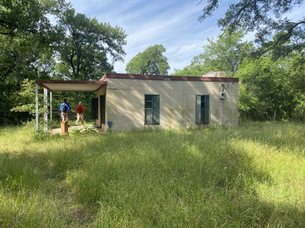
It wasn’t long before we came to our first find at Fort Parker State Park, an empty run-down building. From the materials used, it looked like it was built in the ’80s. Not sure what it housed as it did have a fireplace. There was no signage to say what it once was. Either way, still a cool little find along the trail.
The trail was really well maintained and shaded for most of the 8 miles that we did. Due to this, it allows algae and moss to grow on tree trunks creating vibrate colors of green.

Navasota River Trail
(1.9 mi – one way; Difficulty: Easy)
The River Loop Trail connects with the Navasota River Trail shortly before the Water Only Tent Site Campground (video showing each campsite is below for those interested in seeing what they look like).
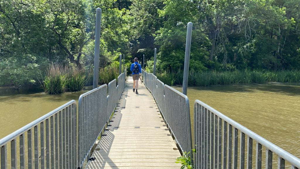
About 1.5 miles after you leave the tent site area, the blue trail (Navasota River Trail) spits you out at the picnic area where you cross a floating bridge that will connect you to the yellow trail (Springfield Trail).
Springfield Trail
(2 mi – loop; Difficulty: Easy)
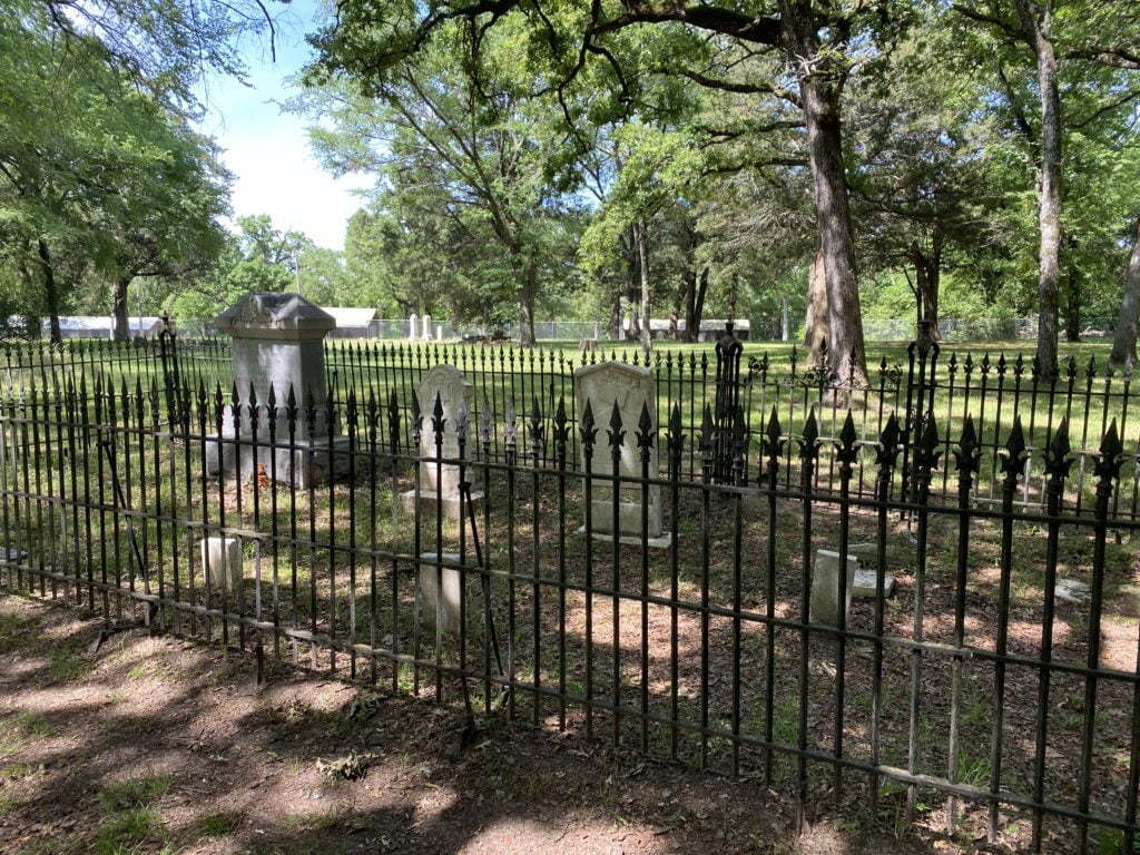
The yellow trail also passes by the Old Springfield Cemetery. We love old cemeteries and took the opportunity look around.
About a 1/4 mile further the trail spits you out at the Fort Parker State Park Group Barracks where you will follow the road to the right. The road will turn left and lead back into the woods.
About 1/2 mile later you will come to spring-fed Lake Springfield. I highly suggest taking a break here and taking in the beauty. There are a couple of benches and the area is just peaceful!

Your next stop will be almost immediate as you come to the dam for Fort Parker Lake. The 423-foot dam is made of limestone, concrete, and earth across the Navasota River, creating the 750-acre Lake Fort Parker. Look closely and you will see a ton of turtles at the bottom of the dam.

From there you continue past the other side of Lake Springfield for about .40 of a mile where you will come to the main entrance of the park. IMPORTANT: Turn left where the trail spits you at the road and walk past the gate guard and look for the trail to continue on to the right before you get to the Fort Parker State Park Headquarters.
From there it is about another .40 of a mile for the trail spits you back out at Old Springfield Cemetery. Once at the cemetery we turned right to start heading back to the SUV.

The total round trip for us was 7.5 miles, but I really wanted 8 miles so I headed back in to find a geocache near the Group Camp.
The only trails we did not do are the Bur Oak Nature Trail (green) and the Baines Creek Trail (maroon). We plan on heading back there in the coming weeks to knock those off of our list! UPDATE: We did the Baines Creek Trail.
Baines Creek Trail
The parking lot for the Baines Creek Trail is not inside the park. It is actually before you get to the park, however, you must still go to the Headquarters and pay an entry fee so you can get your ticket to hang on the windshield. Park Rangers do check that parking lot and will issue citations.
The trail itself is 2.5 miles out and back (so 5 mile round trip). It is listed as moderate, but I feel it should be listed as easy.
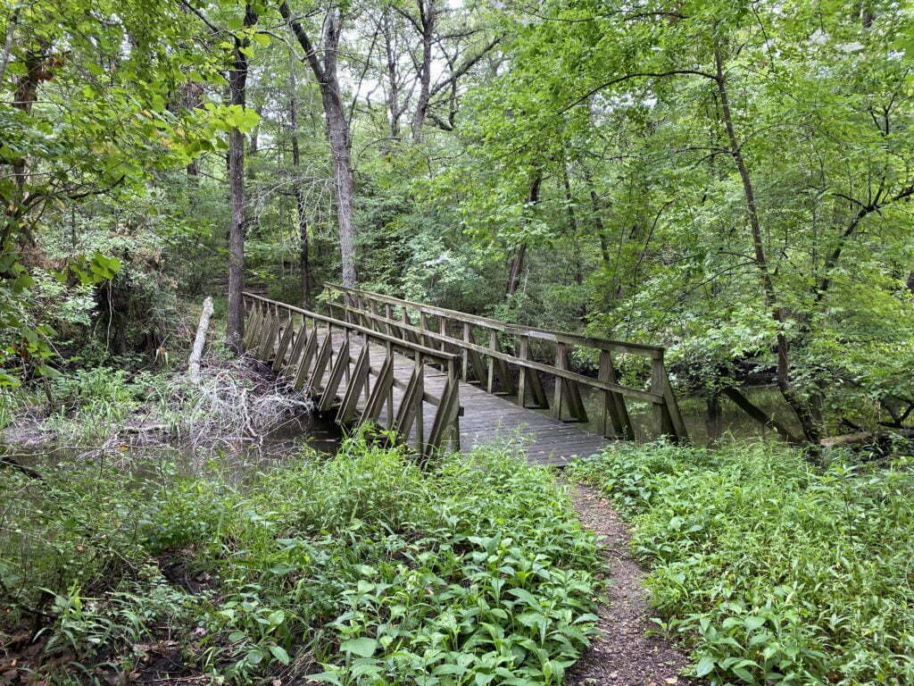
The first mile and half of trail is well maintained. You cross over a couple of bridges before coming to an overlook area with a bench about half a mile in or so.
Once you get to about the 1.5 mile mark, the trail starts becoming overgrown.
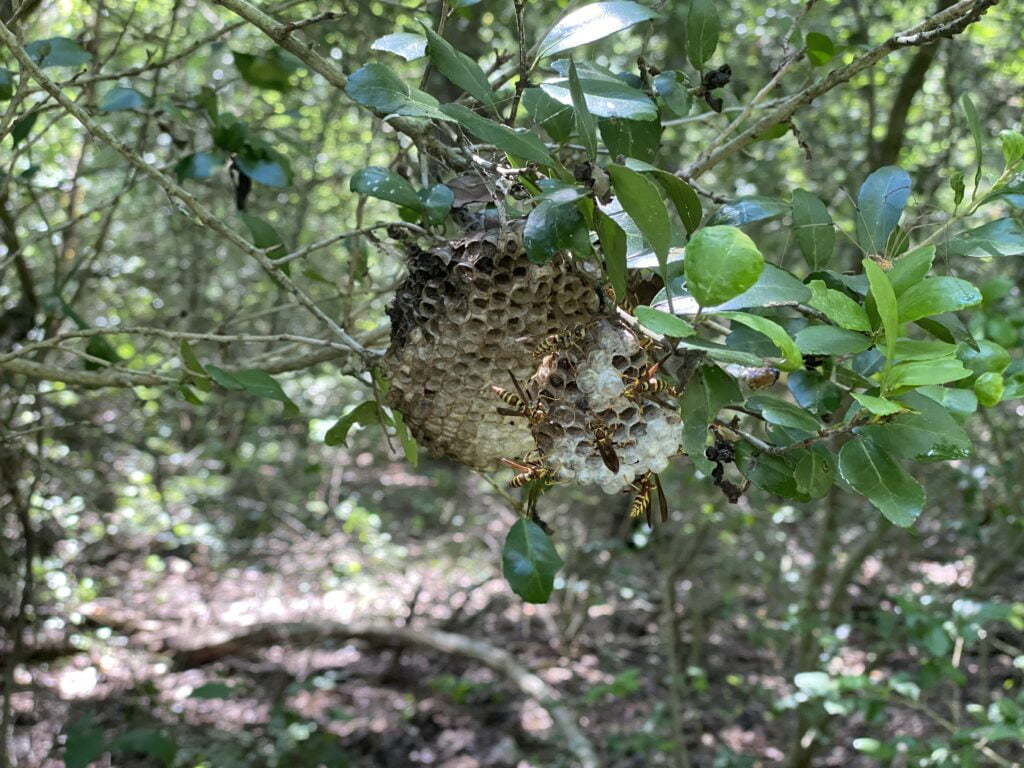
In fact, both my son and I were stung by yellow jackets. Their nest was on an over hanging low limb that was hung almost in the middle of the trail. We did not see it as we pushed our way through. They were NOT happy with us! See the 2nd video below.
Once we made it to the end, we were not impressed. This overlook that they talk about on the map, is NOT an overlook but an overgrown area that looks more like swampland with no view due to the overgrown brush and trees.

None of us recommend this trail at all except for maybe the first mile of it. Stick to the other trails the park has to offer!
Watch Our Fort Parker State Park Hike Video
About Fort Parker State Park
From the Fort Parker State Park website: The park encompasses the historic town of Springfield which was established in 1838. In 1847 when Limestone County was crested, Springfield became its first county seat.
At its peak, Springfield’s population was greater than either Dallas or Houston. The town slowly began to die in the early 1870s after the railroad bypassed the town and the courthouse burned. The Springfield post office closed in 1878 and soon after Springfield became a Ghost Town.
Only the cemetery and spring remain. It is the final resting place of many East Texas pioneers, including an American Revolutionary War veteran and two veterans of the Battle of San Jacinto.
Fort Parker State Park Information
Website || Trail Map || Park Map
ADDRESS:
194 Park Road 28
Mexia, TX 76667
(254) 562-5751
HOURS
Open daily,
8 a.m. – 7 p.m.
FEES
ENTRANCE FEE
- Adult: $4 Daily
- Child 12 Years and Under: Free
CAMPSITES
- With Electricity (Rv & Tents): $20/night
- With Water Only (tents only) $12/night
- Youth Group Site $50/nightly
SHELTERS
- Cabins: $45/night
- Shelters: $30/night
- Barracks Complex: $800/night


Leave a Comment or Suggestion