I didn’t technically begin Pennsylvania today, but I want to keep the blog posts aligned with NOBO miles and make it easier to follow along in FarOut and The A.T. Guide. I am putting these blog posts in the order they would happen on the AT, not in the order that I did them.
I am using mileage points when I recreate these posts from FarOut 2026. Since the trail mileage changes every year, and I am completing it in multiple years, the mileage might be slightly off by a 1/10th or so from the sections I have completed in the past.
In Pennsylvania, I decided I would try a new way of blogging and vlogging, doing it weekly instead of daily. That way I could concentrate on hiking. The problem, which I found out towards the end, is that all my videos and pictures were running together, and I couldn’t tell what belongs where. This dilemma was aggravated by the fact that I did not hike in one direction.
I actually started at the end of Pennsylvania, then moved to the beginning, and finally ended up closer to the middle. All of this was due to campsite unavailability and taking what we could get. This meant I was flip-flopping all over the state.
Some of these posts will span several days, while others will be for a single day, depending on how much history I have to share for that section. For Pennsylvania, I originally opted to do one long video but then decided to just split it into fourths to upload, so some blog posts will have the same video attached as the previous entry.
NOBO Section: Mile 1068.3 – 1081.2 |Pen Mar Rd to PA 233, Rocky Mtn Rd
| AT Miles | Triple B Miles | Total AT Miles Hiked | Miles Remaining |
|---|
13
2
250.7
1947.7
SECTION STATS
| 📍 STARTING POINT: Mile 1068.3 | 🤠 MOOD: Excited |
| 📍 ENDING POINT: Mile 1081.2 | 🤕 INJURIES: Knee still healing |
| 🏔️ ELEVATION GAIN: 2492.5 ft | 🐻 WILDLIFE: Chipmunks |
| 🏔️ ELEVATION LOSS: 2103.7 ft | 🌡️ WEATHER: Cloudy but nice |
Hike Report
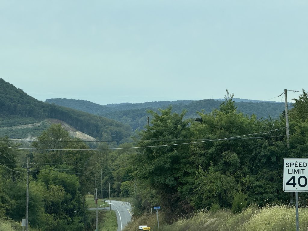
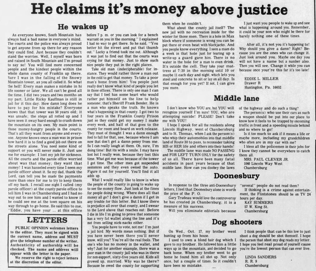
I’m excited for today’s hike, as I get to visit two fire towers that I have never seen another vlogger mention or show.
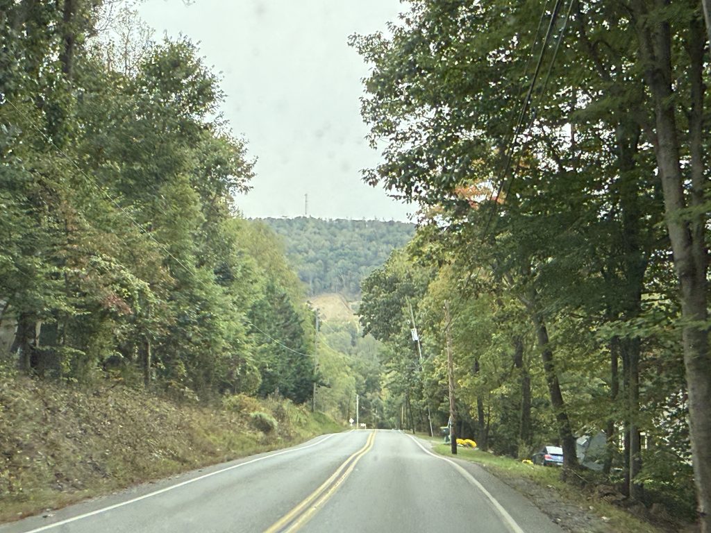
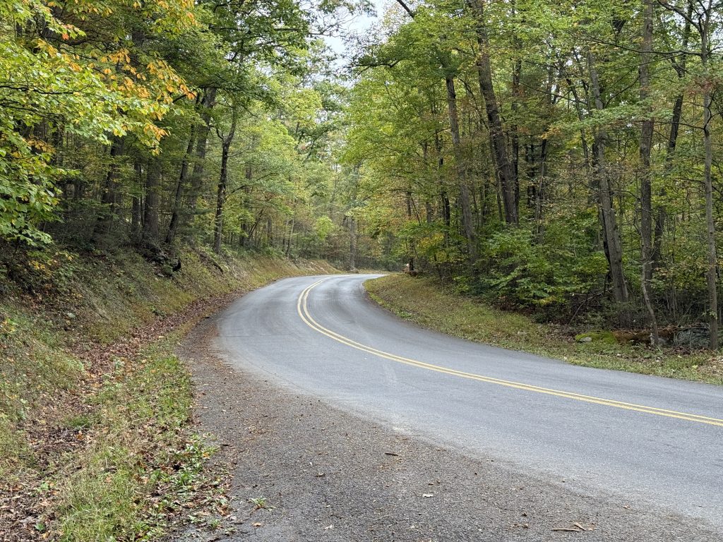
The day started off easily at Pen Mar Park. The rocks that I encountered in northern PA are nowhere to be seen, and I am so thankful for that!
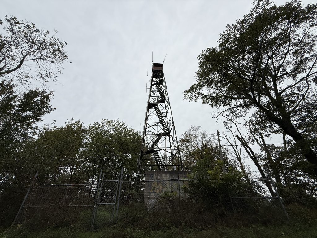
After a short climb up Mount Dunlop, I made my first triple B of the day to the Mount Dunlop Blue Ridge Lookout Tower.
From there I headed to Old Rte 16 and took a Triple B to the Monterey Pass Battlefield Park & Museum. We didn’t stay long there, as the museum was closed, and I didn’t have enough time to tour the battlefield, as I still had hiking to do. Once we were done poking around, I headed back to the AT and met Jerry at the Old Forge Picnic Area.
I did a quick lookover before Jerry dropped me off at PA 233 so I could make my way back, this time heading SOBO to the Old Forge Picnic Area. Why? Because as you all know, I hate uphill, and I will always take the shorter one, lol.
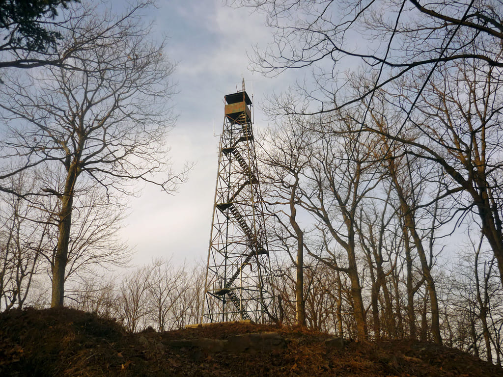
My next and final Triple B of the day was to Snowy Mountain Lookout Tower, where I ran into some DNR folks who were trying to come up with a plan on how to preserve the tower and stop the vandalism from people illegally prying open the fence to climb it. I talked to them about my love for these old towers and my relationship to the fire service. They then asked for my input on how to preserve it and what to do about vandals, including examples of how I have seen other fire towers preserved and what measures they have taken for security. I gave them my thoughts as they took notes before leaving me there to explore the area.
I honestly spent way too much time up there, and I quickly realized this when I checked the time.
I quickly picked up the pace and made my way past chimney rocks, where I did contemplate climbing them, but my knee was still very tender from the trip down into Delaware Water Gap, so I continued on.
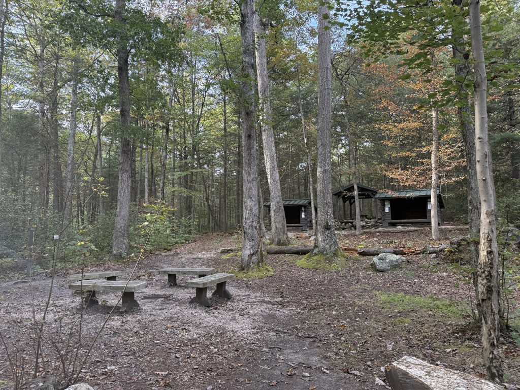
Shortly before coming into the Old Forge Picnic Area, I passed the Tumbling Run Shelters, and man, what a lovely area! The entire shelter and camping area seemed massive and very nice! It would have been a wonderful place to stay the night!
All in all, a nice day, and I very much enjoyed not having the rocks like I did in Northern PA!
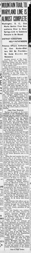
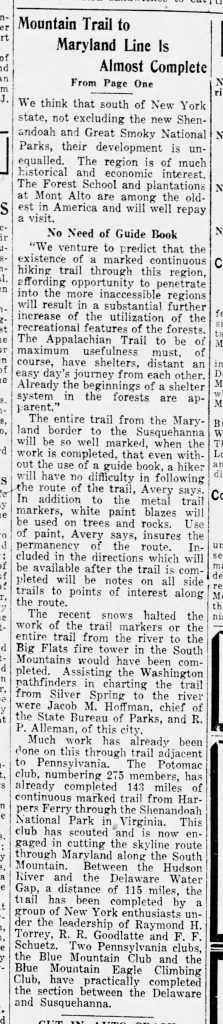
Mount Dunlop (Dunlap) / Blue Ridge Lookout Tower
I actually found out about this lookout tower by looking at an Open Street Map; after a little research, I realized I could get to it via the Appalachian Trail.
(Click Picture to Enlarge)
History
In 1915, surveyors met at the top of Mount Dunlap (Dunlop) to survey a site for a summer capital for the area.
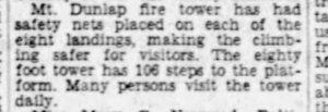
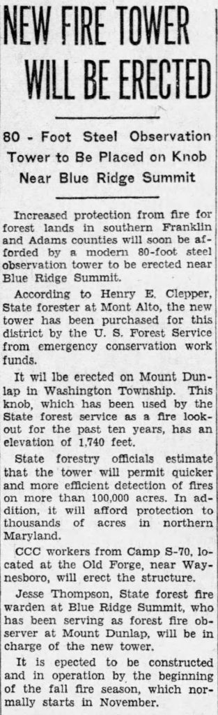
Built in 1936 by CCC workers based at Old Forge, the Mount Dunlop (also referred to as Mount Dunlap) fire tower is an 80-foot Aermotor MC-39 lookout tower. The tower has eight landings and is also the summit for Mount Dunlop, which has an elevation of 1,740 feet.
In April 1938, safety nets were placed at each of the eight landings to create a safer climb for visitors.
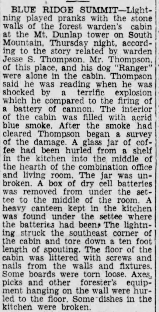
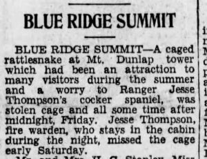
A lightning storm in July of 1940 hit the fire warden’s cabin, causing chaos inside for the warden and his dog. Apparently it sounded like a cannon exploding within the cabin; dishes were also shattered, and a glass jar of coffee was thrown from a shelf in the kitchen into the middle of the hearth that was located in the office/living area.
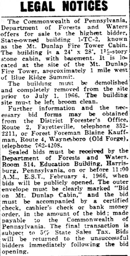
In January of 1966 the fire warden’s cabin was listed for sale to the highest bidder, with the caveat being that it must be completely disassembled and removed from the site.
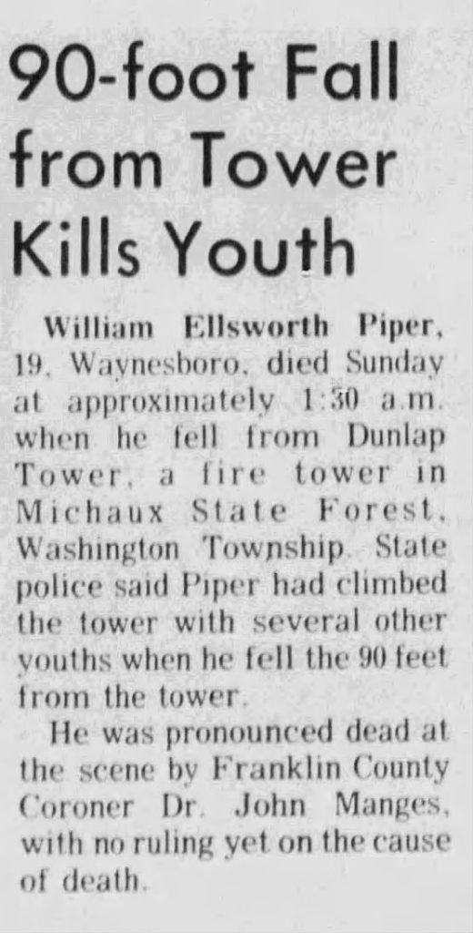
In July of 1973, 19-year-old William Ellsworth Piper fell to his death while climbing the tower with friends.
The tower is now used as a communications tower and closed off by a locked fence.
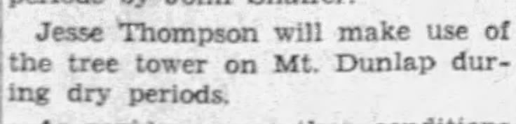
Fun fact: Prior to the tower’s construction, fire watchers used trees as towers.
Newspaper Clippings
The Mt. Dunlap tower was super popular in the late 30s and into the 40s and 50s, with organizations of all kinds holding meetings at the cabin. I opted to not include any of those clippings.
Getting There
If you are headed NOBO on the AT, you will come to an old roadbed as the trail gets close to its highest point on Mt. Dunlap (39°43’45.5″N 77°29’28.4″W). Turn right on this old road, which is now a trail, and follow it to Tower Road (gravel) for 0.3 miles; turn right and walk up the road to the summit roughly 0.3 miles. It is roughly 0.6 miles to the tower from the AT.
Mile 1069.9 – Old PA 16, aka Old Waynesboro Rd
Old Waynesboro Road is the location of the Battle of Monterey Pass, which is Pennsylvania’s second largest Civil War battle and the only one fought on both sides of the Mason-Dixon Line.
Under the leadership of General Judson Kilpatrick, Union cavalry were tasked with disrupting this mountain passage to compel General Robert E. Lee to choose an alternative route back to Virginia. In the early hours of July 5, 1863, following several hours of intense combat, the Union cavalry successfully broke through the Confederate lines. They managed to capture approximately nine miles’ worth of Confederate wagons as they advanced toward Williamsport after the Battle of Gettysburg.
Nearby are the battlefield and a museum.
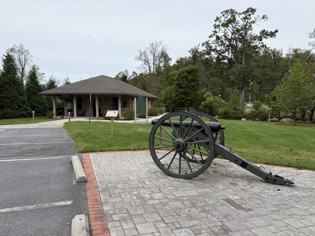
Directions to Battlefield & Museum
Monterey Pass Battlefield Park & Museum is located on Rt 16. NOBO, take a right on Old PA 16. Go about 0.5 miles to Route 16 and take a right. The museum will be on the left. The battlefield is open 8am-dusk year-round, and the museum is open April through October on the weekends from 10am to 4pm. To get back to the Appalachian Trail (AT), you can take Route 16 to the trailhead (about 0.5 miles).
Mile 1070.2 – PA Route 16
Raven Rock Mountain Complex to the right (if going NOBO) – Super Secret Squirrel Shit going on down the road here.
The Raven Rock Mountain Complex, also known as Site R or “The Rock,” is a U.S. military installation with an underground nuclear bunker. The bunker has emergency operation centers for each of the branches of the military and is one of the core bunker complexes for the US continuity of government plan during the Cold War to survive a nuclear attack. It’s illegal to take any picture or make a sketch, drawing, map, etc., of that area without obtaining necessary permission.
Mile 1070.4 – Mentzer Gap Road
In addition to being in the area where the Battle of Monterey Pass occurred, Mentzer Gap Road was also part of the Underground Railroad, where escaping enslaved individuals would travel from the Shockey Farm and head north to the next stop, which was the farm of Hiram and Catherine Wertz in Quincy.
Mile 1074.7 – Old Forge Park
Old Forge Park & Picnic Area is the site of an old ironworks facility for staging charcoal. The Old Forge historical site is a remnant of the Hughes Furnace and the later Mont Alto Iron Works. This area helped support several surrounding communities, including Bieseckers Gap, Glen Forney, and Bearto. You can supposedly still see remnants by following the map at this link. It was late in the evening, and I didn’t have much time to explore. I meant to come back, but we never did.
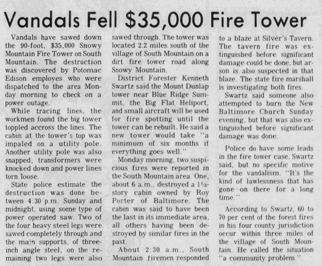
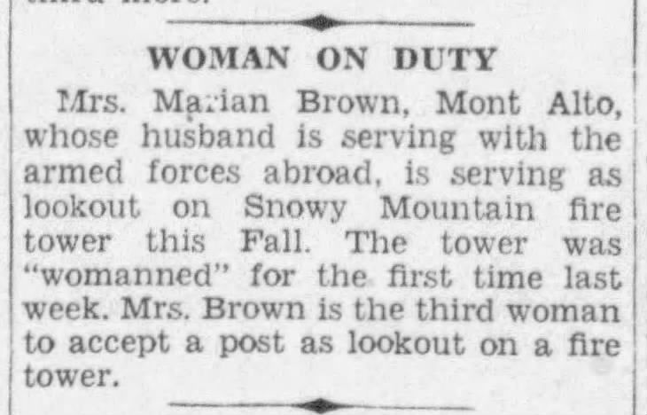
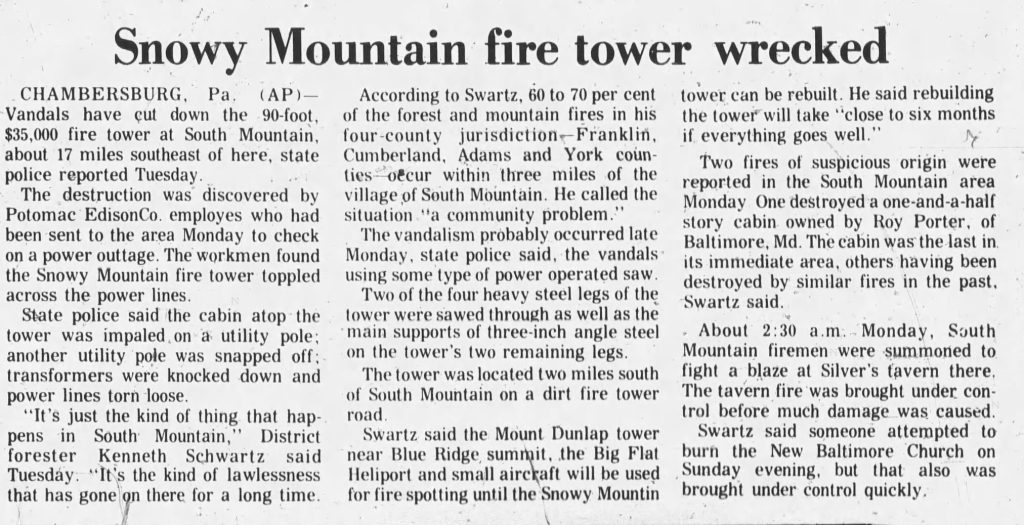
Mile 1079.2 – Snowy Mountain Lookout Tower
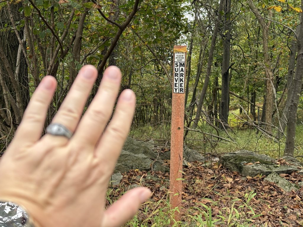
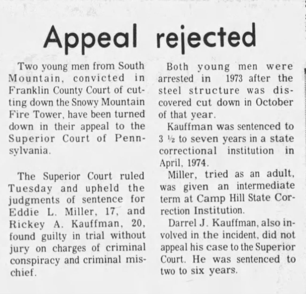
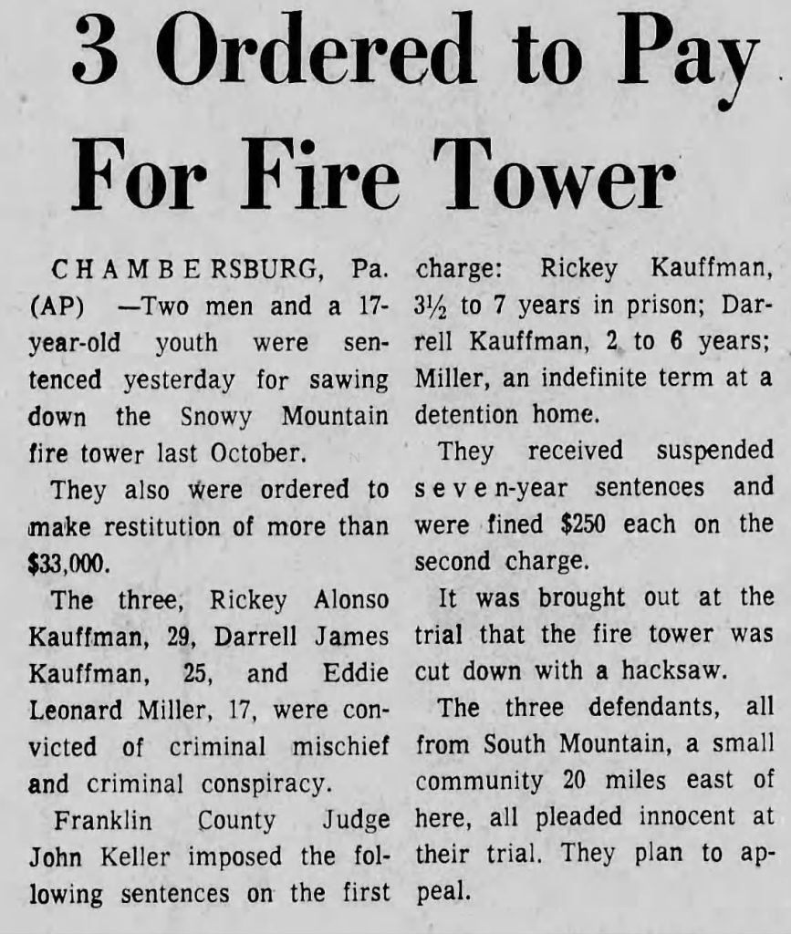
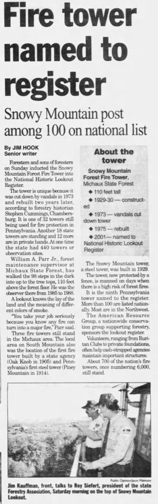
The original 90-foot tower was built in 1930 along with a stone fire warden’s cabin. In 1942, the survey markers were installed. In 1973, vandals brought down the tower by sawing through two of its support legs with hacksaws. In the process, it also damaged some power lines.
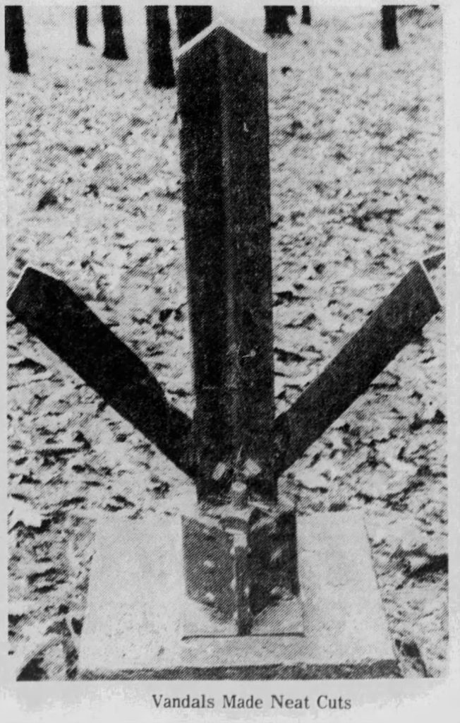
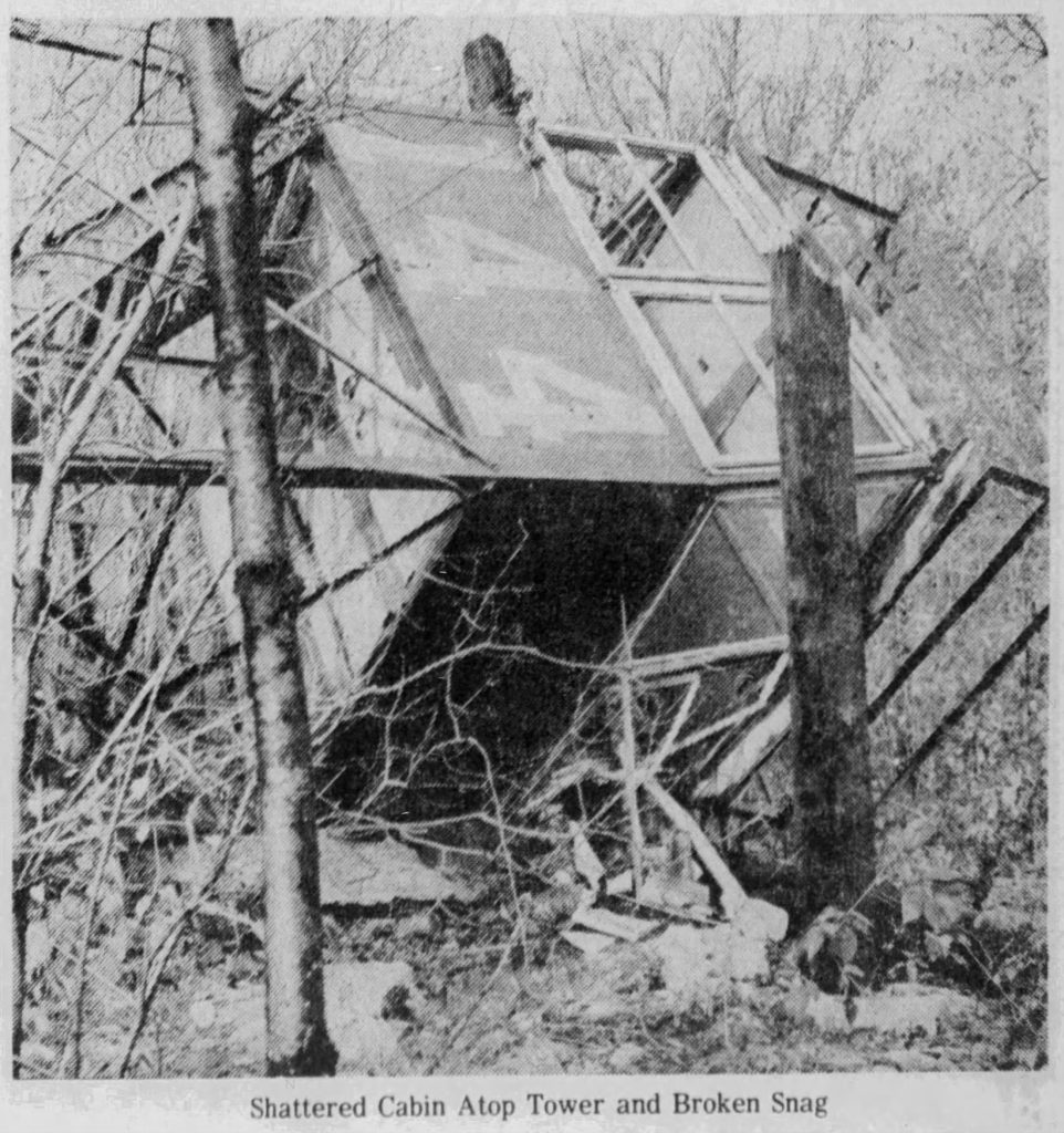
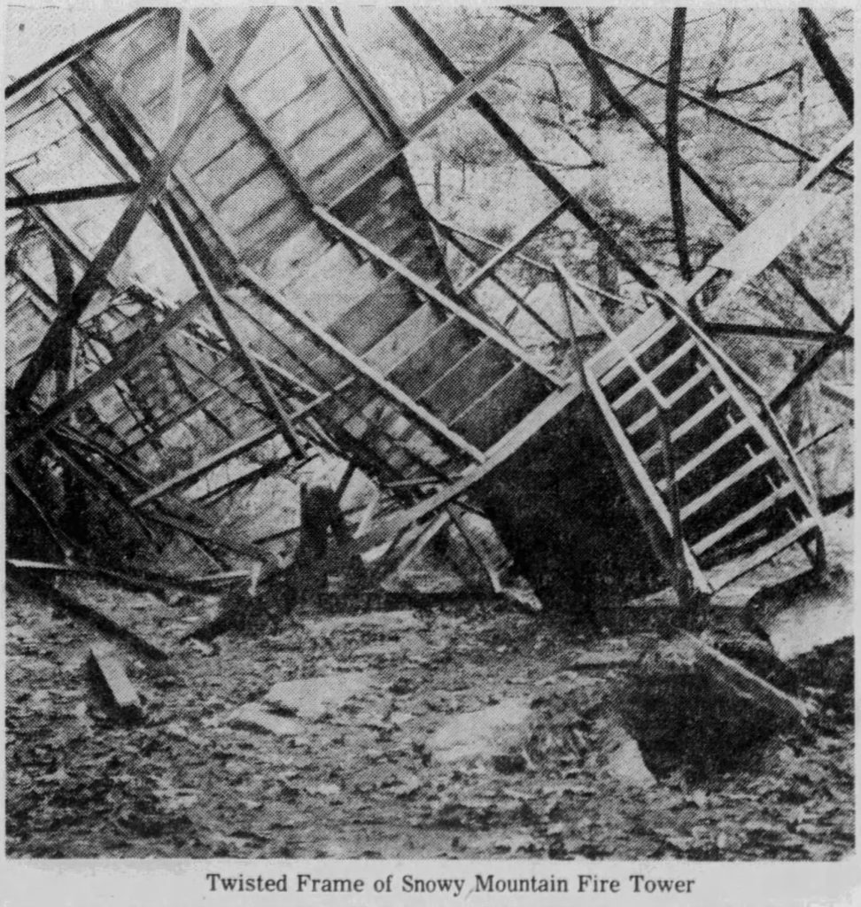
Three individuals from South Mountain were apprehended and subsequently served time in prison. In 1975, an 80-foot replacement tower was constructed to take the place of the one that was vandalized, but this new tower was built at the Snowy Mountain location.
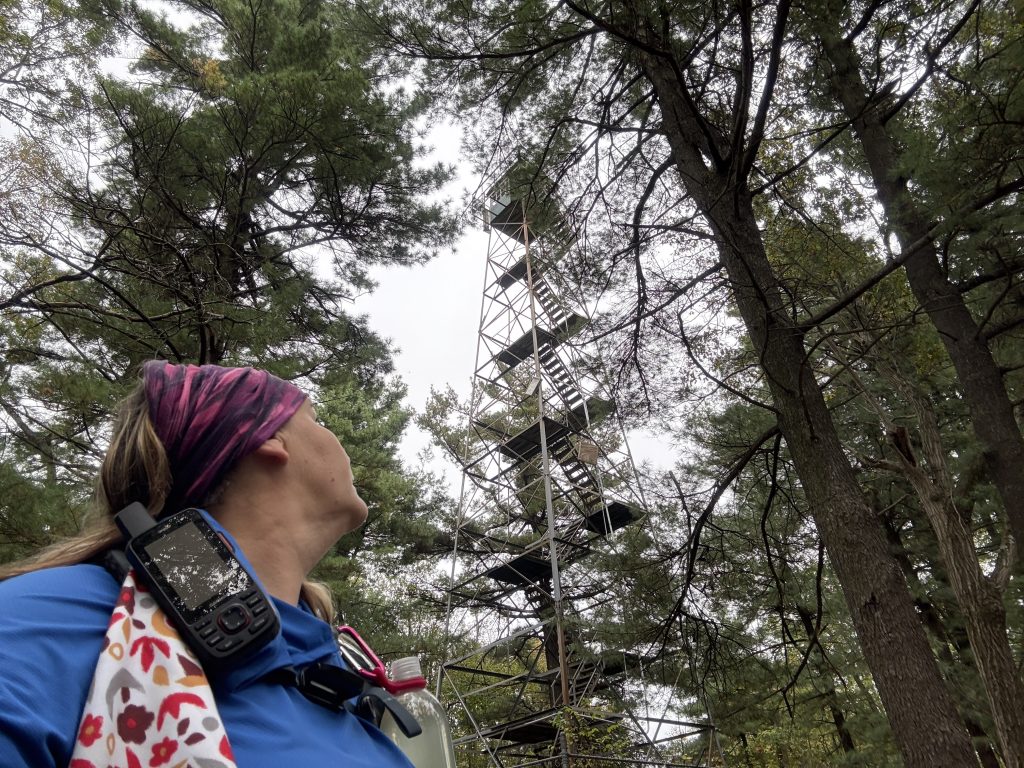
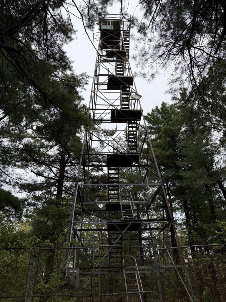

In 2001, the lookout was added to the National Historic Lookout Register and is still in use today during peak fire seasons. Fun Fact…according to an old map, the AT used to run right by the fire tower.
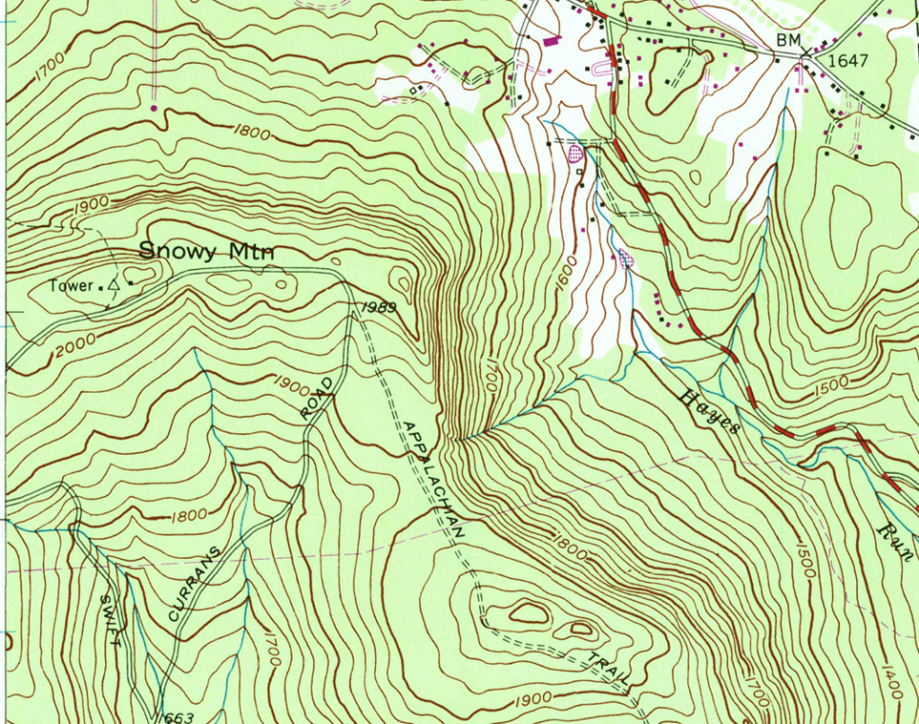
Fun Fact: Snowy Mountain gets its name from being the tallest peak, therefore collecting the first snowfall.
Newspaper Clippings
Getting There
Getting up to it is a tad tricky, as there is no marked trail. I saw a turnoff to the right if heading SOBO or left if heading NOBO around 39.834767, -77.495325 and took that towards the top, following the trail as best as I could. It spit me out next to the communications tower. I turned right at the “road” in front of the communications tower and walked straight to the lookout tower. I forgot to measure the distance from the AT, but I would guess around 300 feet, so a very short side trip.
There is no vehicle access, as the road leading to the tower is gated off (Suspenders tried to meet me up there).
Swamp Road – Mile 1080.5
I don’t have any footage of this, as I did not find out about it until after I got home, but to the right (if going NOBO), just down the road about 1/2 mile, is the South Mountain Restoration Center, formerly known as the Mont Alto Sanatorium.
South Mountain Restoration Center began in 1901 as White Pine Camp, a tuberculosis sanatorium led by Dr. Joseph T. Rothrock. Over the years, it was renamed several times, becoming the Samuel G. Dixon State Hospital in 1956 before closing as a TB hospital in 1968. At its busiest, the hospital housed about 1,200 patients and employed 700 staff.
In the late 1960s, the campus shifted to care for older adults from state hospitals, reopening as South Mountain Restoration Center under the Department of Human Services. By 1970, it served 1,100 residents.
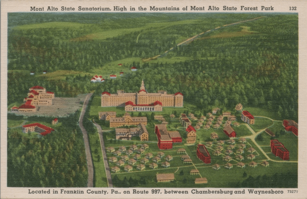
Today, South Mountain Restoration Center1 is a long-term care facility run by the Pennsylvania Department of Human Services. The campus also hosts a Department of Military and Veterans Affairs armory, Abraxas, the local post office, and a secure treatment unit for youth. It operates its own utilities and supports about 1,040 residents and staff. The main residence building dates back to 1938. Check out more about the history and a video from the early 1900s here.
APPALACHIAN TRAIL SECTION VIDEO
COMING SOON!!!!
AT Gear List
Interested in finding out what I carry on my Appalachian Trail Backpacking Trip? Check out my gear list here:
- https://www.pa.gov/agencies/dhs/departments-offices/dhs-facilities/south-mountain-restoration-center ↩︎


Leave a Comment or Suggestion