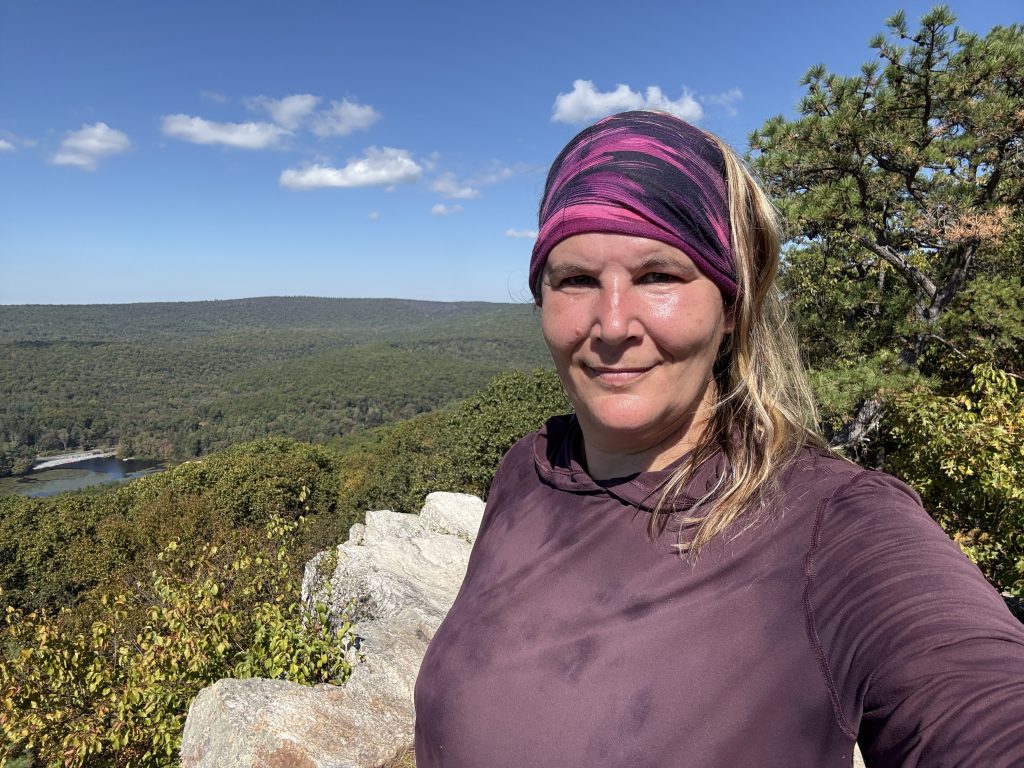
I began at Fuller Lake and headed to my first POI, which was Pole Steeple, where I somehow got on the WRONG blue-blazed trail. It required some bushwhacking to get to the actual Pole Steeple trail, but I found it, and my reward was some amazing views.
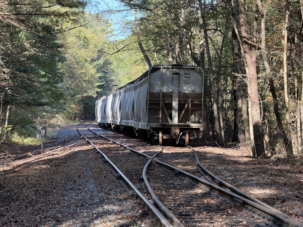
I found a train stashed in the woods, lol, before a road crossing. We ended up coming back to it several days later when my mom and pops came to visit. The leaves had changed colors, and it was beautiful.
I then began my trek into Boiling Springs by first traversing Rocky Ridge, which has been nicknamed the mini Mahoosic Notch. I actually have full footage of that in another video for anyone interested. It was a ton of fun! That is the kind of hiking I love to do!

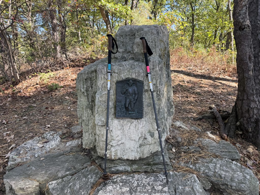
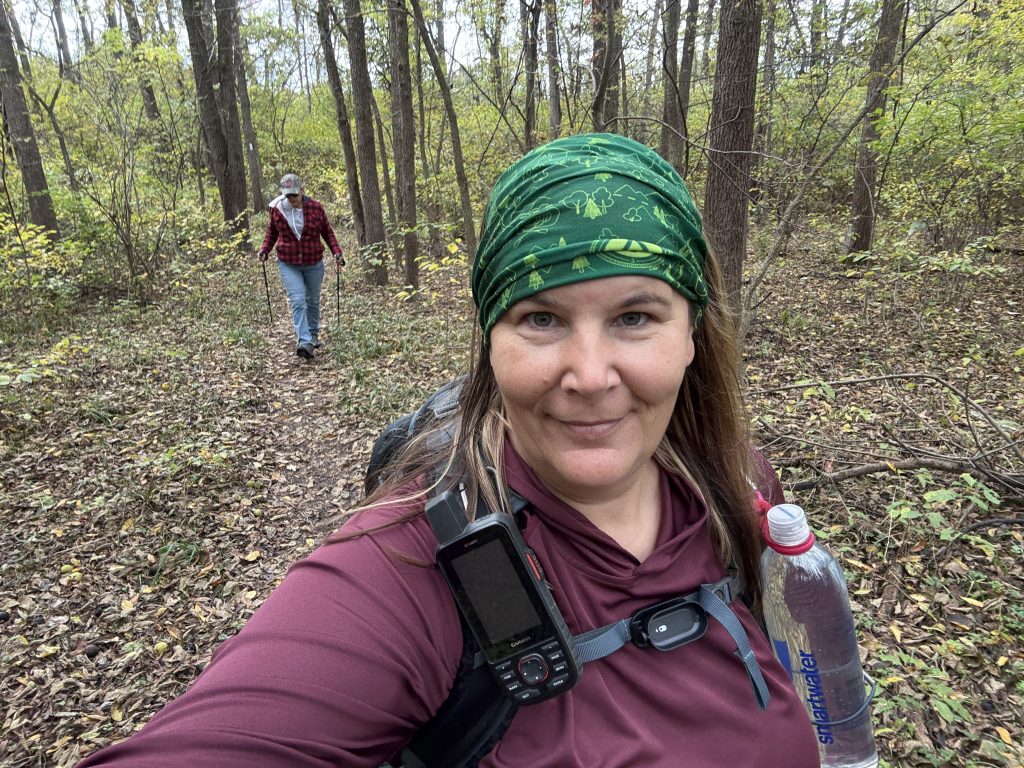
Once I got done there, I passed over Center Point Knob (the original halfway point of the AT) before heading down into Boiling Springs for my 15-mile cornfield and pasture hike. It was actually very enjoyable; then again, I am a country kinda gal.
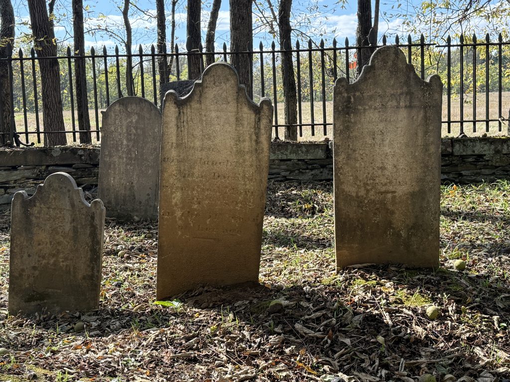
While on my 15-mile trek through farmland, I came across the old Chambers Farm Cemetery. Y’all know how I love old cemeteries. I spent far too long there reading each headstone and taking pictures.
I ended up saving a couple of miles through the Boiling Springs hike so Mom and Pops could hike with me since it was nice and easy. Hopefully I put that section in the right spot when I was editing, lmao.
If you have a story (think paranormal/unusual) or history tidbit to share that has happened along the Appalachian Trail (even if I have already done the section), please reach out to me here.
NOBO Section: Fuller Lake Mile 1106.3 to Sherwood Drive Mile 1136.5
| AT Miles | Triple B Miles | Total AT Miles Hiked | Miles Remaining |
|---|
30.3
1
306
1892.4
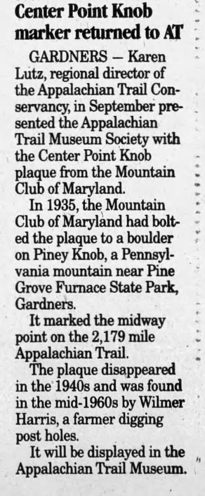
Center Point Knob – Mile 1122.2
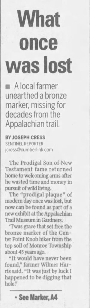
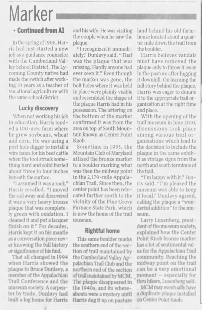
When the trail was finished in 1937, this spot marked the original halfway point. But the plaque here isn’t the first one. The real bronze plaque was set into this boulder back in 1935, only to be stolen later on sometime in the 1940s.
Fast forward to 1966: a man named Wilmer Harris was digging a hole for a fencepost near South Mountain and found the old plaque buried on his property. Turns out, whoever took it just left it there. Not knowing its history, Mr. Harris kept it on his fireplace mantle for years.
In 1994, trail enthusiast and friend Bruce Dunlavy visited Mr. Harris and noticed the plaque. Mr. Harris was excited to give it back to the trail community and a suitable trail organization as soon as he discovered what he had.
When the Appalachian Trail Museum opened in 2010, the plaque found its forever home. A duplicate was created from the original, and in 2011, it was placed at Center Point Knob. The real plaque is now on display at the Appalachian Trail Museum.
Newspaper Clippings
Boiling Springs – Mile 1124.9
Boiling Springs gets its name from the cluster of bubbling natural springs that pour into the now-famous Children’s Lake—a centerpiece of the town and once a vital power source for the old Carlisle Iron Works. But there’s more to this small town than scenic views.
In the 19th century, Boiling Springs found itself at the heart of the Underground Railroad. Daniel Kaufman’s home became a beacon for freedom-seekers, quietly operating as a safe haven and a crucial stop on their perilous journey north.
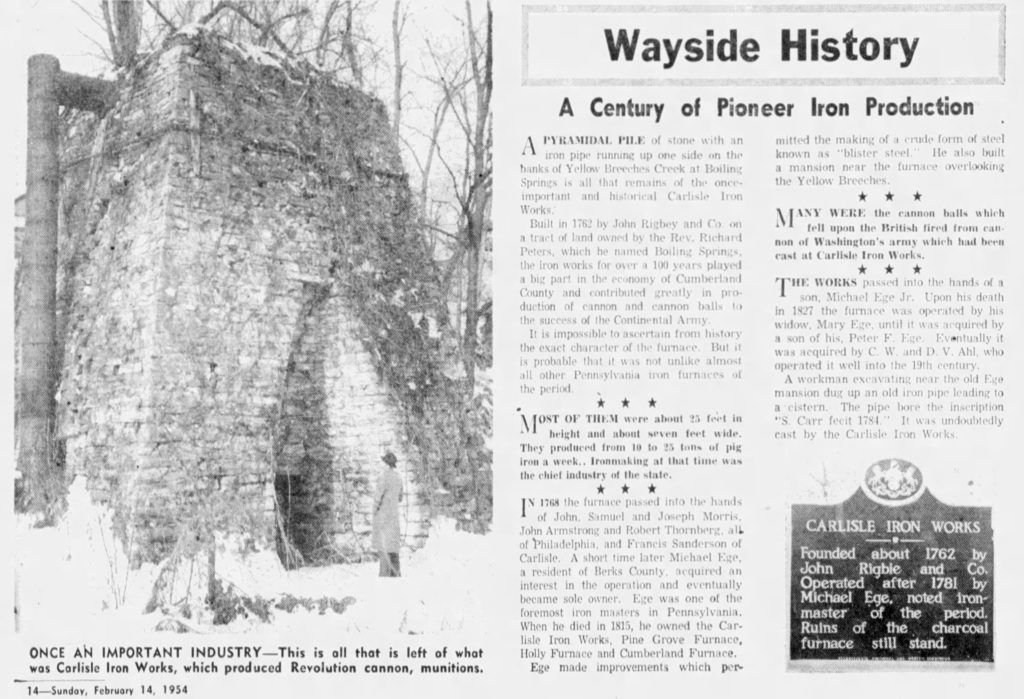
Carlisle Iron Works – Mile 1124.9
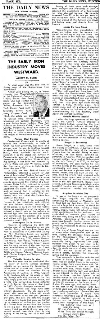
Tucked into the woods near Boiling Springs, the Carlisle Iron Works Furnace holds a secret: it’s likely the oldest iron furnace in all of Pennsylvania west of the Susquehanna River, dating back to around 1762.
It started out as the brainchild of John Rigbie & Co., who gambled that demand for iron would outweigh the British crown’s rules. They were right, at least for a while.
In 1750, Parliament had banned the colonies from building their own furnaces and forges—insisting that raw iron ore be shipped all the way to England for processing. But the Carlisle Furnace ran anyway, quietly forging its place in early American industry—a “bootleg” operation by legal standards of the day.
Click the picture for an enlarged view:
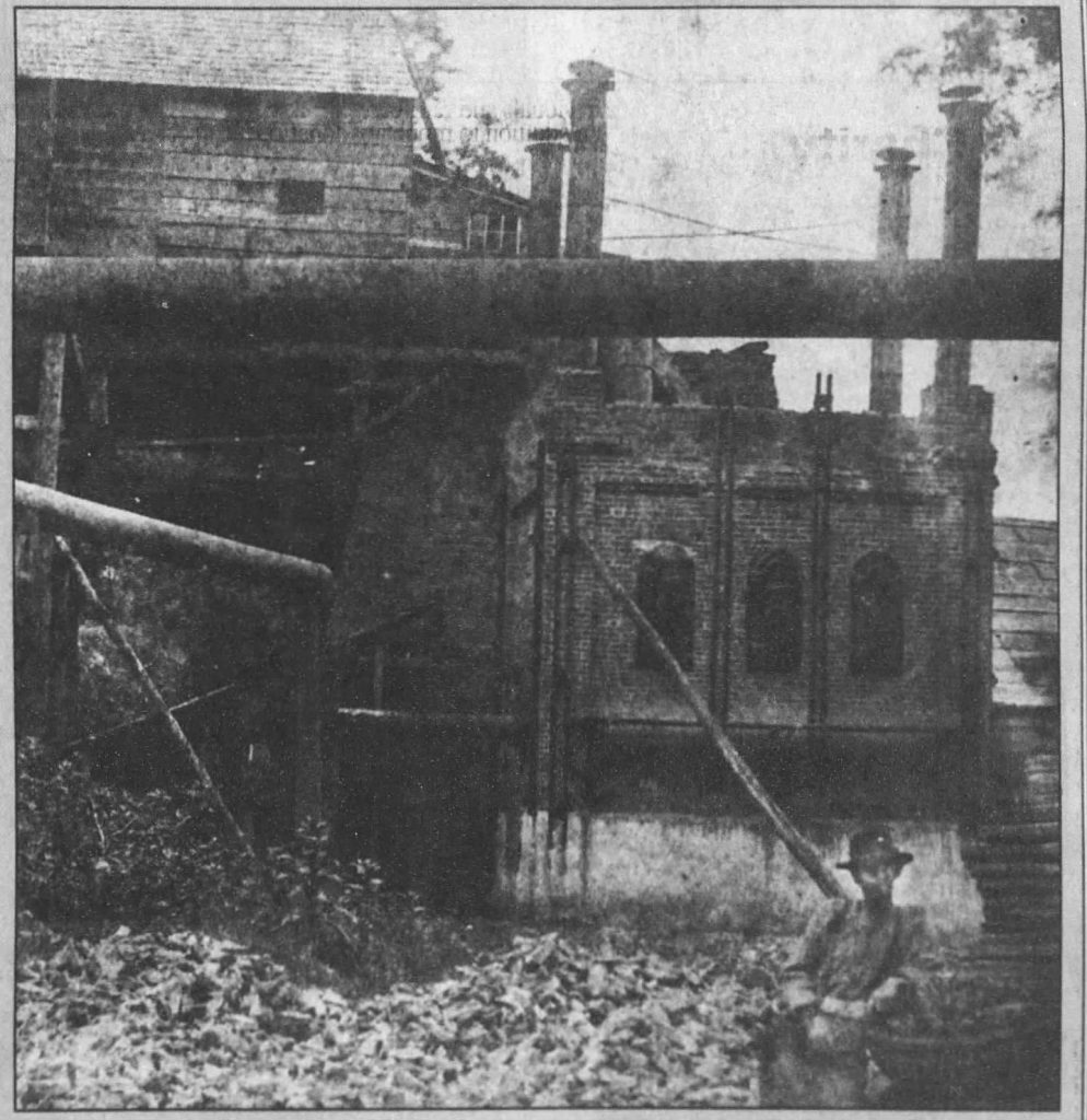
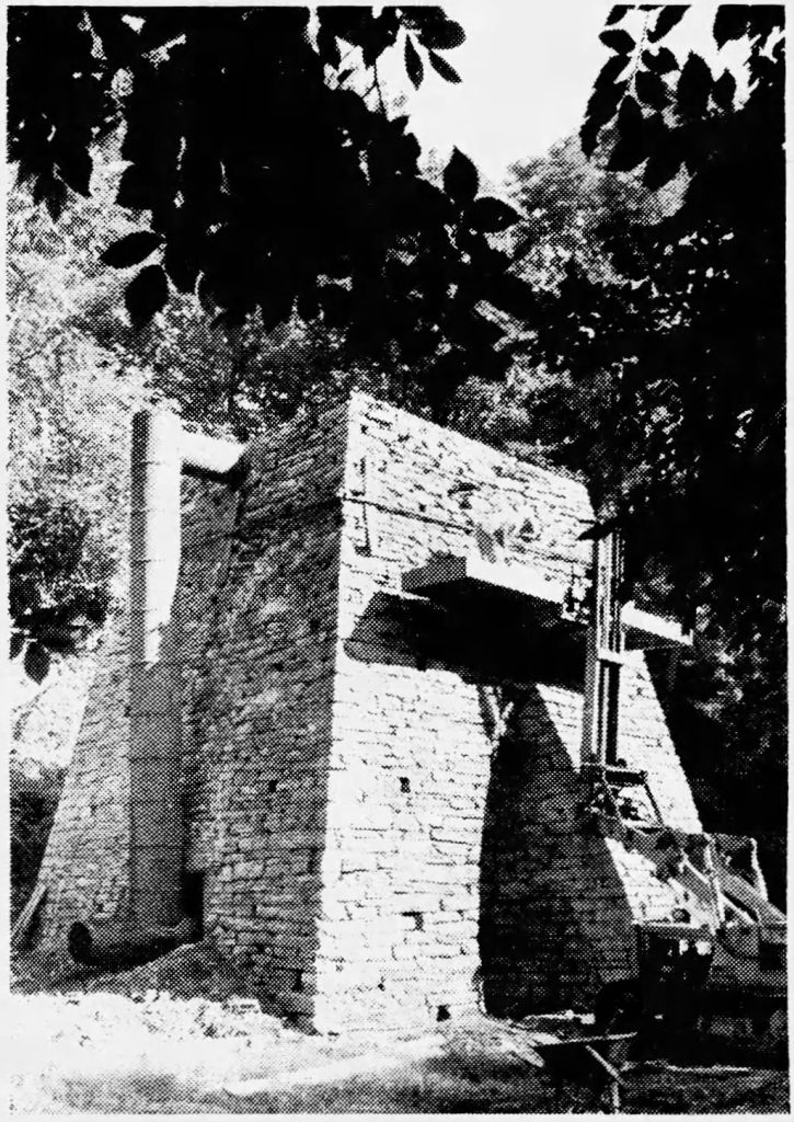
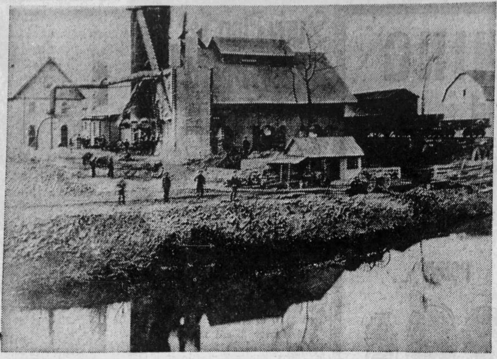
After the Revolutionary War rolled through, Michael Ege, one of the region’s most respected iron masters, took control of the furnace in 1781. Under his direction, the operation became even more crucial. During the war, its roaring fires turned out cannonballs and shot for the patriots, fueling the American fight for independence right from the Pennsylvania backcountry.
For nearly a century after those tumultuous years, the furnace kept churning, though its glory days faded as the village of Boiling Springs began to sprout up around it. By the mid-1800s, the old furnace was running out of steam—its best years behind it, but its story still echoing through the stones that remain.
Newspaper Clippings
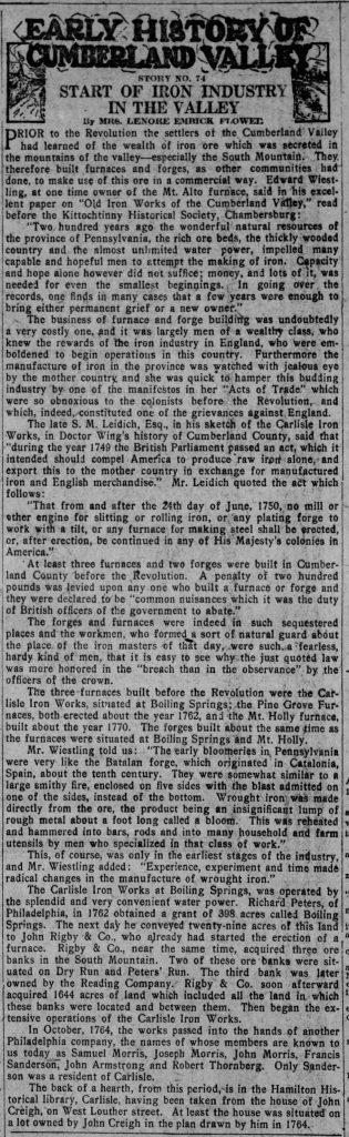
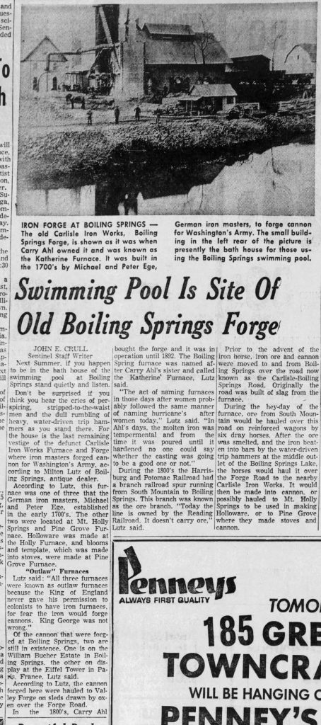
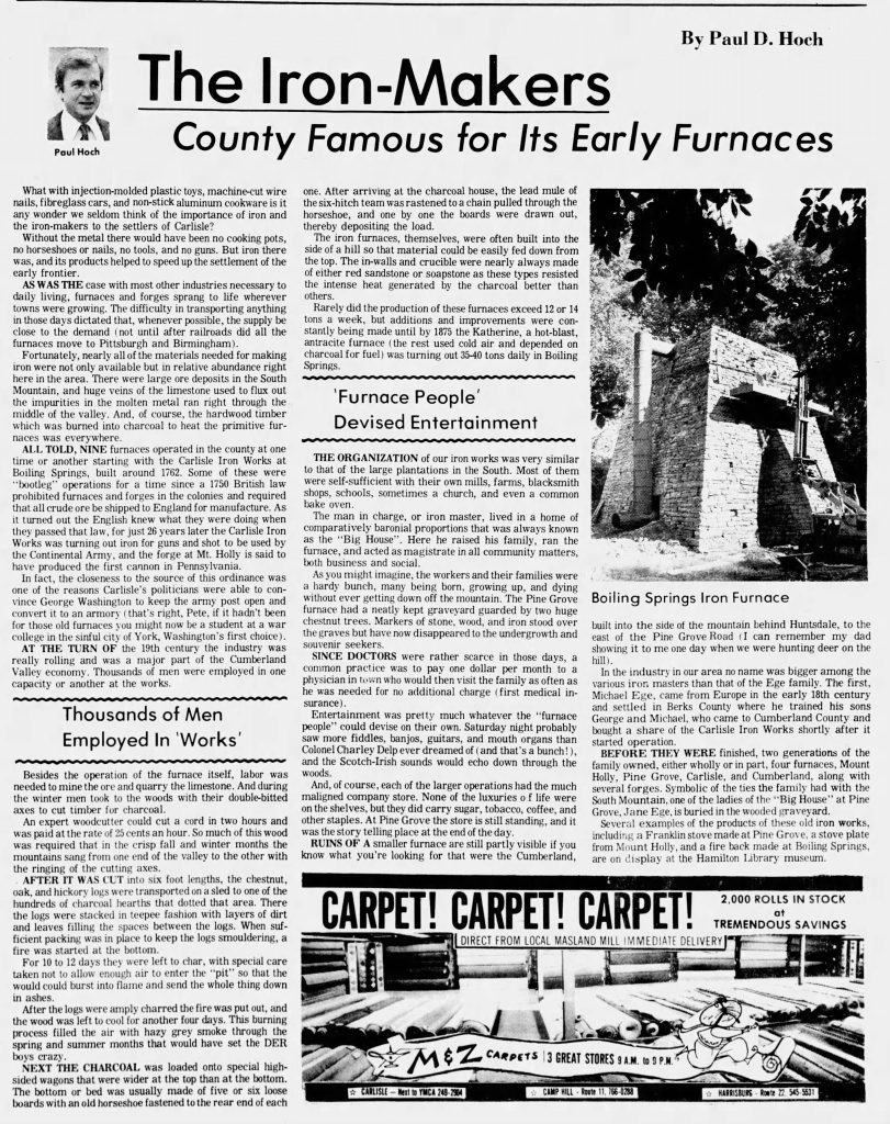
If you’d like to read more history about the old Carlisle Iron Works, here are a couple of newspaper articles I found that I thought were interesting. Click each picture to enlarge.
Carlisle – Mile 1129.2
0.5 mile to the west is the city of Carlisle. Carlisle has far too much history to get into, so here is a short synopsis. If you have time to visit and explore, I highly recommend you do!
Founded in 1751, it was the seat for Cumberland County. In 1757, Carlisle Barracks, the second-oldest military post in the US, was established, which is now home to the US Army War College. In 1863, Confederate troops occupied and shelled Carlisle during the Civil War, leaving marks on the Old Courthouse. From 1879 to 1918, the Carlisle Indian Industrial School operated in the town.
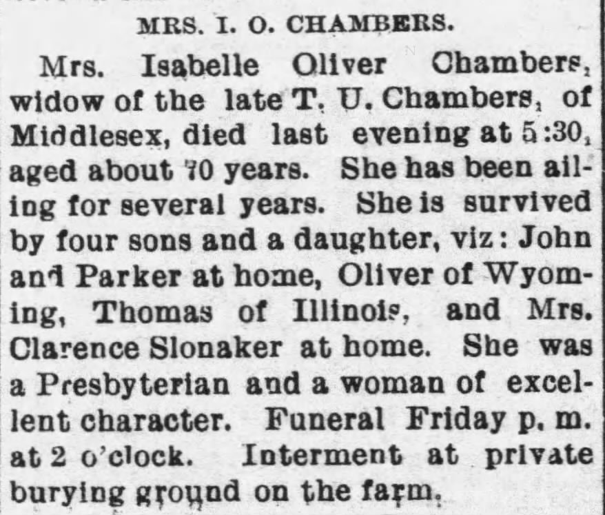
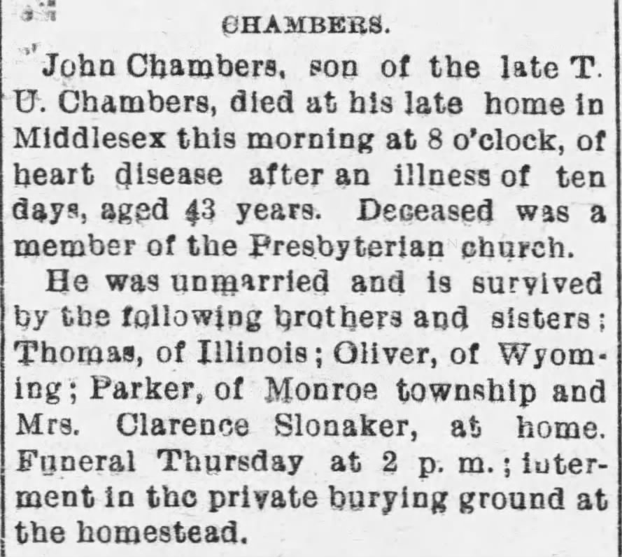
Chambers Farm Family Cemetery – Mile 1131
This cemetery served as the private burial ground for the Chambers family, situated off Old Stonehouse Road within their former property between Mechanicsburg and Carlisle. Dating back to the mid-to-late 1800s, the land is no longer owned by the Chambers family, yet the majority of the family rests here.
The most recent grave, one of about 20, is John Chambers, Thomas Urie Chambers’ son, from 1898. Back then, families often had private graveyards on their farms instead of using public ones.
Here is John Cambers’s obituary as well as his mother’s.
Scott’s Farm – Mile 1135.3
Scott’s Farm is the work center for the Appalachian National Scenic Trail and is owned by the National Park Service. As of recently, there appears to be a deal in the making between the National Park Service and Central Pennsylvania Conservancy. The swap would transfer the Scott Farm property to Central Pennsylvania Conservancy in return for land adjacent to the Appalachian Trail on Peters Mountain in Dauphin County.
SECTION STATS
| 📍 STARTING POINT: Mile 1106.3 | 🤠 MOOD: Happy |
| 📍 ENDING POINT: Mile 1136.5 | 🤕 INJURIES: None |
| 🏔️ ELEVATION GAIN: 3,525.3 ft | 🐻 WILDLIFE: Chimpmunks & Ducks |
| 🏔️ ELEVATION LOSS: 3,972.4 ft | 🌡️ WEATHER: Nice, Warm & Sunny |
APPALACHIAN TRAIL SECTION VIDEO
AT Gear List
Interested in finding out what I carry on my Appalachian Trail Backpacking Trip? Check out my gear list here:


Leave a Comment or Suggestion