Today’s section was actually split into several days and involved hitting the halfway point (although not my halfway point) and tracing the steps of a murder that happened along the Appalachian Trail in the 80s.
If you have a story (think paranormal/unusual) or history tidbit to share that has happened along the Appalachian Trail (even if I have already done the section), please reach out to me here.
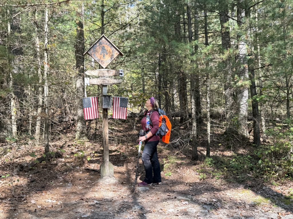
NOBO Section: Mile 1081.2 – 1105.5 | PA 233 to Fuller Lake
| AT Miles | Triple B Miles | Total AT Miles Hiked | Miles Remaining |
|---|
25
0
275.7
1922.7
- Mile 1080.8 – Mont Alto | Civil War History & First Public Forestry Programs
- Mile 1085.5 – Caledonia State Park
- Mile 1094.2 – Rocky Knob Trail Murder & Attempted Murder
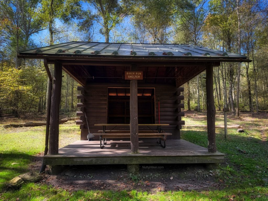
- Mile 1095.5 – Birch Run Shelter – Murder / Attempted Murder
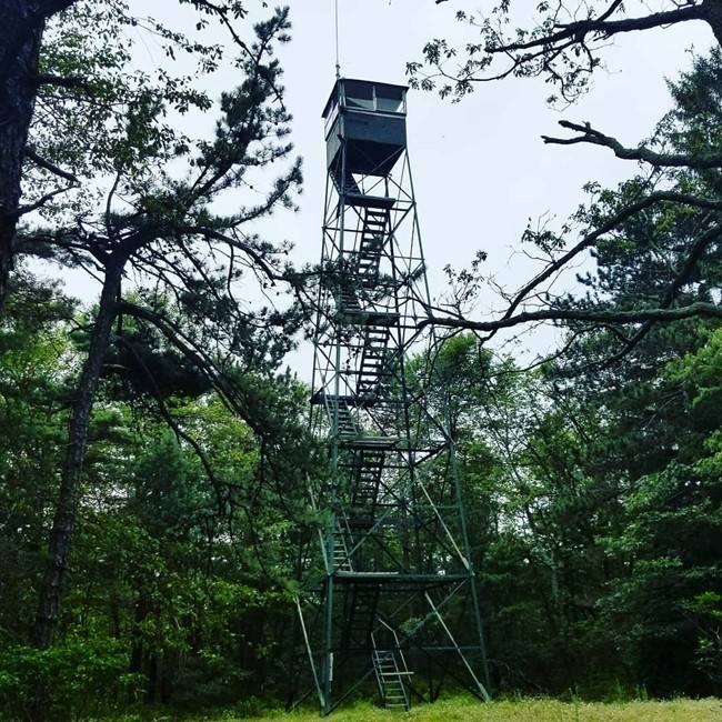
- Mile 1097.1 – Big Flat Fire Tower
- Mile 1097.9 – Dead Woman’s Hollow Rd – Murder/Attempted Murder & Plane Wreck
- Mile 1100 – Outlaw Hideout (Lewis Rocks)
- Mile 1102.9 – Michaux Road – Camp Michaux – POW Interrogation Camp
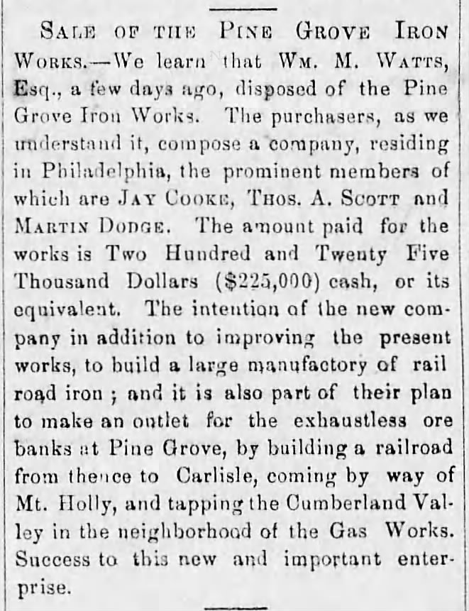
- Mile 1105.1 – Pine Grove Furnace State Park
- Mile 1105.8 – Fuller Lake
- APPALACHIAN TRAIL SECTION VIDEO
The first day had me hiking back to Caledonia State Park, where we were staying, so that was pretty neat! It meant Suspenders could go back to the campsite and just wait for me.
I began the day heading NOBO and ended it heading SOBO so I could hike back to the campsite and also record the chronological order of the murder (the victims were headed SOBO). It was a pretty mild day, and I got to pretty much head downhill both ways, lol.
The following day was pretty neat as I passed by the halfway marker and also got to explore an old POW interrogation camp. I will make a separate blog post about that camp, as it is much larger than I thought and we ended up exploring the entire area.
After exploring the camp, I made my way to Pine Grove Furnace State Park, where Suspenders was waiting for me. We opted not to do the half-gallon challenge, lol.
He wanted to walk the park, so we walked over to Fuller Lake on the Appalachian Trail and also visited the cemetery for Pine Grove after checking out the old furnace.
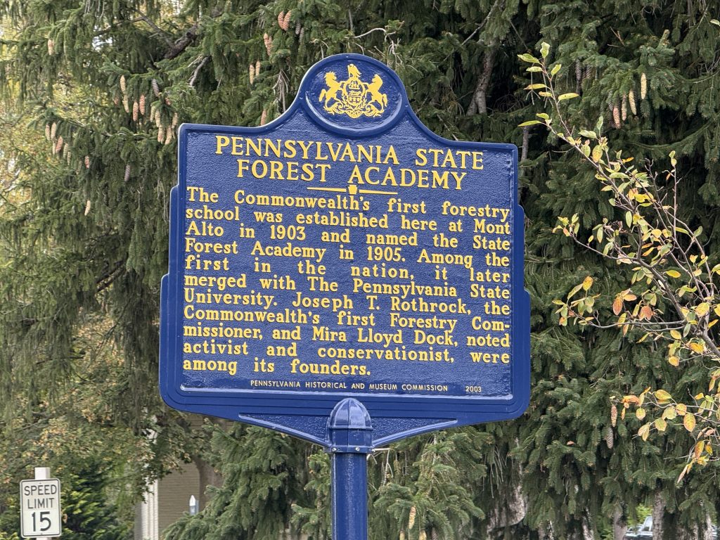
Mile 1080.8 – Rocky Mtn Rd (PA 233) | Mont Alto | Civil War History & First Public Forestry Programs
While I don’t have any history for this exact location, I did want to mention that to the west is the city of Mont Alto, which is home to Penn State Mont Alto. While it is now a satellite campus of Penn State, it was originally established in 1903 as the Pennsylvania State Forest Academy, one of the first public forestry programs in the United States.
Also within the city are a couple of significant Civil War events, and there are historical markers present marking those events.
Pennsylvania State Forest Academy
The academy required first-year students to bring a horse, which they used for firefighting in the Michaux State Forest until the late 1920s. They still offer forestry degrees for anyone interested. You can find more about the history of the Penn Forestry Service here.
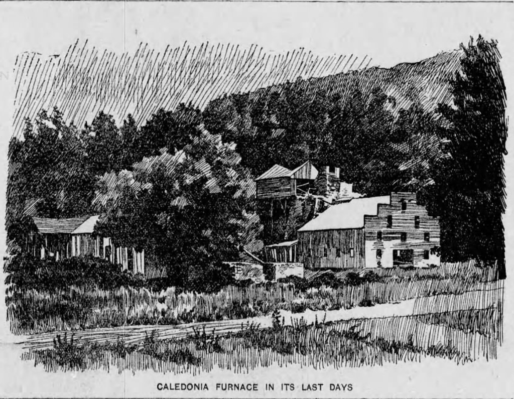
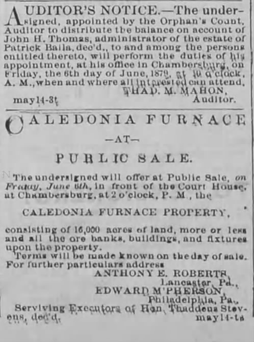
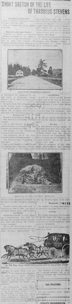
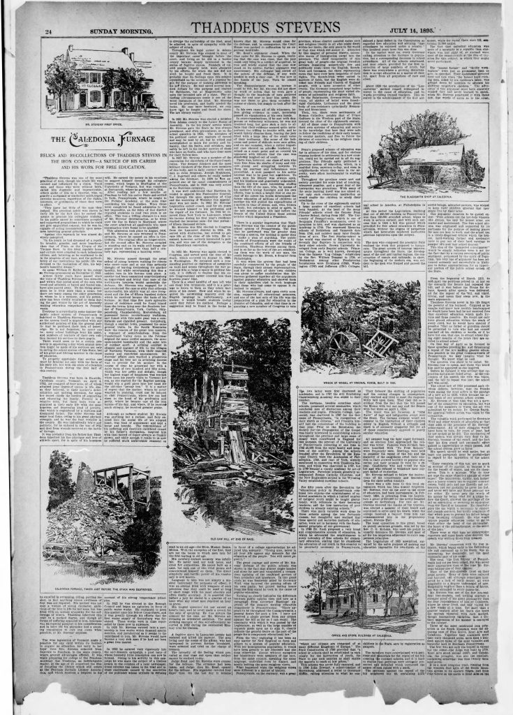
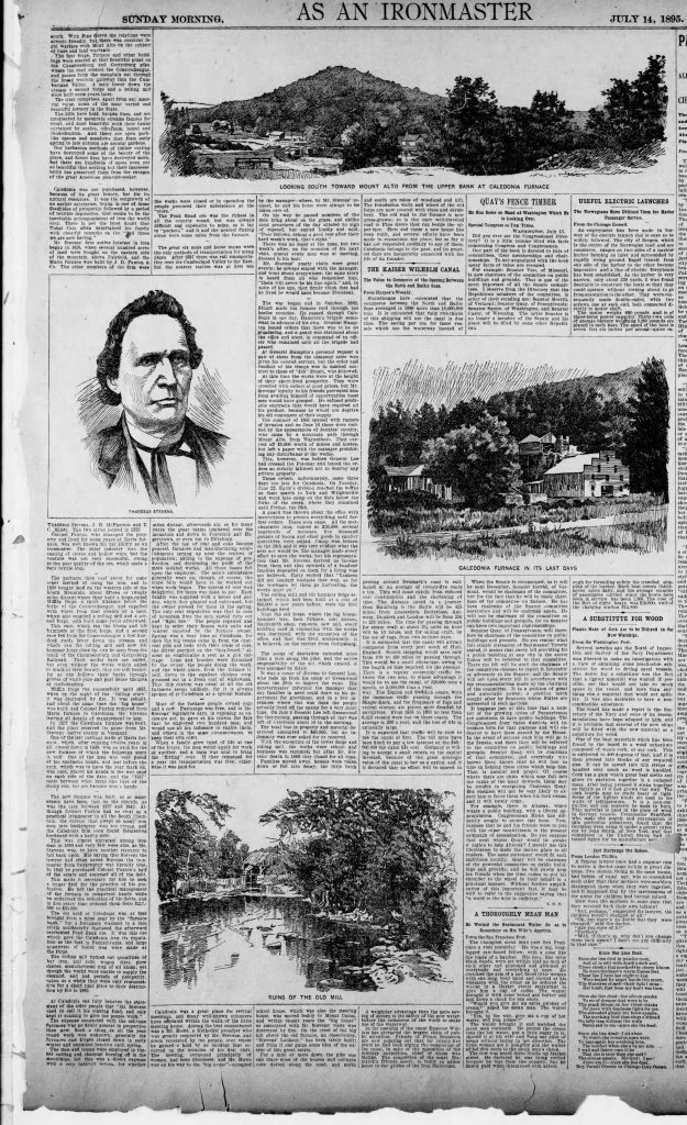
Mile 1085.5 – Caledonia State Park
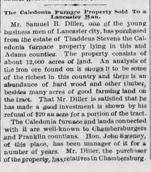
Caledonia State Park, established in 1903, has a history tied to the Chambersburg and Gettysburg Trolley Company, which leased the land and developed amusement rides. The park also shares connections with the former Maria Furnace, a site that saw destruction during the Civil War and subsequent reconstruction.
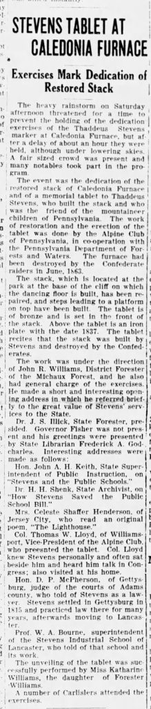
Caledonia State Park is historically significant as the site of a cavalry skirmish between Confederate and Union forces on June 23, 1863. Just a few days later, on June 26, Confederate General Jubal Early’s troops set fire to the ironworks owned by Congressman Thaddeus Stevens, well-known for his strong antislavery stance.
Following the Battle of Gettysburg on July 4-5, 1863, Confederate General John Imboden led a train of wounded soldiers through this area as they made their way back to Virginia. In addition to the wagon train carrying the injured, other groups, including those of Longstreet, portions of Hill’s Corps, and Stuart’s divisional trains, also passed through as they traveled toward the Potomac River.
On July 6, 1863, thousands of New York State National Guardsmen and Pennsylvania State Militia set up camp in this vicinity after coming down from the South Mountain ridge.
Newspaper Clippings
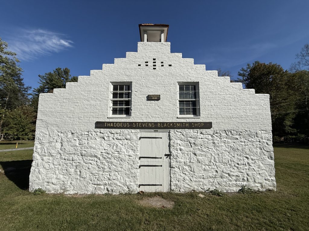
Thaddeus Stevens Blacksmith Shop
John Paxton and Thaddeus Stevens built a blacksmith shop in 1837 as part of the Caledonia Iron Works near Chambersburg Pike. The shop was destroyed during the Battle of Gettysburg but was later rebuilt and operated until 1895, long after the iron furnace closed. Thaddeus Stevens, a key political figure and advocate for abolition during the Civil War, pressured President Lincoln to enlist African-Americans as soldiers and to free enslaved people.
After Confederate General Jubal Early, acting against orders and motivated by Stevens’ strong anti-Southern stance, burned down the Caledonia Iron Works in 1863, Stevens supported the unemployed families affected by the destruction for up to three years. The site of the ironworks is now Caledonia State Park.
Newspaper Clippings
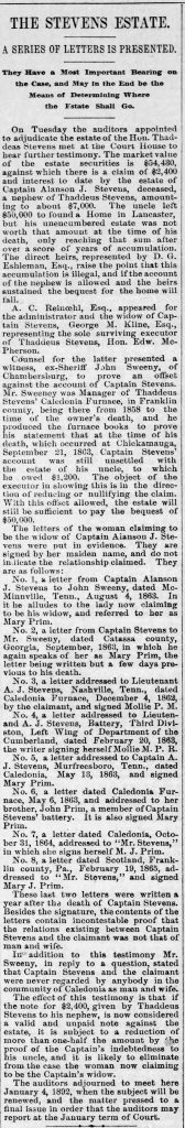
As you can imagine, there are thousands of articles about Thaddeus Stevens. I went down too many rabbit holes and decided to showcase the most notable ones. Please click each picture to see the full article.
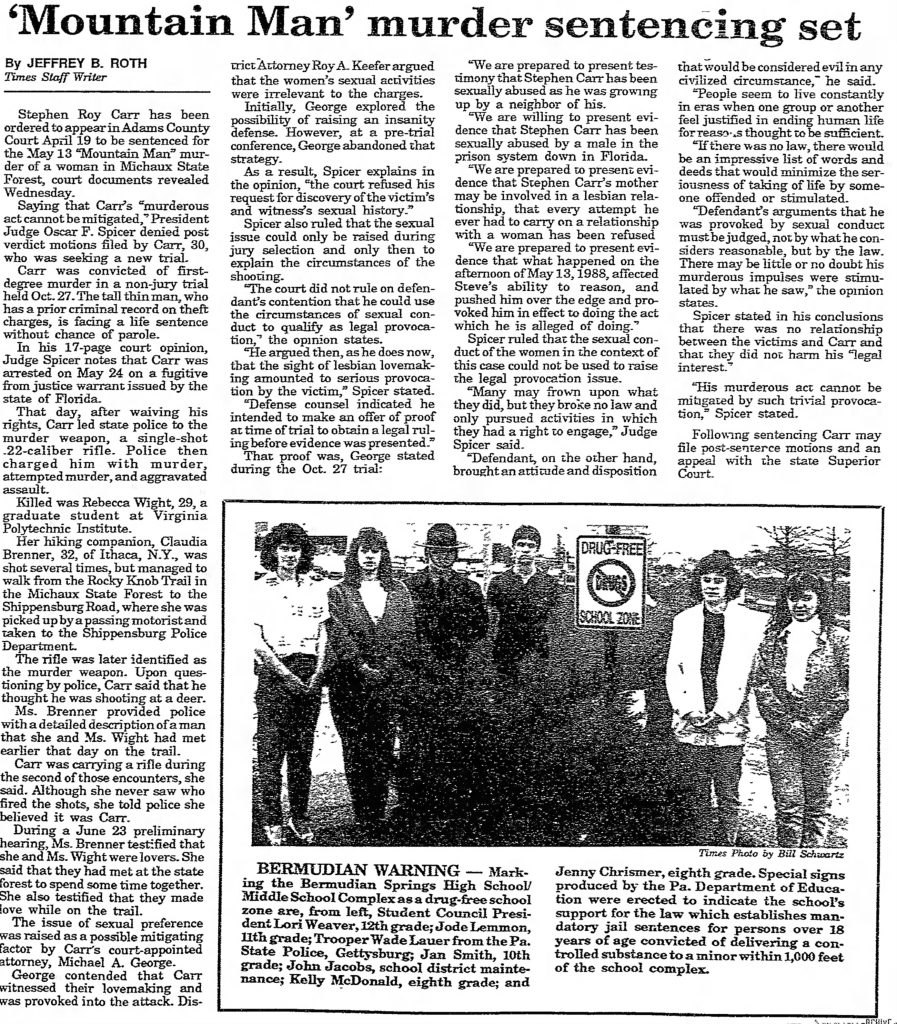
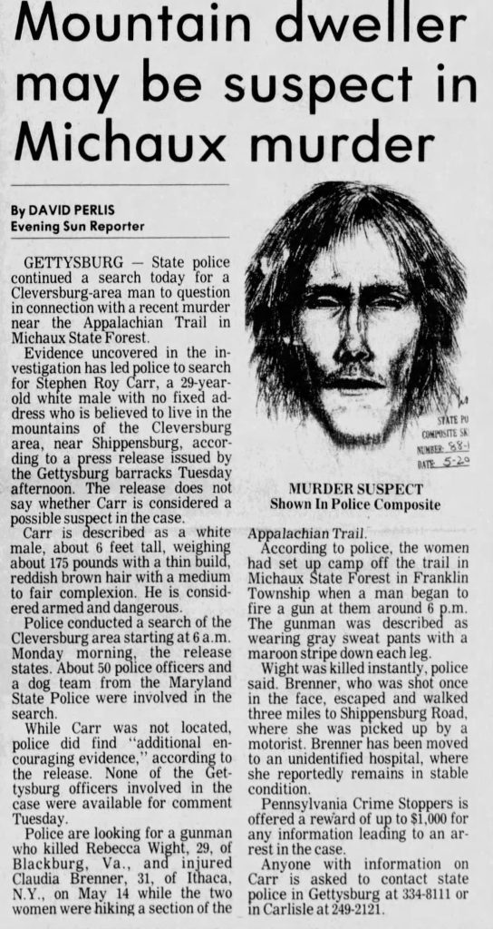
Mile 1094.2 – Rocky Knob Trail Murder & Attempted Murder
In May of 1988, Rebecca Wight and Claudia Brenner had made plans to spend the weekend together. They both had car trouble and ended up arriving later than planned. They left Claudia’s truck at Pine Grove State Park and took Rebecca’s car to locate a closer parking spot to the trailhead.
They planned to stay at Birch Run Shelter Friday night, day hike the Rocky Knob Trail, then hike back to Birch Run Shelter, and then leave Sunday to go to Rebecca’s sister’s in DC before each heading their separate ways on Monday.

They originally wanted to park by the fire tower (which is no longer standing, but you can read the history about it below); unfortunately, there was no parking, so they continued driving. They finally saw parking on a road called Dead Woman’s Hollow (they were unaware of the name).
They set out around 6 PM and started making their way to the Birch Run Shelter. When they arrived, there was still plenty of light, and no one else was there. They set up their tent a little ways from the lean-to for privacy and made dinner.
The next morning, they woke up late and went to the stream to wash up. They then returned to the tent, where Claudia started to make breakfast while Rebecca got up to use the privy, wearing only her sneakers (she was nude). She walked over to the lean-to to grab the logbook to bring back to the tent so they could read through it. However, it was at that time that she saw a man there. The encounter was unexpected, as they thought that they were alone.
That man’s name was Stephen Roy Carr. About 10 minutes later, she came back and told Claudia they need to leave, they’re not alone, and that they need to put their clothes on. They ate breakfast and chatted with each other for a bit, went down to the stream to wash their dishes and bury their uneaten food, and then packed up and left, both telling the man at the shelter, “See you later,” on the way out.
About 30 minutes into their hike, they arrived at where their turnoff was supposed to be but were not 100% sure, so they decided to take out the map and discuss which way they wanted to go, as it was a loop trail.
Right as they were putting the map away, Carr had caught up to them and asked, “Are you lost already?” They answered no and continued on their way. They had no idea where they were going to camp that evening, and the trail was harder than expected.
They kept turning around to make sure they weren’t being followed. They never saw him. Later that day they found a campsite well into the woods and off the trail. They assumed they would be alone. They made their way to the stream, snacked, talked, and then began, let’s just say, heavy petting.
Rebecca was fully dressed, and Claudia was partially dressed. Before long her shoulder exploded. Then another round and another. Claudia had been shot multiple times but could not see the shooter. They decided to make a run for a tree, and that is when Rebecca was shot multiple times.
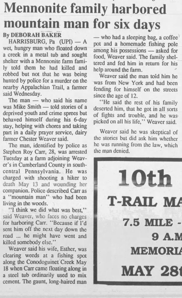
Claudia wrapped Rebecca up in a sleeping bag to keep her warm and made her way out of the woods to get help. She was picked up by teenagers. Claudia survived; Rebecca didn’t. When first responders found her, she was already deceased. Carr was later arrested in a Mennonite community where he had been hiding out.
Carr waived his right to a jury trial in exchange for the prosecution’s agreement to not seek the death penalty. He was sentenced to life in prison without the possibility of parole and remains incarcerated at the State Correctional Institution at Albion in Erie County.
While the exact location is unknown, based on the information that was provided in reports, the estimated location is 39°57’41″N 77°26’49″W. Brenner survived and wrote about her ordeal in the book “Eight Bullets.” There is also another book called The Whole Truth? A Case of Murder on the Appalachian Trail, written more from an investigative standpoint, where all parties and lawyers were interviewed.
Newspaper Clippings
Mile 1095.5 – Birch Run Shelter – Murder / Attempted Murder Continued from above
This is where Rebecca Wight and Claudia Brenner stayed and met Stephen Carr near the privy.
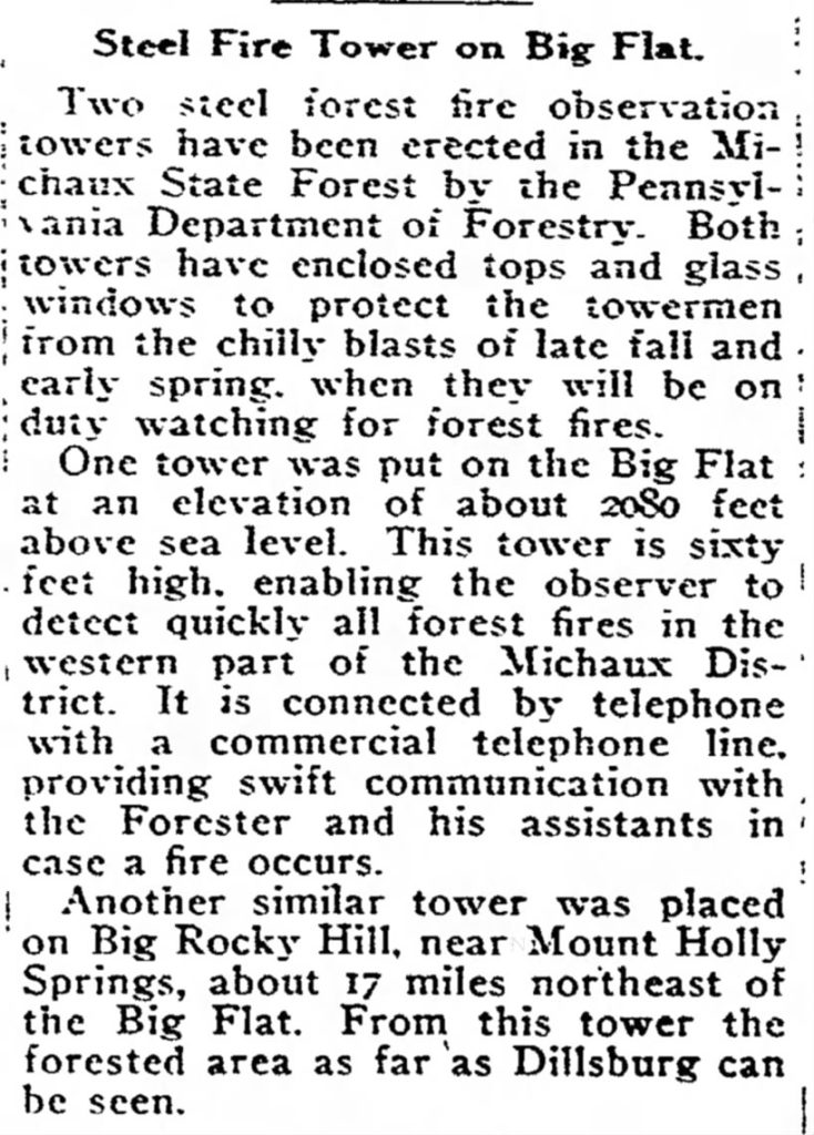
Mile 1097.1 – Big Flat Fire Tower
Just to the west, about a 1/4 mile away, stood Big Flat Fire Tower. It was built in 1921 as a 60-foot steel tower. It was torn down sometime in November of 2021 and is now an empty lot behind a communications tower. The newspaper clipping below is the announcement of its placement. The image of the tower was taken from Facebook. This location is where Rebecca & Claudia originally tried to park.
Mile 1097.9 – Dead Woman’s Hollow Rd – Murder/Attempted Murder from above & Plane Wreck
Plane Wreck
An Army training plane crashed on South Mountain near Dead Woman’s Hollow Rd on June 1, 1942 (about 350 yards from here), killing the pilot, First Lieut. John C. Femenella, and seriously injuring the co-pilot, Second Lieut. Henry A. Salm.
The crash site was difficult to locate due to fog and poor visibility. Salm, despite suffering from a concussion and multiple injuries, managed to make his way down the mountain to seek help. He had shoved a heavy, blackened pole into the soft mud beside the dirt road, and then he recalled passing a game refuge, a stream, and seeing “a park.” His recollection of these landmarks enabled authorities to focus their search and eventually find the wreckage about 30 hours after the crash.
The plane had left Middletown Air Depot en route to Texas and had not been reported since. The wreckage was found near the intersection of Cumberland, Adams, and Franklin counties, off Dead Woman’s Hollow Road. Investigators found no evidence of fire at the scene. Salm was likely thrown from the plane during the crash and regained consciousness the next morning to seek help. The investigation into the cause of the crash was ongoing at the time.
Oddly, apart from a single newspaper article, there is no mention of this wreck in any database or elsewhere.
Murder & Attempted Murder
This location is where Rebecca Wight and Claudia Brenner parked their vehicle. For those that may be wondering if this road, a hollow, was named Dead Woman’s Hollow because of these murders, the answer is no.
How Dead Woman’s Hollow Road Got Its Name
Dead Woman Hollow got its name because a woman who lived on a farm in the area went to a nearby spring for water and was bitten by a rattlesnake along this path in 1908, dying in this hollow. The hollow became known to locals as Dead Woman Hollow.
Yet another story suggests that a woman got lost and never returned home. Years later a pair of shoes, a comb, and a bunch of hair belonging to her were found. Ever since then, it has been known as Dead Woman’s Hollow.
If you like ghost stories, according to old newspaper reports from the late 1800s, there was a murdered woman in white found in Dead Woman’s Hollow, and she can be seen wandering around the hollow. And yet another article reported a woman’s body being found with her head cut off while Pine Grove Furnace was in operation.
I haven’t looked too much further into when the road was named, etc., as there is just too much history in this section (as you can see from this very long blog post). Once I get all my Pennsylvania Appalachian Trail posts/videos out, I will come back and do more research.
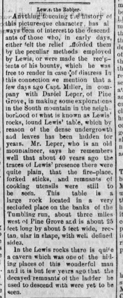
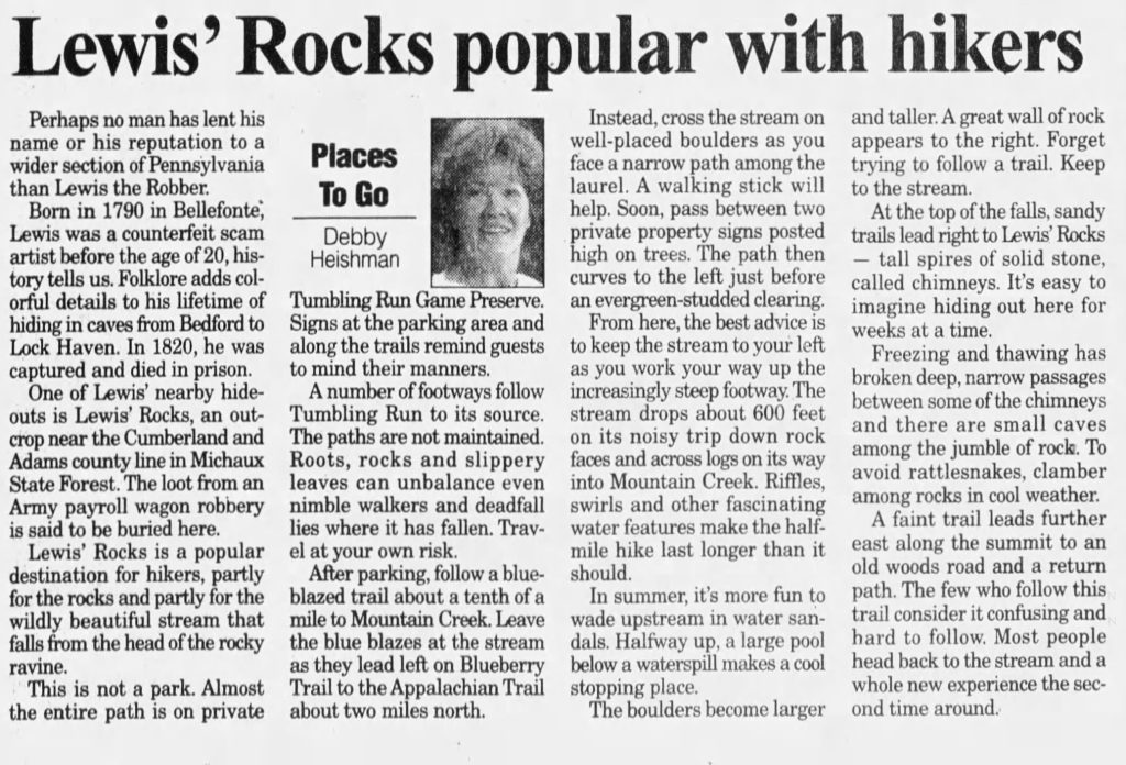
Mile 1100 – Outlaw Hideout (Lewis Rocks)
About 1/2 mile SE of here is Lewis Rocks, where local outlaw Lewis the Robber hid out. I actually found out about this after I got back when I was searching through old newspaper articles. Lewis Rocks is named after him. Apparently, he was a modern-day Robin Hood.
I have included several articles; one is from 1889!
If you’re feeling adventurous, you can reach Lewis Rocks from the AT, which is a popular hiking destination.
Newspaper Clippings about Lewis Rocks

Mile 1102.9 – Michaux Road – Camp Michaux – POW Interrogation Camp
For NOBO, if you take a right and walk a short distance to the intersection of Michaux Road and Bunkerhill Road, you will find a marker for Camp Michaux, aka Pine Grove Furnace POW Camp, which was an old WWII POW camp between 1943 and 1945, as well as a CCC camp and church camp.
There are ruins from the old camp still visible that you can see with a self-guided tour (they have maps at the kiosk). I will actually do a completely separate blog post and video, as we walked the entire grounds.
I thought it was just a marker and one structure, but there’s much more to see, and it’s worth it for history buffs.
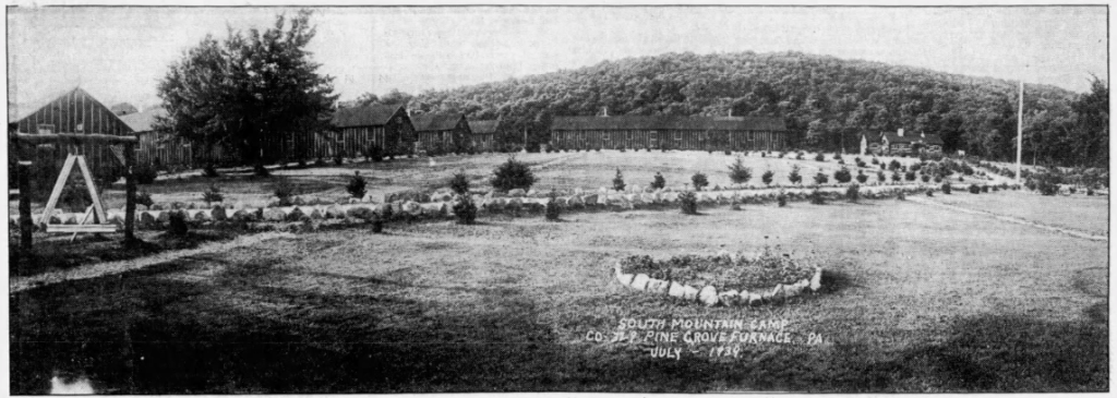
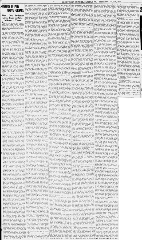
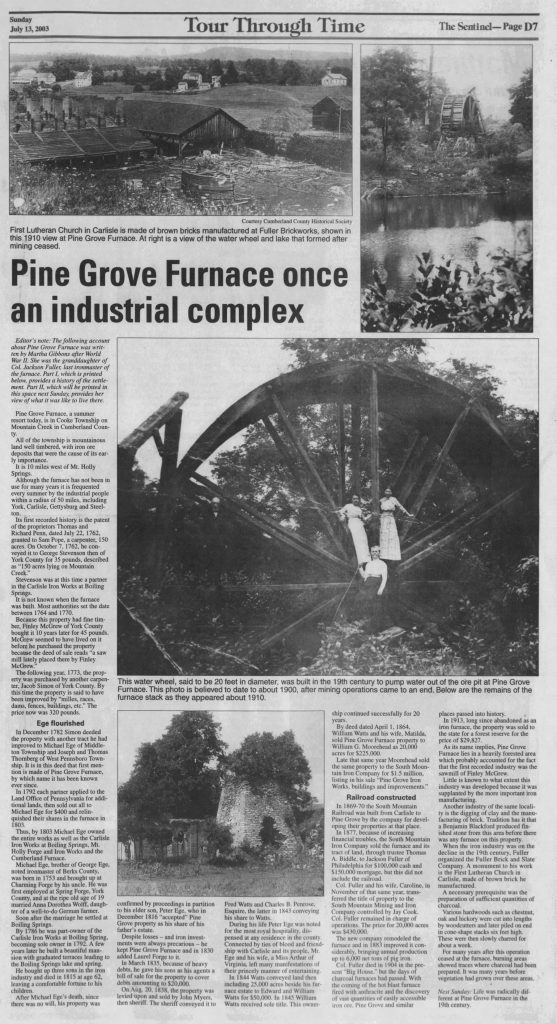
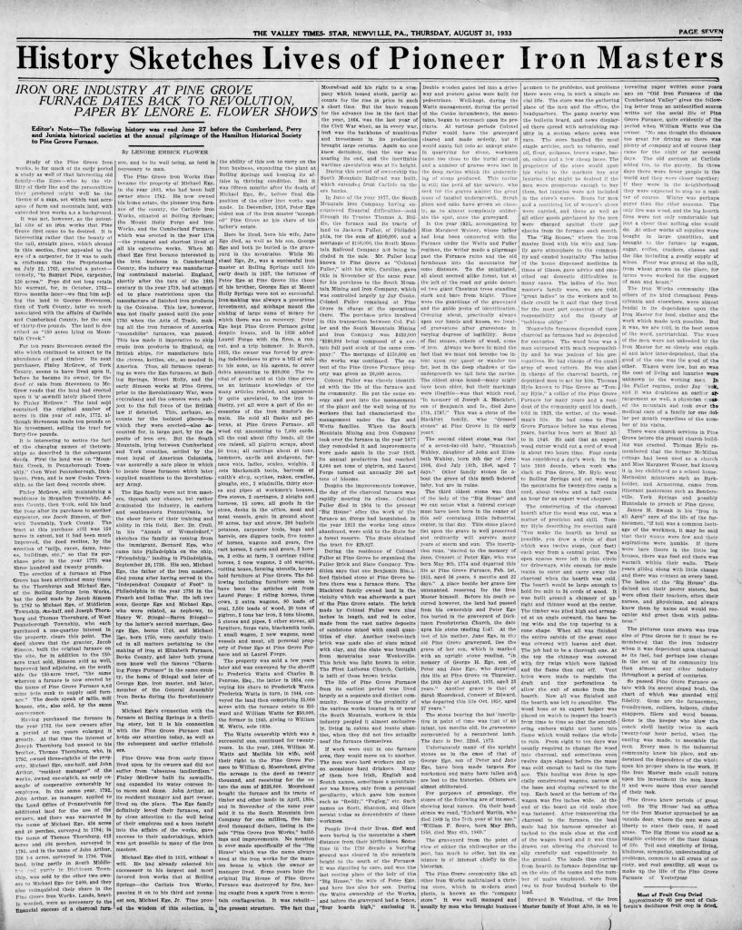
Mile 1105.1 – Pine Grove Furnace State Park
Pine Grove Furnace State Park is the site of an iron furnace called Pine Grove Iron Works. It manufactured ten-plate stoves, fireplace backs, iron kettles, and possibly munitions during the American Revolution.
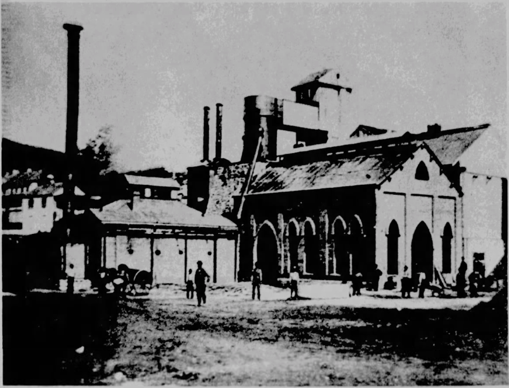
Here is a newspaper clipping from 1933 with some fascinating history along with some other ones (click to enlarge):
Civil War
Pine Grove Furnace State Park is notable for being the encampment site of thousands of New York State National Guardsmen and Pennsylvania State Militia on July 4-5, 1863, as they prepared to head to Gettysburg. The weather was dismal, with heavy rains causing nearby creeks to overflow. The multitude of soldiers quickly caused damage to the mountainous roads from Mount Holly Springs to Laurel Forge and Pine Grove Furnace.
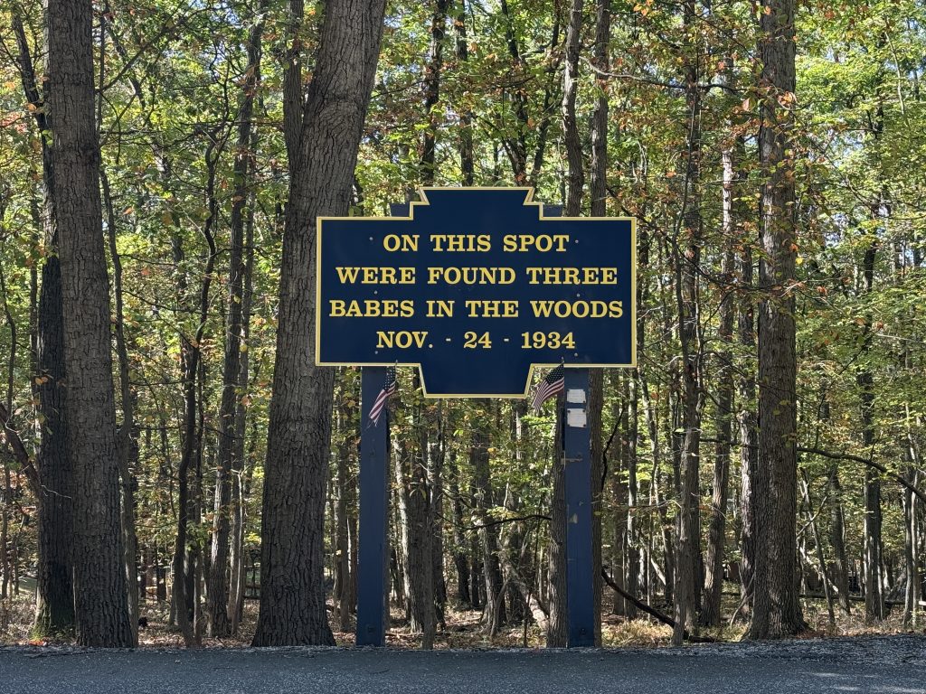
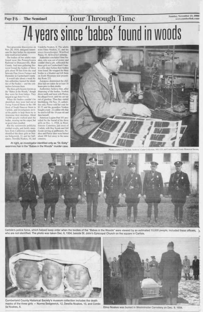
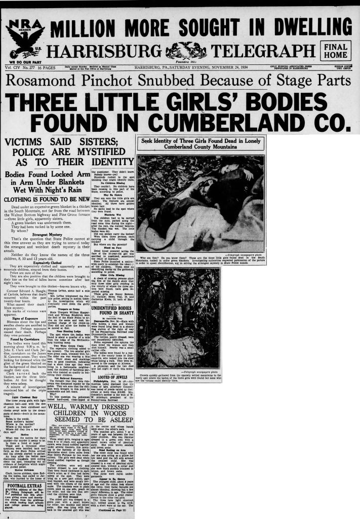
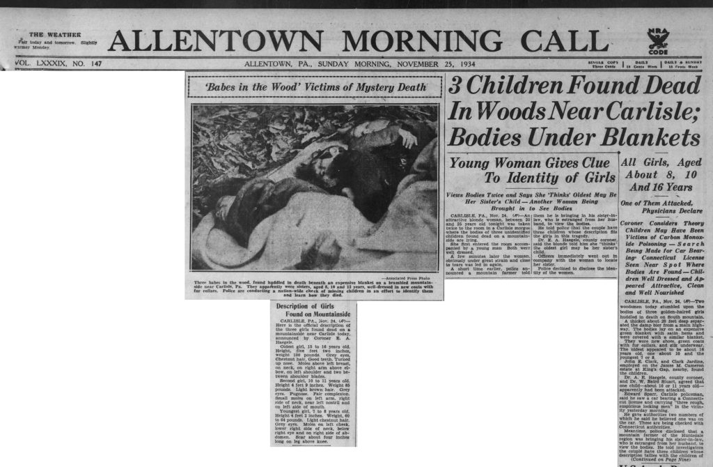
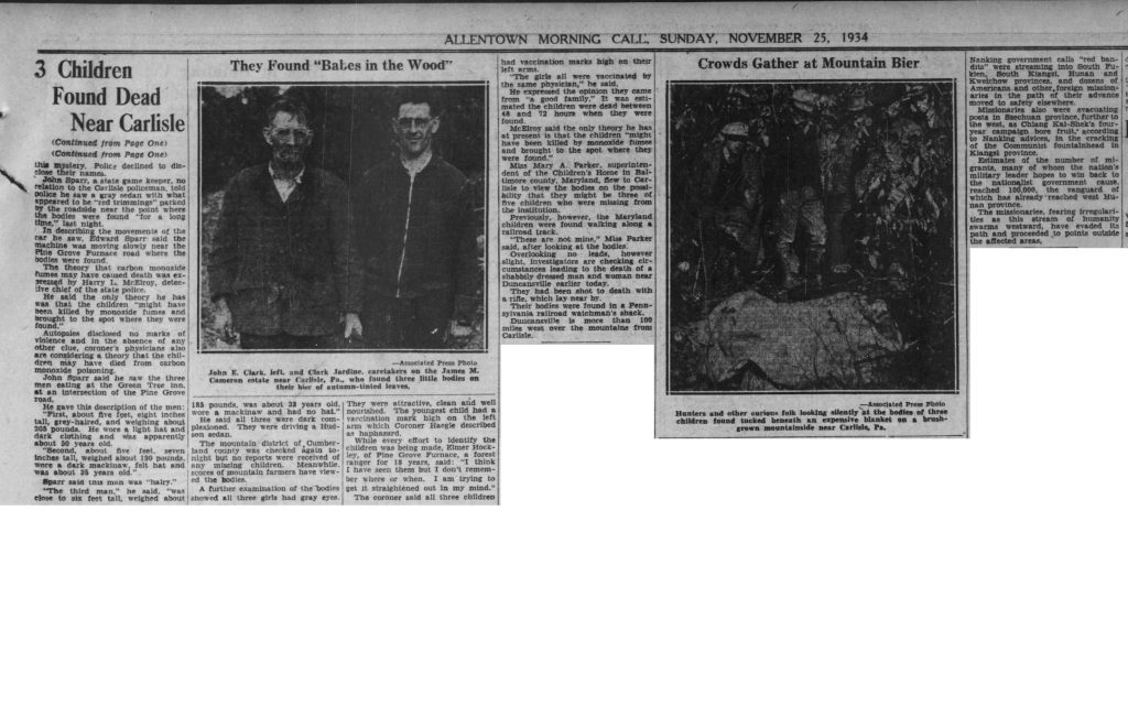
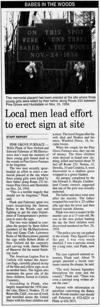
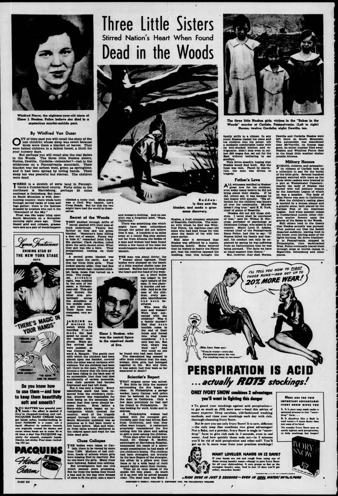
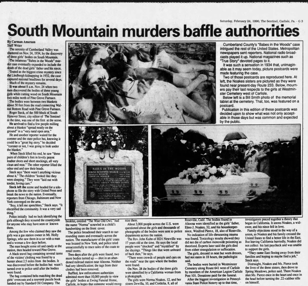
Babes in the Woods
Pine Grove Furnace State Park is also known for a tragic event known as the “Babes in the Woods” murders. In 1934, the bodies of three young girls were found in the park, and their deaths were linked to a murder-suicide involving their father and his niece/lover, over 100 miles away.
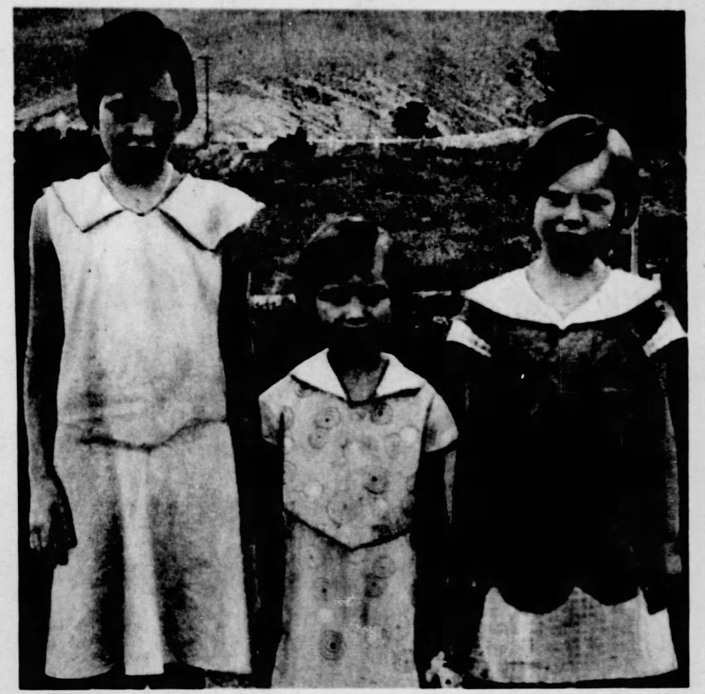
It brought national attention, and many questions were left unanswered. To this day investigators are still trying to uncover what really happened.
There is a sign coming into Pine Grove State Park along 233 that marks the location where their bodies were found, and they are buried at Westminster Cemetery not too far from here in Carlisle. There is a good video presentation here.
There are hundreds, if not thousands, of newspaper articles about the murder; I have chosen a couple of intriguing ones to share. Be forewarned: some of the articles contain hard-to-look-at pictures of the three girls’ bodies.
Amusement Park & Girl Scout Camp
This site was once an amusement park that operated from 1878 to around 1900 and a Girl Scout camp from 1921 to the late 1960s. You can still find remnants of the amusement park and the old camp right off the Appalachian Trail along the Kappenhuver Trail.
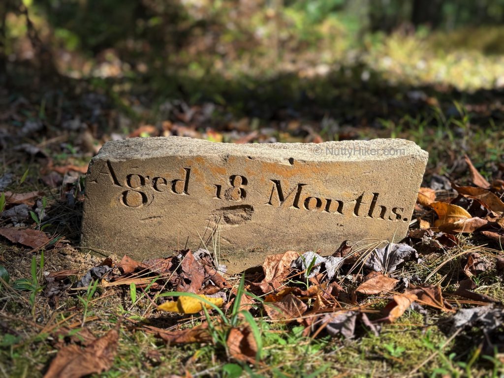
Pine Grove Furnace Cemetery
Established around 1780, Pine Grove Furnace Cemetery ceased burials in the mid-1800s due to its proximity to a limestone quarry, which accidentally unearthed graves. One of the last known burials was in 1891, for a Hungarian building a railroad, killed in a dynamite explosion. It is now pretty overgrown, despite the efforts of boy scouts who cleaned it up in the late 1980s.
I was only able to find one marker; however, it had been broken off. From my understanding, most markers were simple rocks to mark a grave (you see this a lot in very old cemeteries), and most other markers were vandalized (broken into pieces) or stolen.
Getting there from the Appalachian Trail
It’s only about 0.3 mile from Fuller Lake via Quarry Road. Turn left on Cemetery Road, and you will see the sign for it on the left.
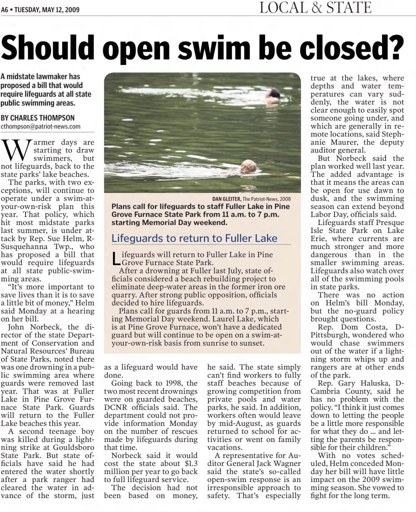
Mile 1105.8 – Fuller Lake
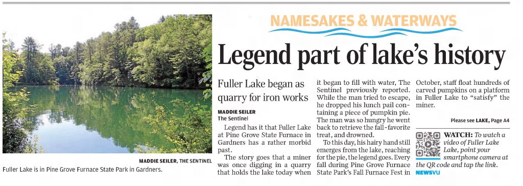
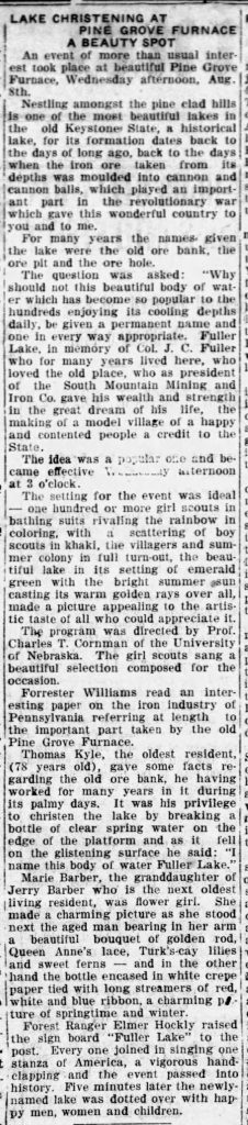
Fuller Lake is a former 90-foot-deep iron ore quarry that was allowed to fill with groundwater in the mid-1890s when ore was no longer being mined and created the lake you see today. It was officially named Fuller Lake in August 1923 after Col. Jackson Fuller, a co-owner of the Pine Grove Iron Works who also built an amusement park on the grounds after the iron works closed down.
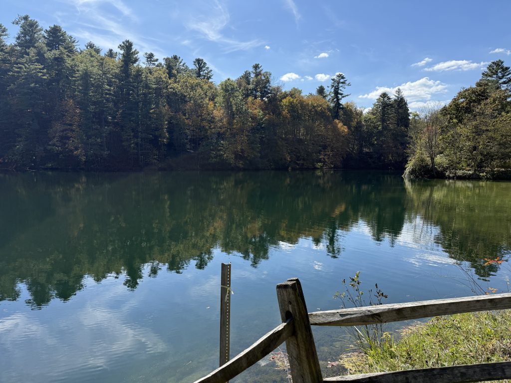
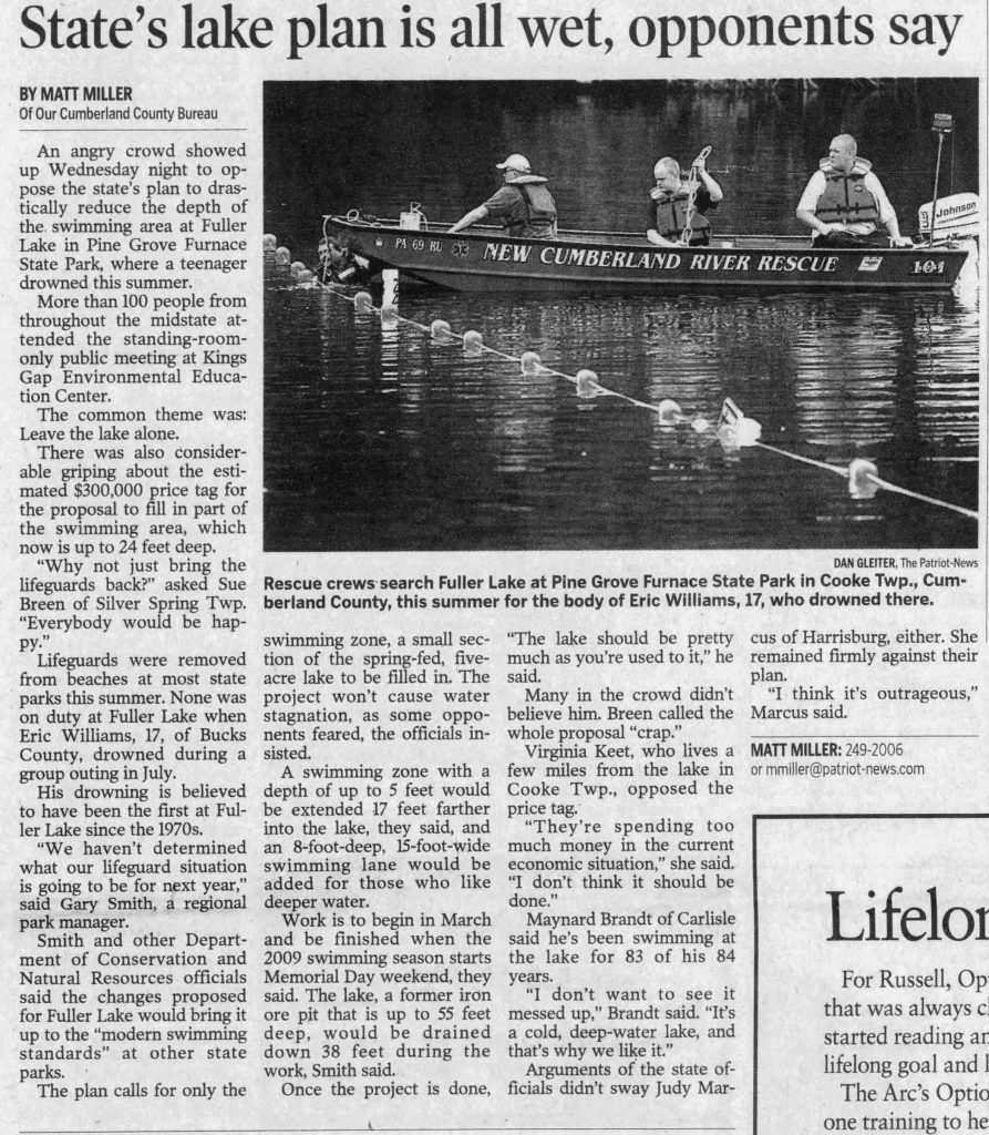
Unfortunately, in July 2008, a 17-year-old boy drowned while swimming in the lake. After the drowning, officials considered reducing the depth of the lake from 40 feet to 8 feet but were met with fierce opposition by the community, and the idea was scrapped. There have been multiple drownings at the lake, dating back to the 1930s.
Legend of Fuller Lake: Every year Pine Grove hosts a fall festival where they float pumpkins in the lake to satisfy the hairy hand of a miner that drowned in the lake. The legend goes that a miner was digging for ore when the pit began to suddenly fill with water. As he was trying to escape, he accidentally dropped his lunch pail, which contained a piece of pumpkin pie, into the water. He went to retrieve it and drowned. According to legend, his hairy hand still reaches out from the depths of Fuller Lake, trying to retrieve that slice of pumpkin pie.
Fun Fact: Before it was officially named Fuller Lake, it was often referred to as the Ore Bank, Old Ore Pit, and Ore Hole.
Newspaper Clippings

SECTION STATS
| 📍 STARTING POINT: Mile 1081.2 | 🤠 MOOD: Happy =) |
| 📍 ENDING POINT: Mile 1105.5 | 🤕 INJURIES: None |
| 🏔️ ELEVATION GAIN: 3027.6 ft | 🐻 WILDLIFE: Chipmunk |
| 🏔️ ELEVATION LOSS: 3774.9 ft | 🌡️ WEATHER: Misty AND Sunny & Mild |
APPALACHIAN TRAIL SECTION VIDEO
AT Gear List
Interested in finding out what I carry on my Appalachian Trail backpacking trip? Check out my gear list here:


Leave a Comment or Suggestion