Nighttime thunder and rain, a foggy/misty morning, climbing hump mountain, some injuries, leaving NorthCarolina for good, and finally making it to 19E
| AT Miles | Triple B Miles | Total AT Miles Hiked | Miles Remaining |
|---|
6.9
0
163.9
2034.5
DAY STATS
| ⏰ TIME TO COMPLETE: 5hr 15min | 👣 TOTAL MILES TODAY: 6.9 |
| 📍 STARTING POINT: Campsite (mm 388.7) | 🤠 MOOD: Neutral |
| 📍 ENDING POINT: 19E (mm 395.6) | 🤕 INJURIES: Several – Slipping on Rocks |
| 🏔️ ELEVATION GAIN: 665.7 ft | 🐻 WILDLIFE: Snail |
| 🏔️ ELEVATION LOSS: 2,966.2 ft | 🌡️ WEATHER/TEMP: Foggy then Sunny |
| 📐 TOTAL GRADE: 524.5 ft/mi | 💰 EXPENSES: $245 (BnB, Medical, Food) |
It rained for most of the night, so we packed up a wet tent and set out. Thankfully, instead of starting out uphill right away (as it typically goes) we had a short downhill into Bradley Gap, which supposedly gets its name from the Bradley Family, who used to own land in the area.
Bradley Gap apparently has amazing views, but we wouldn’t know lol.
Hump Mountain – Mile 390.2
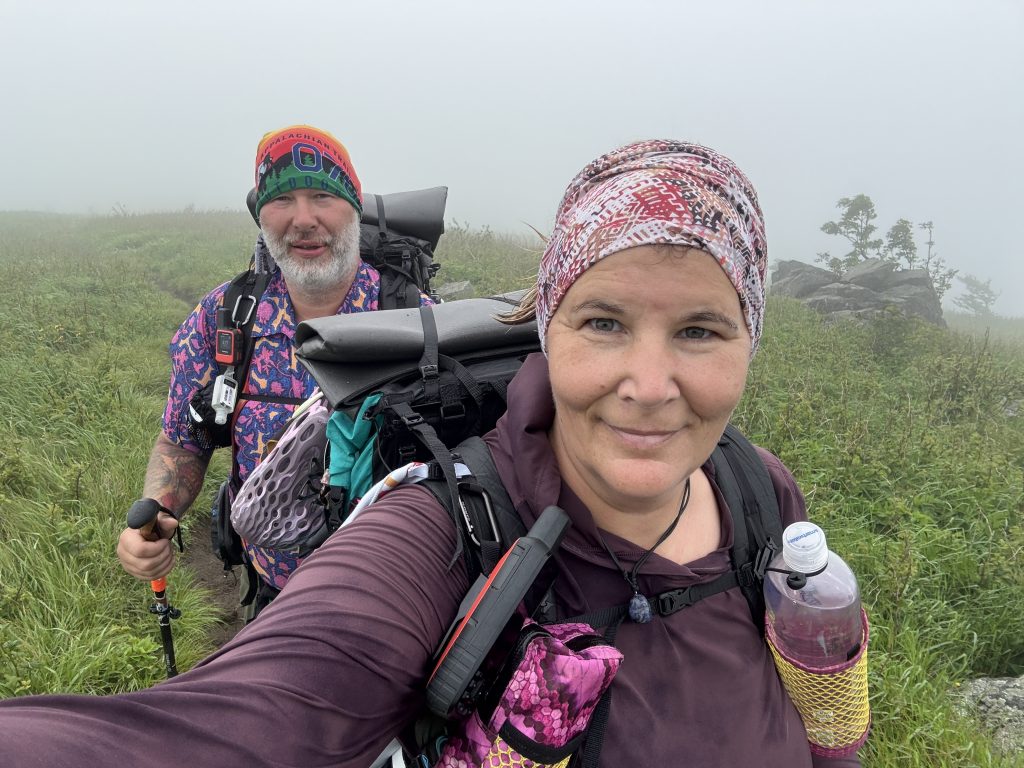
The climb up Hump Mountain wasn’t horrible, but in the fog, it seemed to go on forever.
Atop Hump Mountain stands a memorial plaque dedicated to Stan Murray.
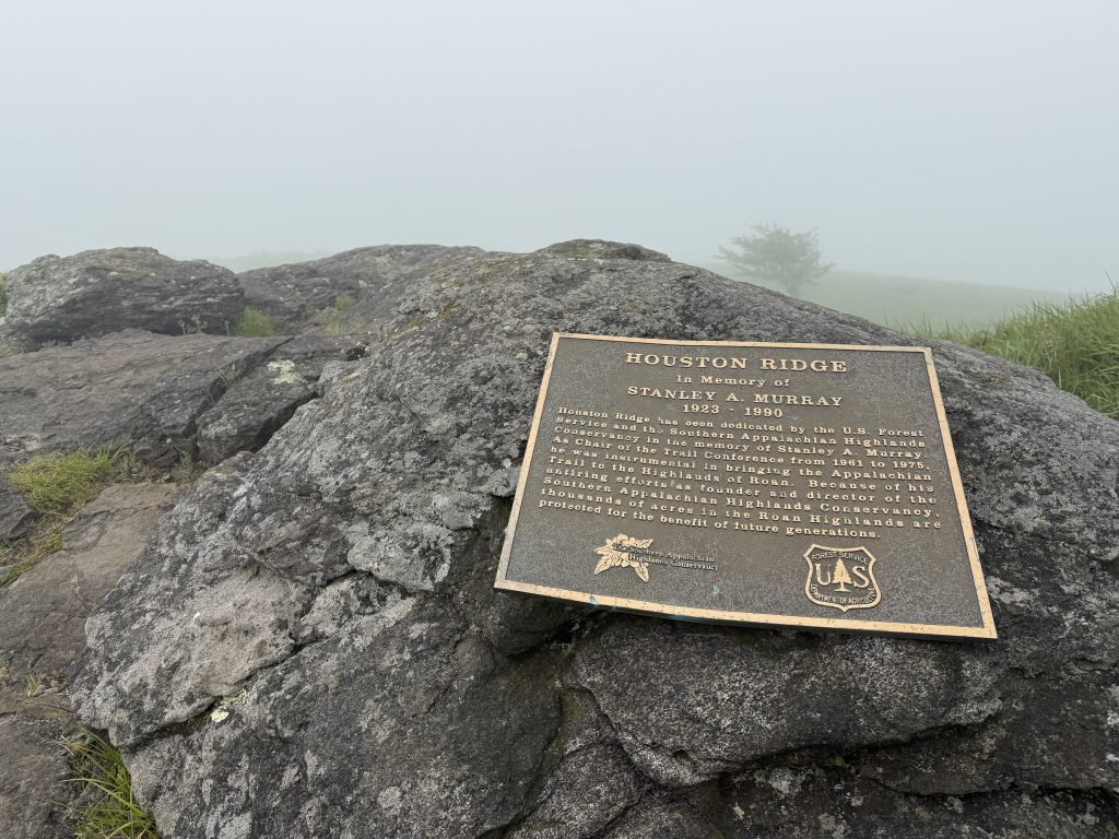
Stanley A Murray worked to accomplish federal protection for the Appalachian Trail. He wrote a draft bill and lobbied Congress, playing a significant role in the passage of the National Trails System Act in 1968. He envisioned more than just a narrow footpath for the AT. He advocated the “greenway” concept to protect a wider corridor around the Trail.
Murray was especially concerned with how to preserve Roan Mountain and the balds in the Highlands of Roan on the North Carolina-Tennessee state line, and personally focused much of his energy on that area of the Appalachian Trail.
His work on the Tennessee Eastman Hiking Club’s relocation of the AT over Roan and the formation of the ATC’s Roan Mountain Preservation Committee in 1966 led to the 1974 incorporation of SAHC with the goal of protecting thousands of acres along the Roan Mountain Massif from development.
It was a long way down to 19E, and Suspenders fell several times on the slippery boulders.
Doll Flats – Mile 392.6
Thankfully, the fog cleared out to sunny skies, and we finally rolled into Doll Flats.
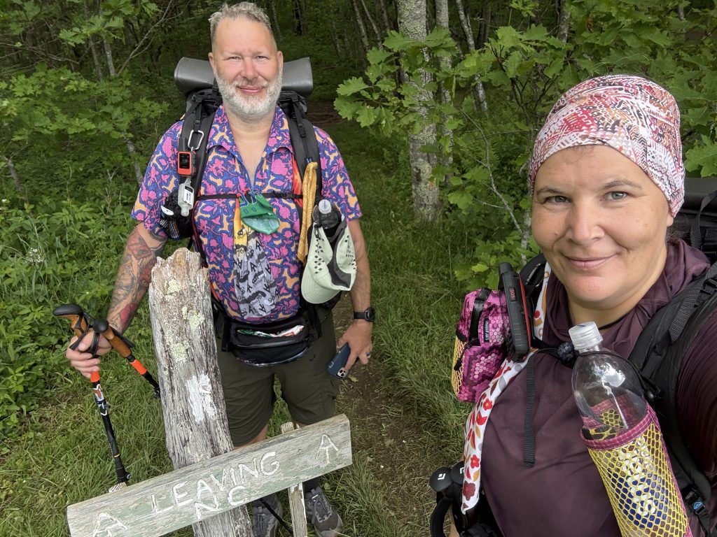
This is also where you leave North Carolina for the last time (you’ll find out in a couple of days that this is a lie). You see, up until this point. From Smoky Mountain National Park to here, the trail has been following the NC/TN border. This means you are constantly going from NC to TN and back. Anyway, we took the opportunity to do our border bourbon here as we officially leave NC behind.
History Lesson for Doll Flats
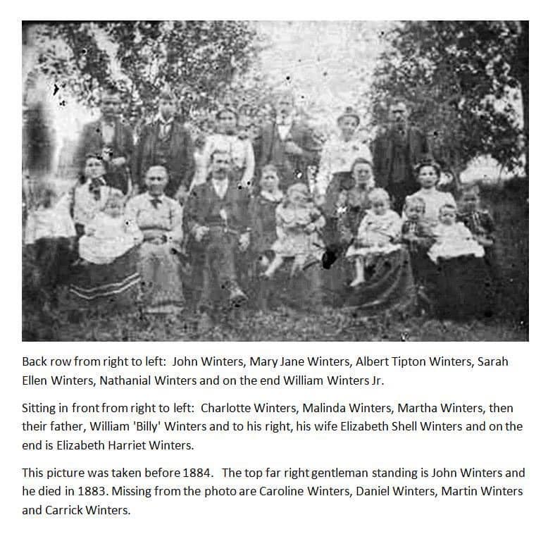
According to family lore, passed down through the generations, the children of William Winters and Eliza Shell were known to be ornery. This couple’s seven male children were commonly referred to as the “Seven Devils” in the Appalachian Mountain area. William himself had quite a reputation for fist-fighting and would challenge almost anyone.
The Winters Clan held regular “tough man contests” or “fights” on the Doll Flats. People came from all around to watch the fights, and apparently, it was quite entertaining.
Doll Flats has also gained a reputation for strange lights, often referred to as the Brown Mountain Lights, as well as paranormal experiences. Supposedly, there is also a cemetery nearby, but the only one I found was about a mile away as the crow flies.
We continued our descent down the mountain. Suspenders fell a couple of times more, and this time, they were bad falls. His back was hurting, but thankfully, we were almost done.
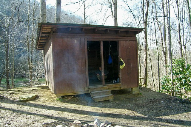
Apple House Shelter / Former Site – Mile 395.1
The trail seemed to level out around the old Apple House Shelter site, which was a welcome change.
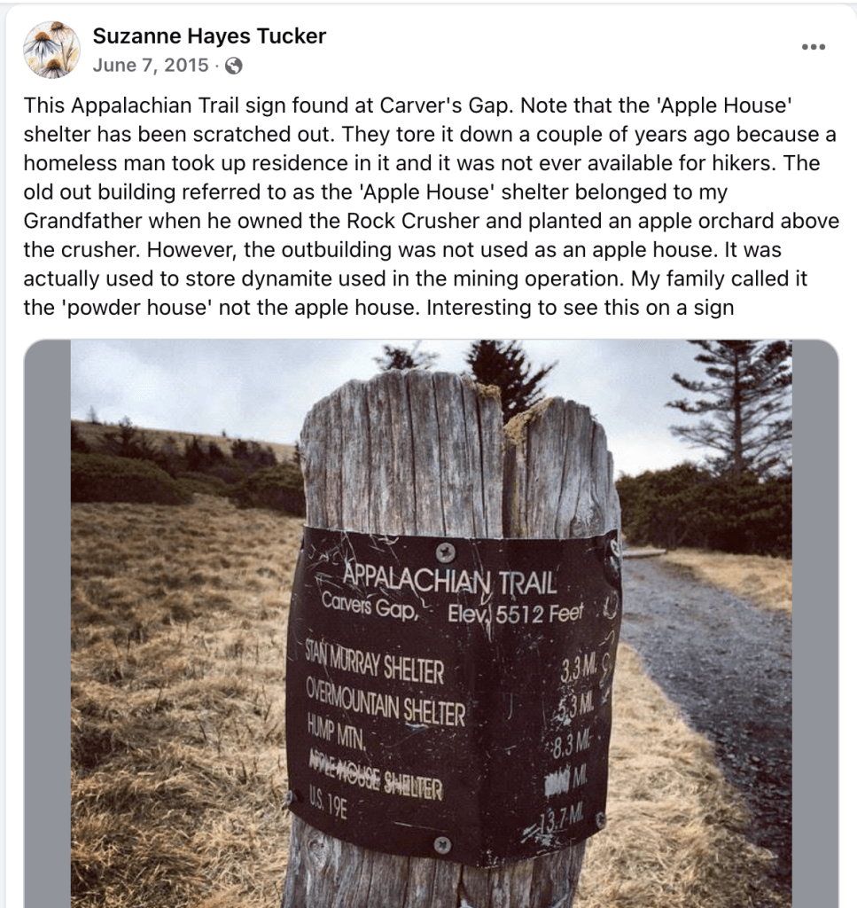
The Apple House Shelter was once located in this area. Originally built in 1952, the structure served as a storage facility for explosives at the old Iron Mine. It was also supposedly used to house tools for a nearby apple orchard; however, I found a comment on Facebook1 from someone claiming to have firsthand knowledge that it didn’t:
According to Suzanne Tucker:
The old outbuilding referred to as the ‘Apple House’ shelter belonged to my Grandfather when he owned the Rock Crusher and planted an apple orchard above the crusher. However, the outbuilding was not used as an apple house. It was actually used to store dynamite used in the mining operation. My family called it the ‘powder house’ not the apple house.
In 1984, the shelter was rebuilt to fulfill its intended purpose. However, it was ultimately demolished in 2012 due to its proximity to Highway 19E and the fact that a homeless man had taken up residence in it, making it unavailable for hikers.
We passed by some homeless people living in tents right before the trail let out onto 19E. Thankfully, they didn’t give us any issues. We only had a short wait for our shuttle to take us to our bed and breakfast.
Another Change of Plans
Tonight, the decision was made that Suspenders will no longer be backpacking with me. The multiple falls have caused pretty severe pain in his back. Until he can get another MRI (he has a service-connected disability for his back already), he’s not to carry more than 10 pounds. If his back pain does not improve or gets worse over the next 24 hours, we will have to head home so he can see his doctor.
So, for now, we are heading back 6 hours to my Mom’s to pick up my truck, and he will be slackpacking me from here on out. This means we will set up a Basecamp (like we did for key swapping), and he will take me to the trailhead. I will hike for the day, and he will pick me up when I’m done. I won’t be carrying all my gear.
APPALACHIAN TRAIL DAY 33 VIDEO
AT Gear List
Interested in finding out what I carry on my Appalachian Trail Backpacking Trip? Check out my gear list here:
- https://www.facebook.com/groups/1521975384734918/posts/1579012969031159/ ↩︎


Leave a Comment or Suggestion