I found this T-28 plane wreck when I was researching this section of the trail for my Appalachian Trail hike. I had gone down several rabbit holes and somehow randomly ran across this.
I knew I had to check it out, especially since I had never heard any other Appalachian Trail YouTube hiker mention this specific T-28 plane wreck (there is another one nearby). I truly believe that most people are unaware of its existence!
What Happened?
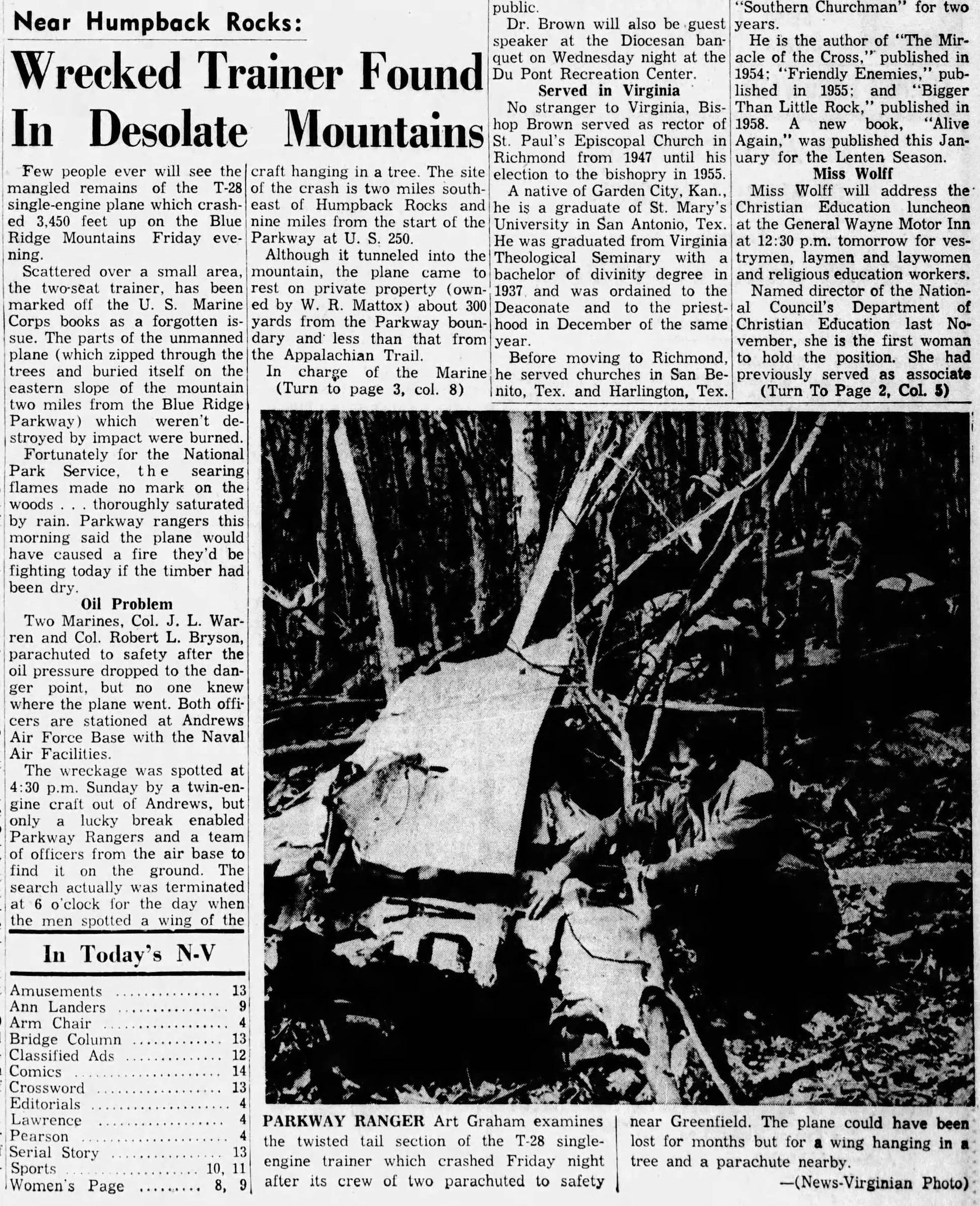
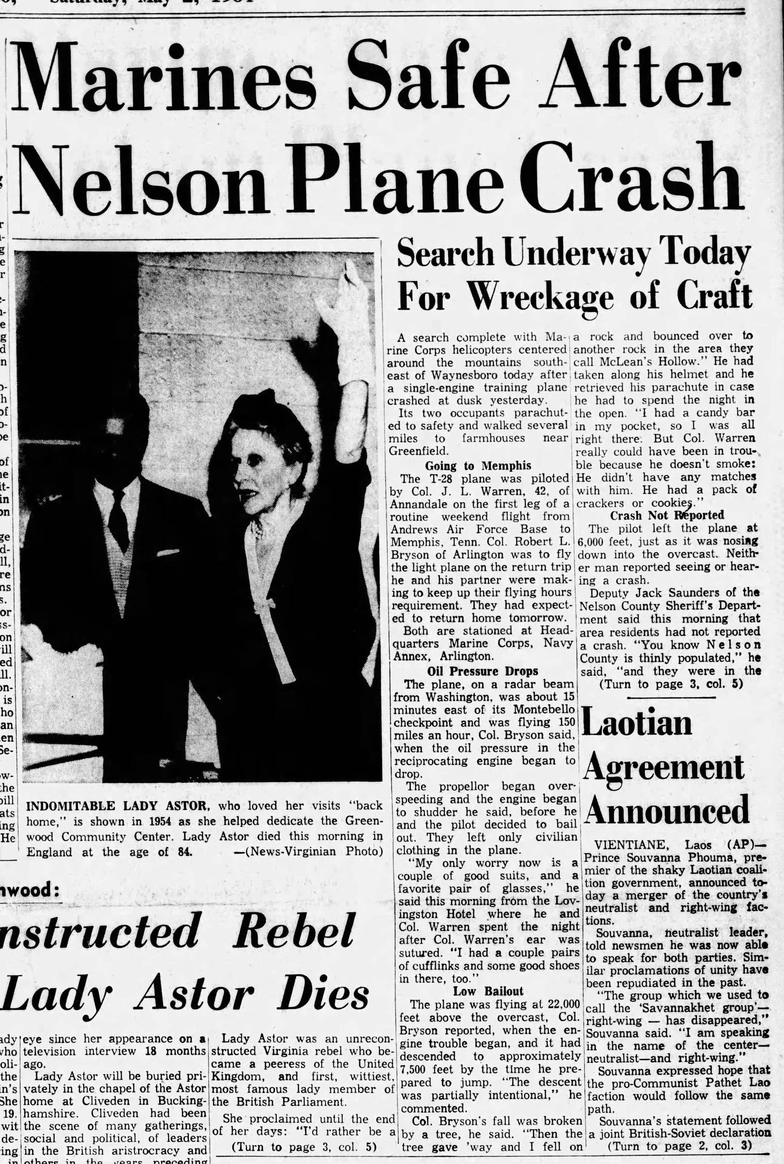
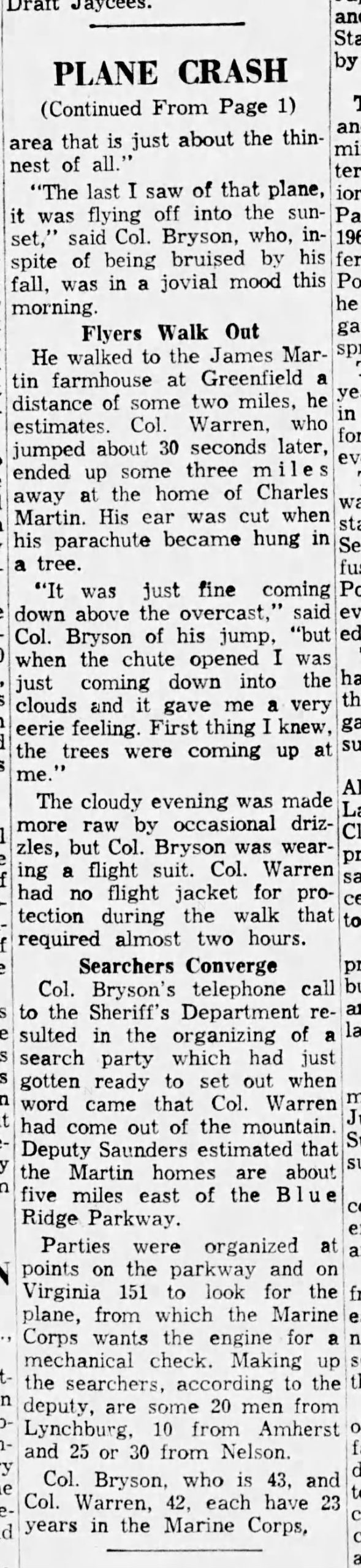
On May 1, 1964, a single-engine T-28 Trojan Trainer Navy plane crashed into the mountain. Thankfully, both the pilots survived. The aircraft was piloted by Marine Corps Colonel Joe L. Warren, 42. The pilot sitting in the passenger seat was Colonel Robert Bryson, 43, who was supposed to fly it on the return trip home so they could keep up their flight hour requirements.
They were en route to Memphis from Andrews Air Force Base when they suddenly lost oil pressure, which was followed by total engine failure. They had no choice but to ditch the plane.
Without ejection seats to rely on, the men had to jump from the plane and parachute through a thick cloud deck at about 6,000 feet.
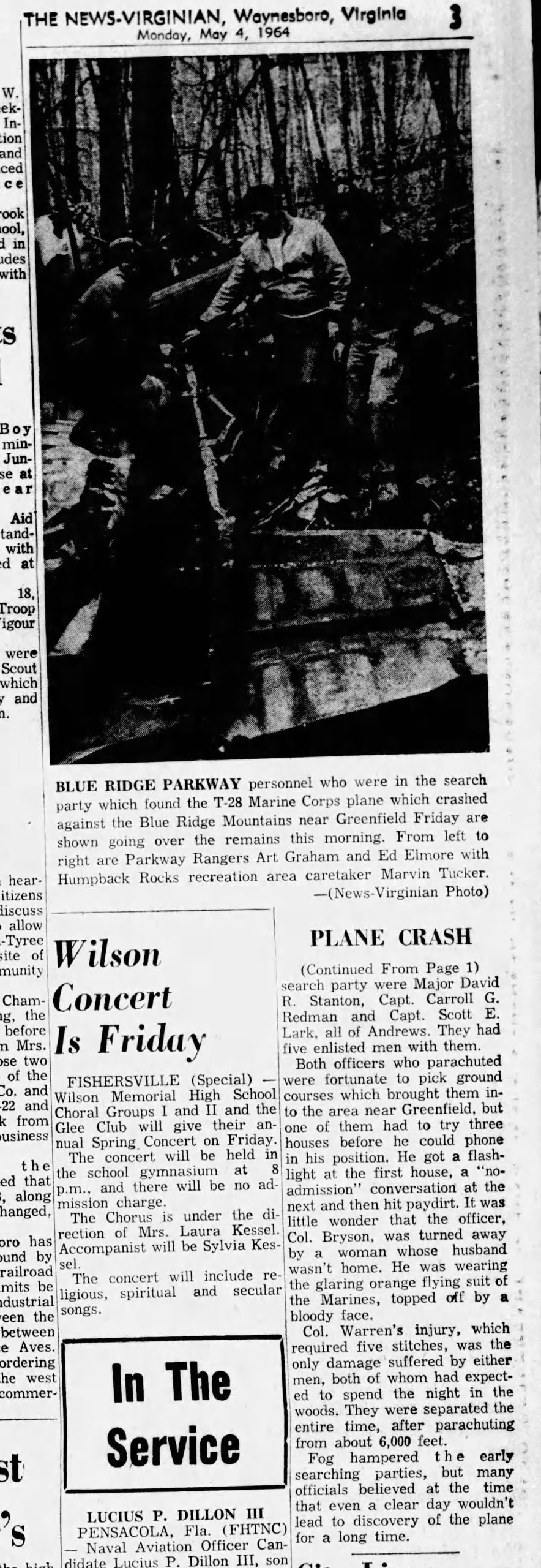
During the jump, Col Bryson’s chute got hung up in a pine tree before letting loose, sending him crashing into a rock below before bouncing to another rock in an area called McLean’s Hollow. After regaining his composure, he had to walk to several houses (and a couple of miles) before finding one that would help him find a telephone and call the local sheriff.
Col. Warren had parachuted safely and later met up with Bryson in Lovingston, Virginia, where the two were able to contact friends and family to let them know they were safe.
Unfortunately for the plane, no one saw it crash, not even the pilots. Locals in the area never called it in, and if it hadn’t been for a wing of the aircraft hanging in a tree, it may have never been spotted from above and could have taken months or years to locate.
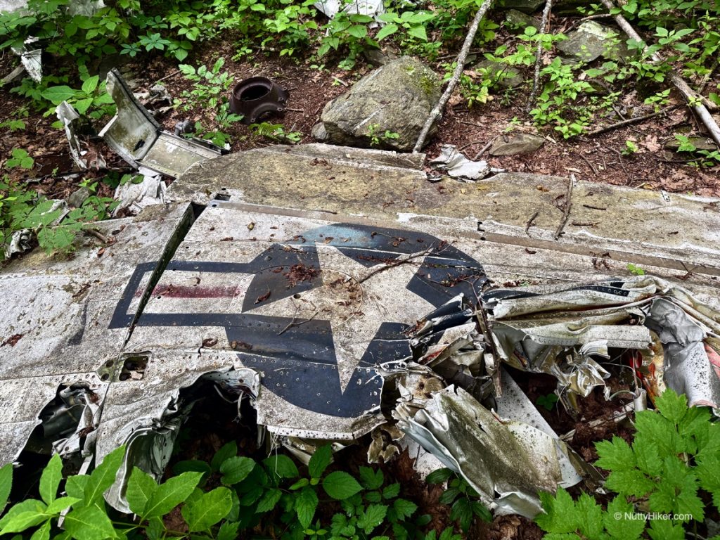
The plane came to rest on what was the private property of W.R. Mattox, about 300 yards from the Blue Ridge Parkway boundary, or about 2 miles southeast of Humpback Rocks and nine miles from the start of the Parkway at US 250.
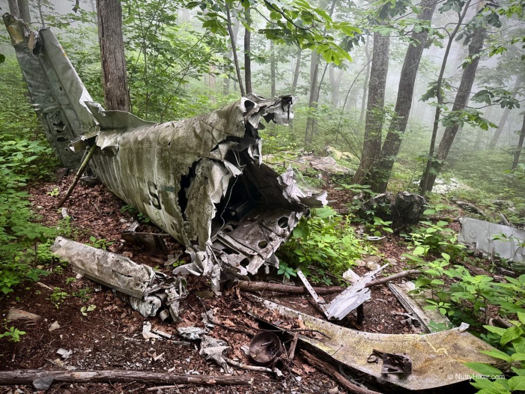
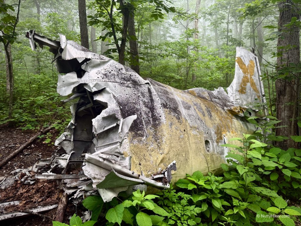
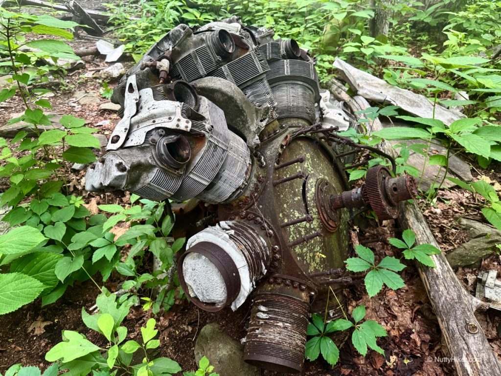
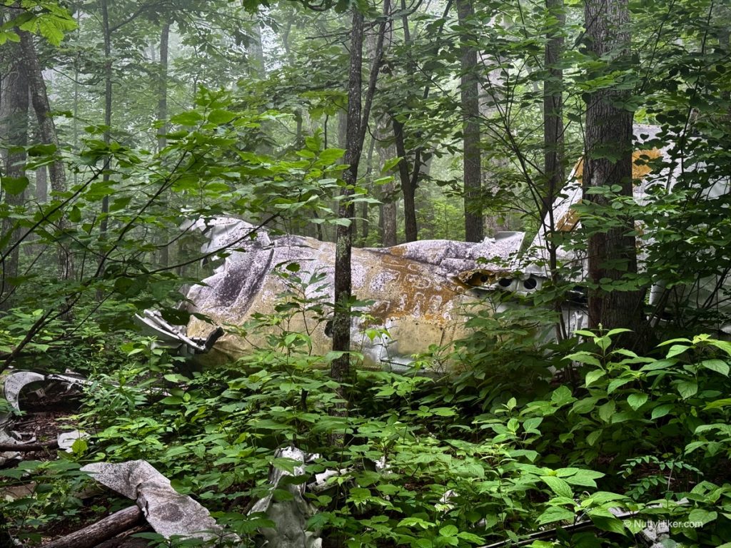
Photos of the Wreckage
Here are some pictures of the wreckage. Check out the video tour below if you’d like to visit the T-28 plane wreck yourself.
Location / Getting There
I am usually very hesitant to give out exact locations of places like this thanks to all the souvenir hunters and other disrespectful humans that like to graffiti and tear crap up. However, there are several other sites that do list the GPS coordinates. For those interested in the exact coordinates of the T-28 plane wreck on Humpback Mountain, watch my video below, as I listed them about halfway through.
I chose this method to avoid ruining the fun for those who prefer to find the crash site through research and directions.
To get to the crash site:
You can either park in the Humpback Rocks Picnic area, take the spur trail to the Appalachian Trail, and head north, or you can park at the Humpback Gap Overlook and take the Humpback Rock trail to the Appalachian Trail, and head south.
The T-28 crash site is located 1.61 miles due south from the Humpback Gap Overlook parking area, or 1.36 miles due east from the Humpback Mountain Rocks Picnic Area, and 3500 feet from the Blue Ridge Parkway. Keep in mind I did not use a measuring wheel to measure the precise distance and instead used Google Maps. The distance is an estimate, but if you use all the measurements, they should overlap, and where they all meet should be the crash site (or very near it).
I, personally, would grab the GPS coordinates from the video to have on hand, just in case. Additionally, if you enjoy peak bagging, this location is close to the summit of Humpback Mountain.
A couple of tips and things you should know if you decide to go:
- Go during the fall when there is less foliage (and thank me later).
- You will need a GPS device that you can use offline (there was no cell service).
- There is no trail; this will require bushwhacking and a good general sense of direction.
- Use caution; exploring old wreckage can cause serious injury and even death.
- Leave it be. Don’t take items, move items, or touch items at wreckage sites. While there were no deaths here, it is illegal to remove items from a crash site.
News Articles
Here are clippings from the news articles I found about T-28 plane wreck on Humpback Mountain. Click to enlarge to read.
1st Article:
2nd Article:
About the T-28 Trainer
In mid-June 1950, the 3200th Fighter Test Squadron brought the T-28A to the Air Proving Ground, Eglin Air Force Base, Florida, for advanced trainer suitability tests, taking into account its transition, instrument, and gunnery capabilities. After being deemed adequate, a contract was granted, and 1,948 were constructed in total between 1950 and 1957.
The United States Navy and Marine Corps also adopted it after the USAF adopted it as a primary trainer. By the early 1960s, the Air Force had phased out the aircraft from primary pilot training, limiting its use to primary training of select foreign military personnel and limited training of special operations aircrews. However, the Navy (and by extension, the Marine Corps and Coast Guard) continued to use the aircraft as a primary trainer well into the early 1980s.
T-28 Plane Wreck Video Tour
For those that are unable to make it to the site, I did a pretty extensive video tour. I wish I had done this side quest in the fall when there was less foliage, but you take what you can get when you find something hard to reach.
CHECK BACK IN A LATER THIS AFTERNOON AS IT IS CURRENTLY UPLOADING.
Disclaimer: These articles are here to serve others as a guide on their own outdoor & travel adventures. You use any advice given on this site at your own risk. Exploring & Hiking Hiking can be risky activities; fatalities and injuries do occur. You assume responsibility when you decide to visit or hike in a particular location. Not all trails, attractions, and travels are safe for everyone. What works for me, may not work for you. Do your own research on gear and destinations before proceeding. Information is accurate at the time of posting and is subject to change at any time.


Leave a Comment or Suggestion