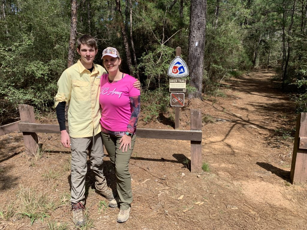
• Skip to main content
  • Skip to secondary menu
  • Skip to footer
  • Home
  • About
  • Subscribe
  • ☕ Support
  • ✉ Contact
    • Contact Me
    • Request Product Review
    • Work With Me
    • Submit Guest Post
  • Blog Archives
Nutty Hiker Adventures Logo

Nutty Hiker Adventures

Hike Every Hike Like It Is Your Last

  • Hiking >>
    • Hiking Articles
    • Hiking 101 >
      • 10 Essentials of Hiking
      • Types of Hikes
      • Trail Etiquette
      • Hiking Terms & Jargon
      • Hiking First Aid Kit
      • What to Bring On Every Hike
      • Pre Thru-Hike Checklist
      • Hacks to Lighten Your Backpack Weight
      • How to Avoid Norovirus While Backpacking
      • Choosing a Sleeping Bag Liner
      • How to Poop in the Woods
      • Gift Guide for Hikers
      • Books for Hikers & Backpackers
      • Movies About Hiking
      • Subscription Boxes for Hikers
      • Thru-Hiking Trails Bucket List – USA Edition
      • Your Hiking Questions Answered
    • Long Trails >
      • Appalachian Trail
      • BamatoBaxter
      • Greenbrier River Trail
      • Lone Star Hiking Trail
      • Pinhoti Trail
    • Rails To Trails >
      • Greenbrier River Trail
    • Gear Reviews
    • Ask Nutty Hiker
  • Camping >>
    • Camping Articles
    • Camping Gear Reviews
  • Survival >>
    • Survival Articles
    • Survival Gear Reviews
  • Destinations >>
    • The Ultimate Road Trip Checklist || Adventure Safely
    • State Highpoints
    • National Parks & Forests >
      • Black Hills National Forest
      • Guadalupe Mountains National Park
    • Arizona
    • Arkansas
    • Colorado
    • Idaho
    • Kansas
    • Kentucky
    • Louisiana
    • Maryland
    • Nevada
    • New Mexico
    • North Dakota
    • Pennsylvania
    • South Dakota
      • Black Hills National Forest
    • Tennessee
    • Texas
      • North Texas
      • Central Texas
        • San Antonio
      • East Texas
      • South Texas
      • West Texas
      • Texas State Parks
      • Guadalupe Mountains National Park
    • Utah
    • Washington
    • West Virginia
  • Road Trips >>
    • The Ultimate Road Trip Checklist || Adventure Safely
    • Road Trip Ideas
  • Motorcycle >>
    • Sturgis 2024
  • News >>
    • Outdoor News
    • Interviews
  • Video’s
  • Photography >>
    • Latest Work
    • Photography Gear Reviews
    • Portrait Portfolio
  • ✎ Logbook >>
    • My Daily Antics
    • Ask Nutty Hiker
  • Resources >>
    • Recommendations
    • The Ultimate Road Trip Checklist || Adventure Safely
    • Hiking Essentials Checklist
    • Morse Code Converter || Send a Message in Morse Code
    • Military Time Converter
    • Message Encryption & Decryption
    • Message Transformer
  • Shop
    • My Artwork
    • Merch Store (T-Shirts & More)
You are here: Home / Hiking / Lone Star Hiking Trail / Lone Star Hiking Trail: Day 6

Lone Star Hiking Trail: Day 6

March 16, 2019 by Nutty Hiker Last Modified: April 21, 2020Leave a Comment

Day 6
Big Woods Pond to Trailhead #11
15.5 Miles
March 16, 2019

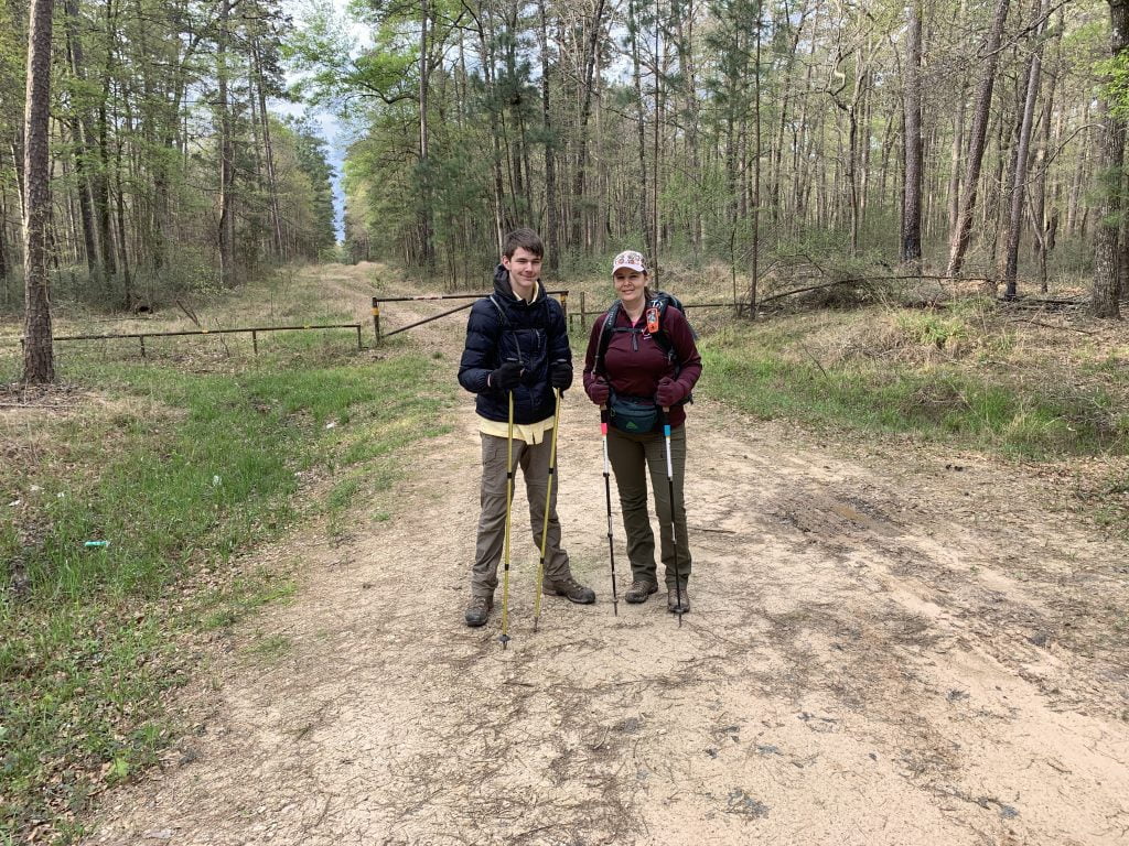
Lone Star Hiking Trail Day 6. We started the morning by trying to find our way back to the trail from the Forest Service Road. It was a tad chilly so we decided to put on our base layers. I also had on my fleece and Clayton wore his puffy.

IMG 2664

This section includes a 5 mile road walk that is “dry” (meaning no where to fill up on water). Thankfully this section of trail has been mostly dry which made today’s hike pretty enjoyable.

We did come into some mud shortly after the pond sign at mile 58.5, and more mud with an obstacle (downed trees on the trail) after mile 59.

IMG 2672

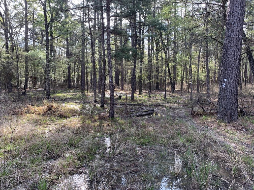
Shortly after the hiker’s camp before mile 60 we ran into the trail underwater and surrounded in water and mud as far as the eye could see. However, with my mad ninja skills, I somehow managed to not get my feet wet. I had also warmed up by now and decided to take off my fleece and gloves.

Lone Star Hiking Trail Day 6

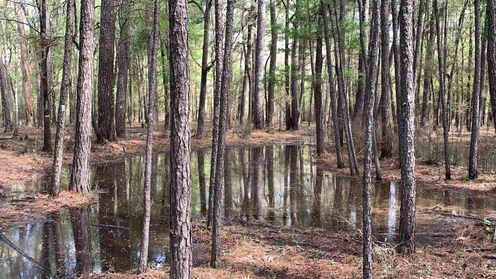
Basically the Big Woods section from the pond on has a lot of mud that you get to enjoy before doing a 5-mile road walk.

Lone Star Hiking Trail Day 6

You will want to make sure you have plenty of water before the road walk as there isn’t really any shade and on hot days you will sweat your butt right off. It does, however, have interesting scenery such as the mangled helicopter that sits outside of the gate to someone’s house.

Once you enter the Magnolia section, it asks you to register, however, when opening the box we realized a huge wasp had made the box it’s home and quickly shut the lid.

Lone Star Hiking Trail Day 6

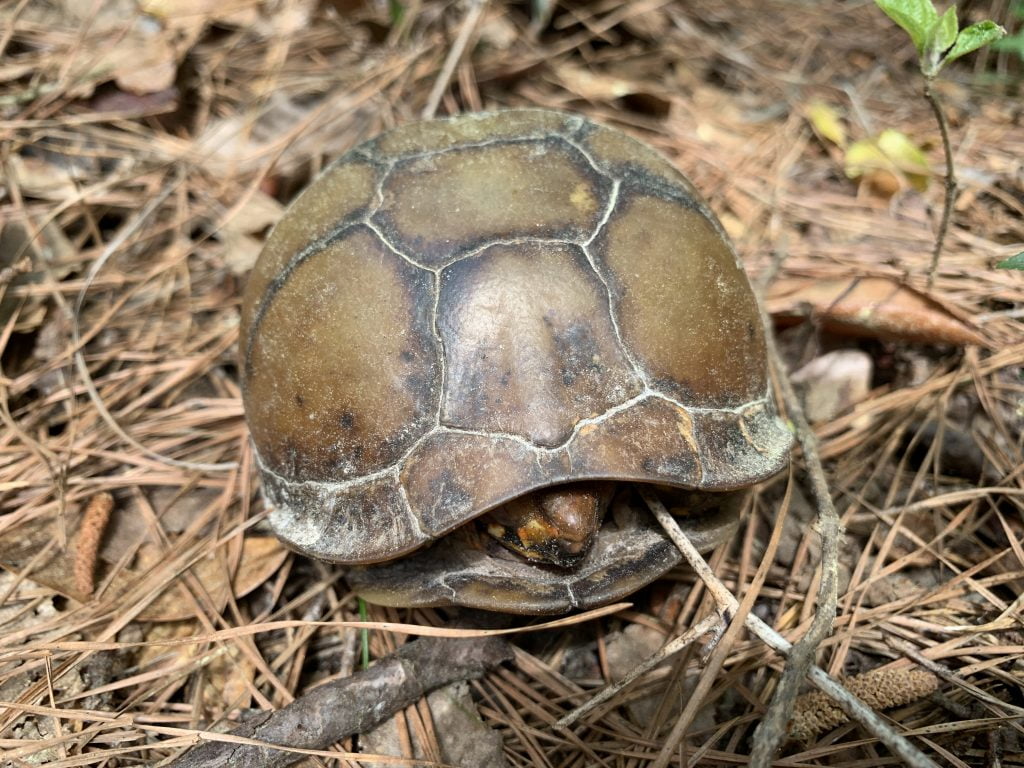
Around Mile 68 we saw our first snake. Well actually, Clayton saw it and warned me. I never saw it but I did get to see a turtle around mile 69. He was sitting right on the side of the trail.

IMG 2702

This part of the section (see special notes below) requires fording or swimming across (during heavy rain periods like we have had) the San Jacinto River, I chose to be drove around it due to having my son with me. There was no way I was going to risk his life.

We called it a day after crossing a busy road and headed home for the week (Spring Break is over). However, we will be back out next weekend to finish up the last 22 miles.

IMG 2718

Lone Star Hiking Trail Day 6 Information

Trail Condition: The Big Woods section had mud, but the Magnolia section was mostly dry with only very occasional mud. Made for a great day!
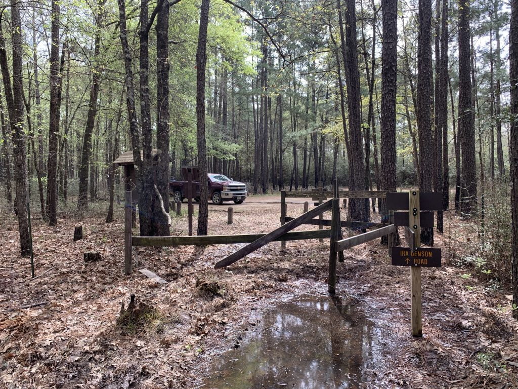
Camping: There is a hiker’s camp near mile 60. There is a stealth camp spot right after mile marker 62. Primitive campsite around mile 68.5.
Water: Pond at mile 58.5. Right past mile 68 you will cross a creek, however, it seemed shallow and stagnant so not sure water would be there during dry months. Pond between mile 69 & 70. San Jacinto River at mile 71.

SPECIAL NOTES: You will have to cross over the East Fork of the San Jacinto River in the Magnolia section (shortly after mile 71) which can be dangerous as the footbridge was washed away a long time ago and never replaced. That will mean fording or swimming depending on how high. In periods of extended rain and can become impassable. There is a bushwhack alternate that you can try, but your best bet is to plan ahead and get a ride around it. You can be picked up at mile 70 from FS2126 and dropped off at mile 72 on FS280D.

<< DAY 5 || DAY 7 >>

Filed Under: Lone Star Hiking Trail, Hiking, The Logbook

Reader Interactions

Leave a Comment or Suggestion Cancel reply

Your email address will not be published. Required fields are marked *

Footer

FOLLOW

  • Facebook
  • Instagram
  • YouTube
  • RSS Feed
  • Amazon
  • Patreon

SUPPORT =)

This blog is my full-time job. I rely heavily on support from my readers. If you would like to help offset the cost of running this blog and my nutty adventures so I can continue to bring you travel & outdoor adventures, please feel free to donate =)
PayPal
Cash App
Venmo

DISCLOSURE

Per the FTC, This website contains affiliate links, advertisements, and sponsored posts. For reviews, I was provided with a complimentary copy of the item unless otherwise stated. As an Amazon Associate, I earn from qualifying purchases using the amazon links located on my website. Read my full policy here.

AWARDS/ASSOCIATIONS

OWAA Member Logo Best Outdoor Blogs Best Hiking Blogs

Copyright © 2025 — Nutty Hiker Advenures | Bridget Carlson • All rights reserved.
The links on this website are solely for the convenience of our visitors. Nutty Hiker does not endorse, operate, or control external websites.
Terms of Use • Privacy Policy• Disclosure• Contest Rules