• Skip to primary navigation
  • Skip to main content
  • Skip to footer
Nutty Hiker Adventures Logo

Nutty Hiker Adventures

Hike Every Hike Like It Is Your Last

  • Hiking >>
    • Hiking Articles
    • Hiking 101 >
      • 10 Essentials of Hiking
      • Types of Hikes
      • Trail Etiquette
      • Hiking Terms & Jargon
      • Hiking First Aid Kit
      • What to Bring On Every Hike
      • Pre Thru-Hike Checklist
      • Hacks to Lighten Your Backpack Weight
      • How to Avoid Norovirus While Backpacking
      • Choosing a Sleeping Bag Liner
      • How to Poop in the Woods
      • Gift Guide for Hikers
      • Books for Hikers & Backpackers
      • Movies About Hiking
      • Subscription Boxes for Hikers
      • Thru-Hiking Trails Bucket List – USA Edition
      • Your Hiking Questions Answered
    • Long Trails >
      • Appalachian Trail
      • BamatoBaxter
      • Greenbrier River Trail
      • Lone Star Hiking Trail
      • Pinhoti Trail
    • Rails To Trails >
      • Greenbrier River Trail
    • Gear Reviews
    • Ask Nutty Hiker
  • Camping >>
    • Camping Articles
    • Camping Gear Reviews
  • Survival >>
    • Survival Articles
    • Survival Gear Reviews
  • Destinations >>
    • The Ultimate Road Trip Checklist || Adventure Safely
    • Road Trips >>
      • The Ultimate Road Trip Checklist || Adventure Safely
      • Road Trip Ideas
    • State Highpoints
    • National Parks & Forests >
      • Black Hills National Forest
      • Guadalupe Mountains National Park
    • Arizona
    • Arkansas
    • Colorado
    • Idaho
    • Kansas
    • Kentucky
    • Louisiana
    • Maryland
    • Nevada
    • New Mexico
    • North Dakota
    • Pennsylvania
    • South Dakota
      • Black Hills National Forest
    • Tennessee
    • Texas
      • North Texas
      • Central Texas
        • San Antonio
      • East Texas
      • South Texas
      • West Texas
      • Texas State Parks
      • Guadalupe Mountains National Park
    • Utah
    • Washington
    • West Virginia
  • Motorcycle >>
    • Sturgis 2024
  • Photography >>
    • Latest Work
    • Photography Gear Reviews
    • Portrait Portfolio
  • ✎ Logbook >>
    • My Daily Antics
    • Ask Nutty Hiker
    • News >>
      • Outdoor News
      • Interviews
    • Resources >>
      • Recommendations
      • The Ultimate Road Trip Checklist || Adventure Safely
      • Hiking Essentials Checklist
      • Morse Code Converter || Send a Message in Morse Code
      • Military Time Converter
      • Message Encryption & Decryption
      • Message Transformer
  • Shop
    • My Artwork
    • Merch Store (T-Shirts & More)
  • Video’s
You are here: Home / Hiking / Lone Star Hiking Trail / Lone Star Hiking Trail: Day 3

Lone Star Hiking Trail: Day 3

March 11, 2019 by Nutty Hiker Last Modified: February 21, 2022Leave a Comment

Day 3
Stubblefield Campground to Alligator Branch Swamp
13 Miles
March 11, 2019

Lone Star Hiking Trail Day 3, we woke up early at the overflow campground ready to start our day. Little did we know that our 12-mile day would turn into a 13-mile day due to being unable to find a spot to camp.

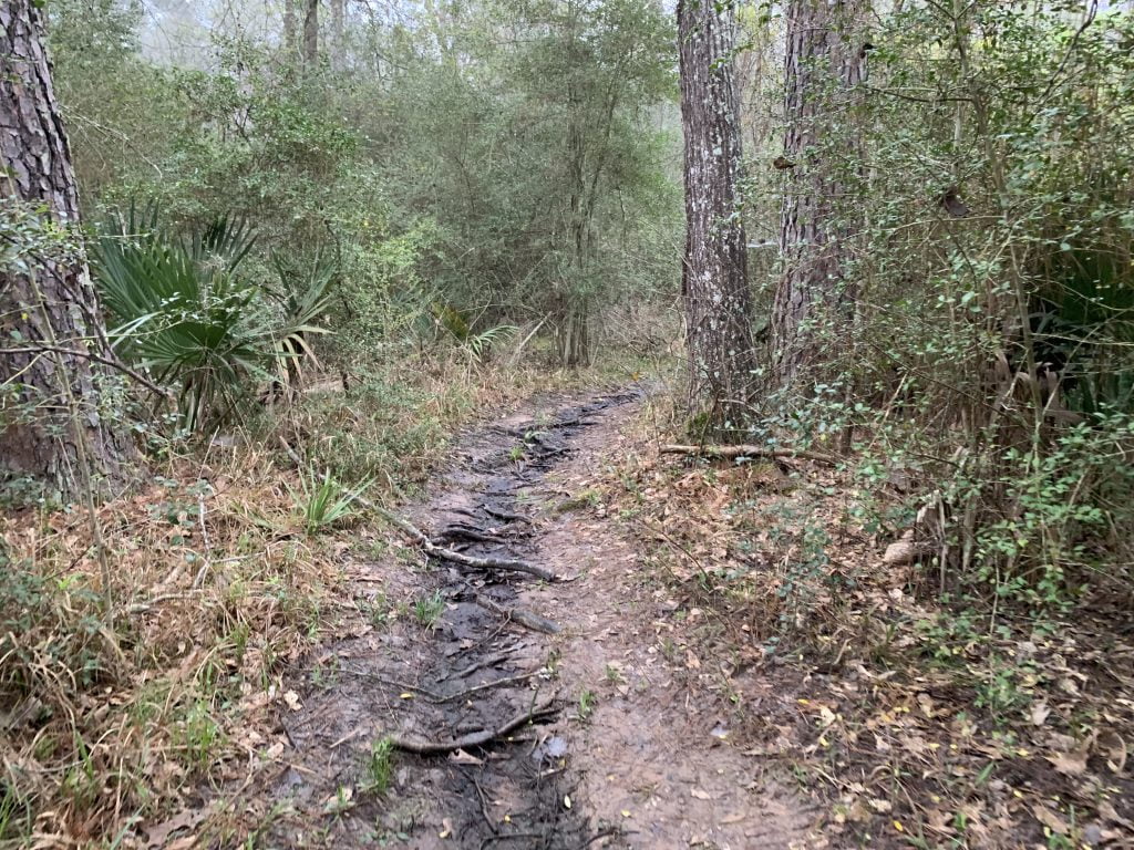
The trail is located directly across from the overflow camping area and we were soon greeted with mud and tree roots (aka trip hazards). It was misty and seriously humid and the mosquitos were horrible during the first hour of the morning.

Lone Star Hiking Trail Day 3

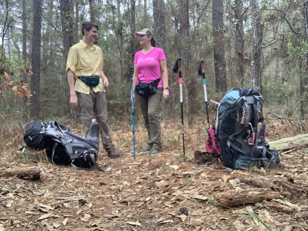
Our packs were loaded down and this was the first day hiking with our full load (an extra 15 pounds for myself, with a pack weight of 45 pounds). The day was going to be slow.

Lone Star Hiking Trail Day 3

We knew it was going to be a long day, so we decided we would stop at every mile marker and take a quick 5-minute break.

Lone Star Hiking Trail Day 3

There were a lot of creek crossings during just the first mile.

Clayton took the opportunity to scare the crap out of me while recording video and for the first half of the morning it drizzled and rained which felt great.

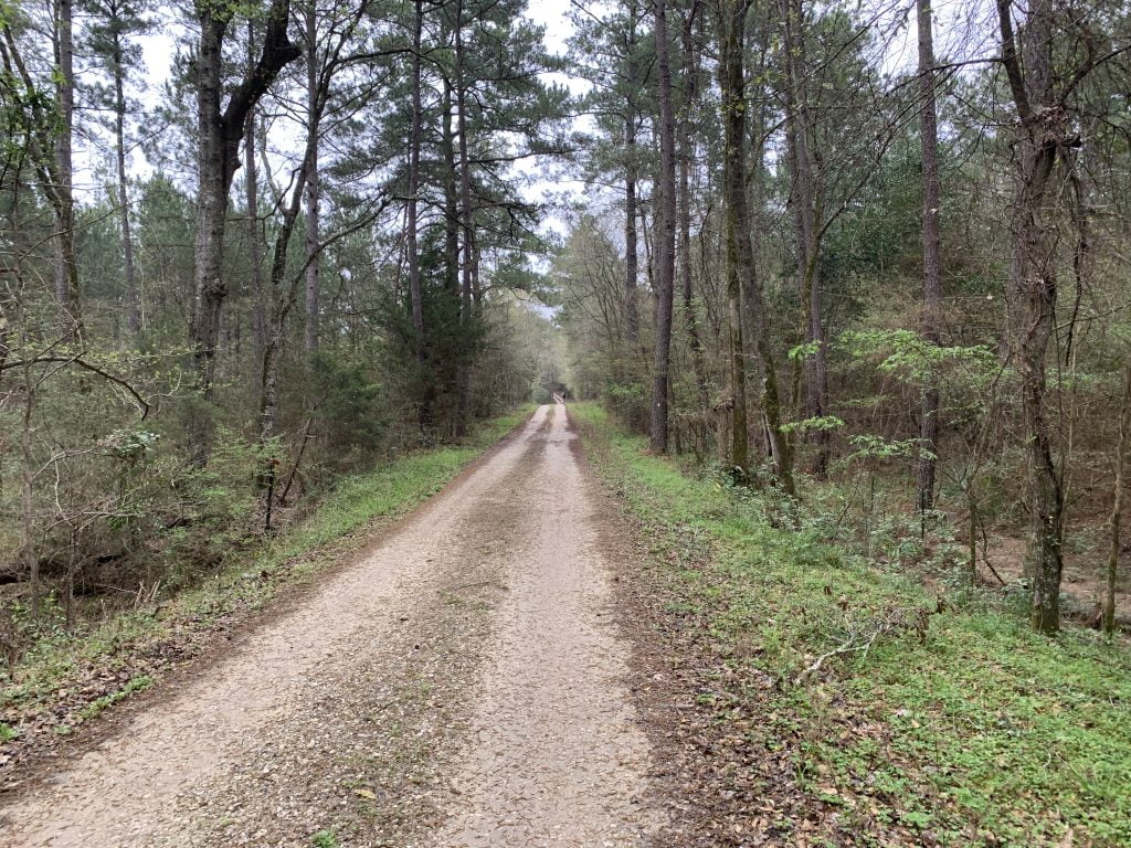
We did our first road walk of the trail today, it wasn’t too bad but it seemed to go on forever (even though it was only around 2 miles) especially since I had to tinkle and decided I could hold it (stupid). It was fenced off private property on both sides, so literally nowhere to go find a spot.

IMG 2428

Shortly after the road walk (and after an immediate potty break) we hiked to a pond so we could fill up with water (filtered of course). Clayton learned how to filter water in the backcountry.

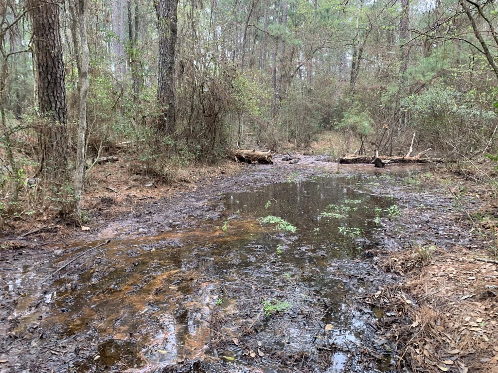
Once we filled up our water it was time to hike to the funnest portion of this section, the Camelia Lake Dam and Spillway which is a private lake located within a subdivision. The trail crosses right over the spillway so precaution needs to be taken when crossing it as it is slippery.

Lone Star Hiking Trail Day 3

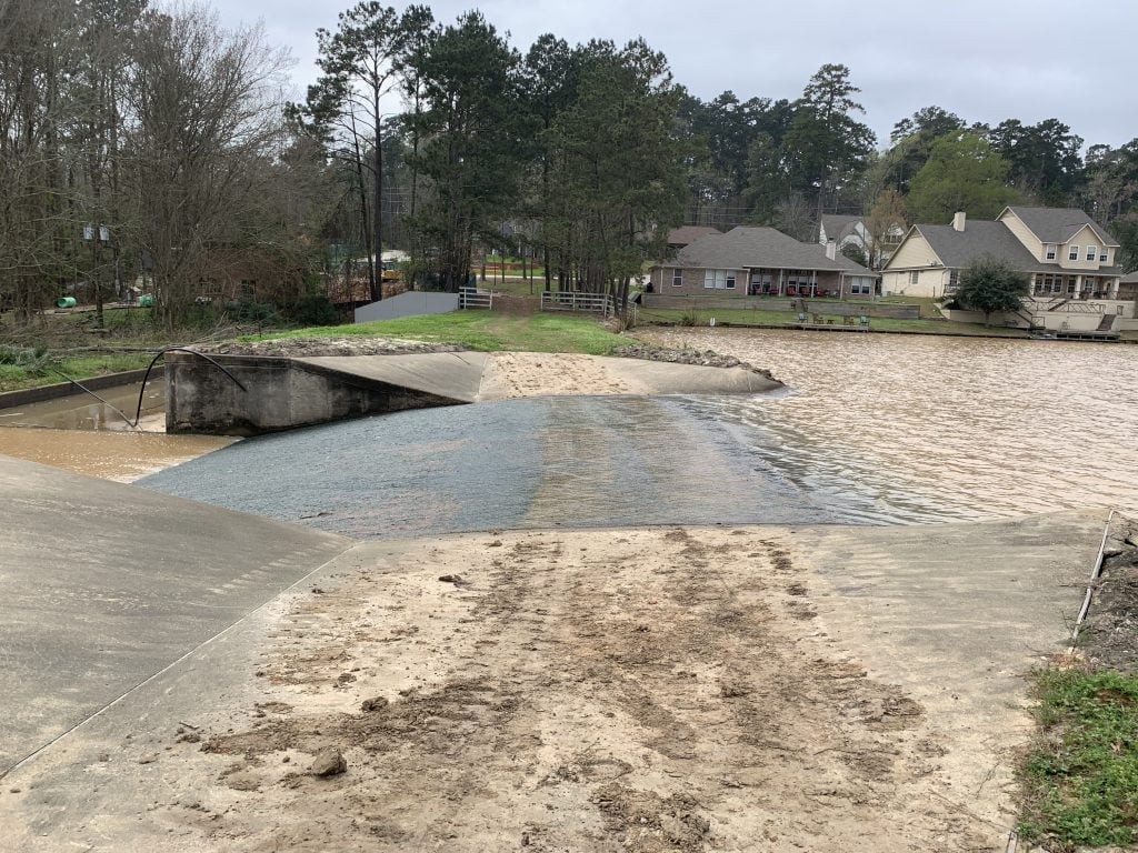
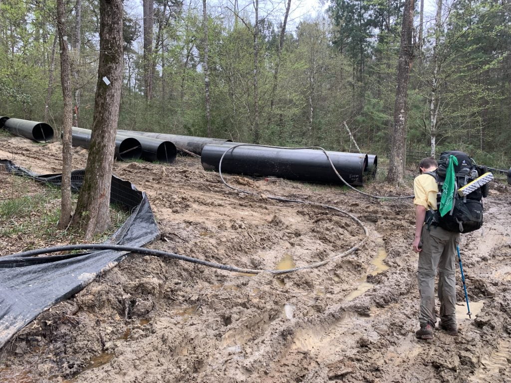
Once we crossed the spillway we were immediately greeted by ankle to calf-deep mud thanks to construction equipment that had made huge ruts and caused it to be a huge muddy/soggy mess. Due to this it also obscured the trail which made the trail very hard to find.

IMG 2447

We had planned to make camp shortly after the spillway, but could not find a spot due to downed trees and widow makers so we ended up hiking another 2.5 miles to get to Alligator Branch Swamp where we finally found a place to make camp, bonus that it was near a creek with clear water.

Lone Star Hiking Trail Day 3

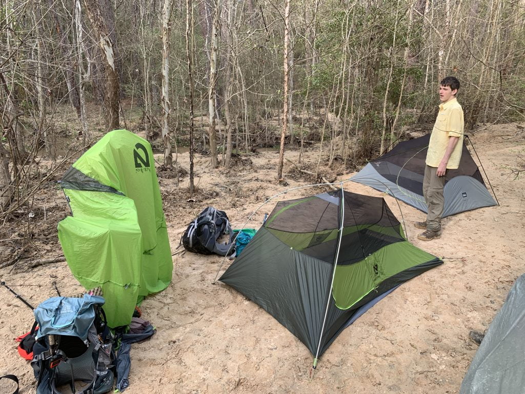
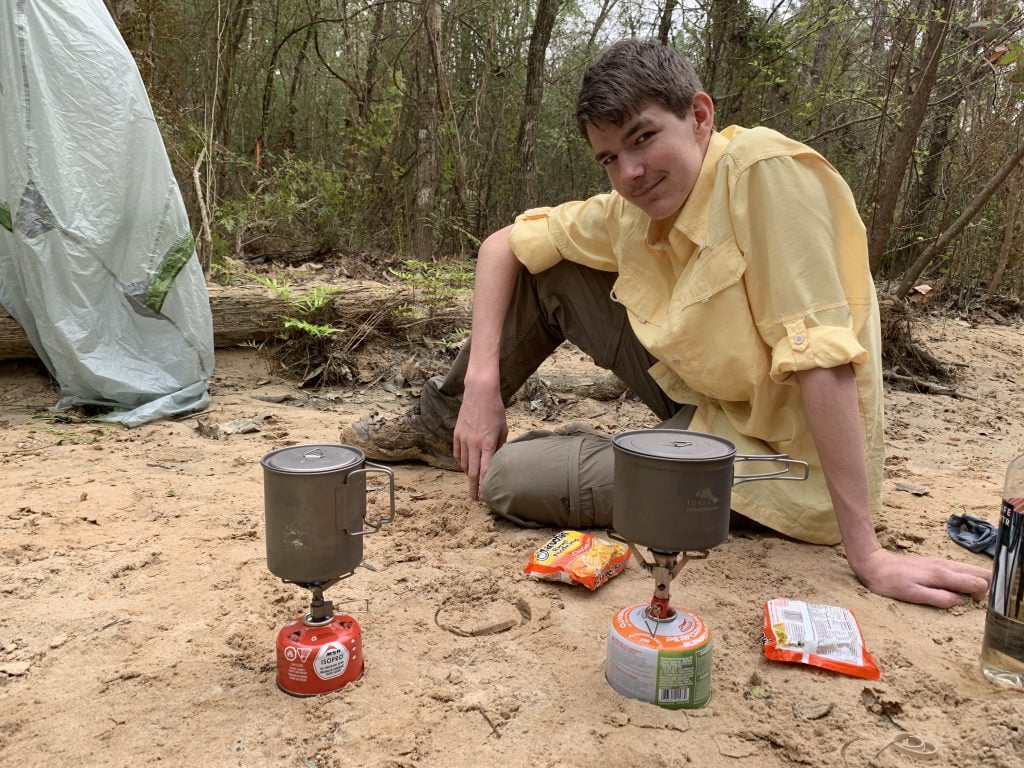
It was an exhausting day, so once we reached camp we set up our tents, cooked dinner, and then both went straight to bed despite that it was only about 6:30 pm. I didn’t even bother to film us heading into camp or setting up camp because I was that exhausted lol.

IMG 2452

Watch the Video =)

Lone Star Hiking Trail Day 3 Information

Trail Condition: Muddy (ankle to calf-deep in places), not as bad as prior sections.
Camping: Didn’t see many good camping spots. Around mile 29 (before you get to 29 and after the road walk) there is a primitive campsite for camping next to a pond. The next camp spot would be Alligator Branch Swamp after mile 33. We were following the guidebook which said there were some good sites for camping before then but could not find those spots (downed trees and/or widow makers).
Water Sources: Several creeks from mile 20 to 26, however the only reliable sources we saw were the pond around mile 29 and the Creek around mile 33. You do not want to filter from the lake unless it is a last resort due to run-off from lawns (fertilizer, etc..)

<< DAY 2 || DAY 4 >>

Filed Under: Lone Star Hiking Trail, Hiking, The Logbook Tagged With: Trails

Reader Interactions

Leave a Comment or Suggestion Cancel reply

Your email address will not be published. Required fields are marked *

Footer

FOLLOW

  • Facebook
  • Instagram
  • YouTube
  • RSS Feed
  • Amazon
  • Patreon

SUPPORT =)

This blog is my full-time job. I rely heavily on support from my readers. If you would like to help offset the cost of running this blog and my nutty adventures so I can continue to bring you travel & outdoor adventures, please feel free to donate =)
PayPal
Cash App
Venmo

DISCLOSURE

Per the FTC, This website contains affiliate links, advertisements, and sponsored posts. For reviews, I was provided with a complimentary copy of the item unless otherwise stated. As an Amazon Associate, I earn from qualifying purchases using the amazon links located on my website. Read my full policy here.

AWARDS/ASSOCIATIONS

OWAA Member Logo Best Outdoor Blogs Best Hiking Blogs

Copyright © 2025 — Nutty Hiker Advenures | Bridget Carlson • All rights reserved.
The links on this website are solely for the convenience of our visitors. Nutty Hiker does not endorse, operate, or control external websites.
Terms of Use • Privacy Policy• Disclosure• Contest Rules

  • Home
  • About
  • Subscribe
  • ☕ Support
  • ✉ Contact
  • Blog Archives
  • Recommendations
  • >> Resources