Today we did the Roan Highlands, and it was a beautiful day for it. The weather was great. We did some bonus trails, and there’s a lot of history in this area, so the video that I made was 35 minutes long.
| AT Miles | Triple B Miles | Total AT Miles Hiked | Miles Remaining |
|---|
7.9
2.2
157
2041.4
DAY STATS
| ⏰ TIME TO COMPLETE: 8 hrs 40 min | 👣 TOTAL MILES HIKED: 10.19 |
| 📍 STARTING POINT: Carvers Gap (380.8) | 🤠 MOOD: Happy & Excited |
| 📍 ENDING POINT: Campsite (388.7) | 🤕 INJURIES: None |
| 🏔️ ELEVATION GAIN: 1,674.5 ft | 🐻 WILDLIFE: a very friendly deer |
| 🏔️ ELEVATION LOSS: 1,998.4 ft | 🌡️ WEATHER/TEMP: 70 & Overcast |
| 📐 TOTAL GRADE: 466.4ft/mi | 💰 EXPENSES: None |
Steve, with Unicoi Shuttle, dropped us off at Carver’s Gap. He’s a super nice guy, and I highly recommend giving him a call. He and Randy, with Lost & Found Shuttle, work together, so if one can’t get you, they typically check with the other one. We highly recommend both of them!
He even got some video of us checking out the blooming Rododendrons (or as the locals call them, Rodi’s).
Speaking of Carver’s Gap, there’s some history here about the Roan Highlands.
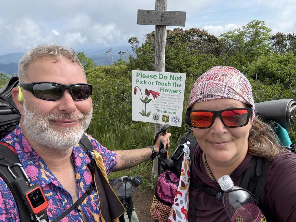
Carver’s Gap – Mile 380.8
In 1780, during the peak of the American Revolution, British General Charles Cornwallis kicked off his invasion of the southern colonies by capturing Charleston, South Carolina, and winning a battle against American forces at Camden. Feeling pretty confident about South Carolina, he then marched north towards Charlotte, North Carolina. While on the move, Cornwallis sent out a group of Loyalists led by Major Patrick Ferguson to stir things up in western Carolina.
To deal with this situation, a bunch of frontiersmen from the mountains of what’s now East Tennessee, North Carolina, and Virginia gathered at Fort Watauga, which is in present-day Elizabethton. These guys came to be known as the Overmountain Men. They crossed the Roan Highlands to the other side of the Blue Ridge Mountains and clashed with Ferguson’s forces at the Battle of Kings Mountain, coming out on top. After the battle, most of them headed back home, but a few decided to keep going south to join up with Daniel Morgan’s troops and help clinch an American victory at Cowpens in 1781.
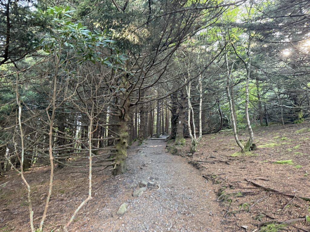
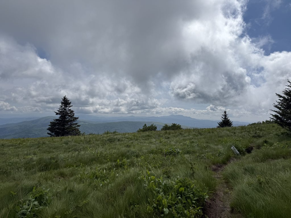
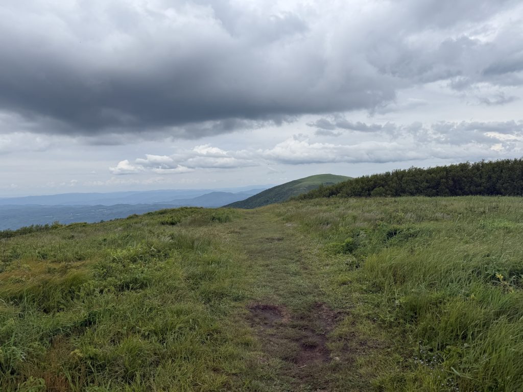
We began our ascent to the first bald, known as Round Bald. It led us through some spooky woods (actually, it was quite beautiful).
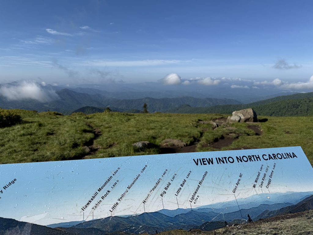
Round Bald – Elevation 5,826 ft – Mile 381.5
Once we reached the top of Round Bald, we noticed two Triple Bs (a term I have coined to mean Bonus Blue Blaze, a blue blaze that leads to a point of interest). They both lead to an information board showing the mountains you are looking at. One for Tennessee and one for North Carolina.
Engine Gap – Mile 381.9
About halfway between Round Bald and Jane Bald is Engine Gap. It’s hard to imagine, but a rail line ran through here in the late 1800s, when the logging industry was booming. As forests in the lower lands were cut down, loggers began moving into the more mountainous areas in search of timber. A steam engine was set up in the gap between Round Bald and Jane Bald (which is still called “Engine Gap”) to move lumber from the Tennessee side to the mills located on the North Carolina side.
After taking some more pictures, we made our way to Jane Bald.
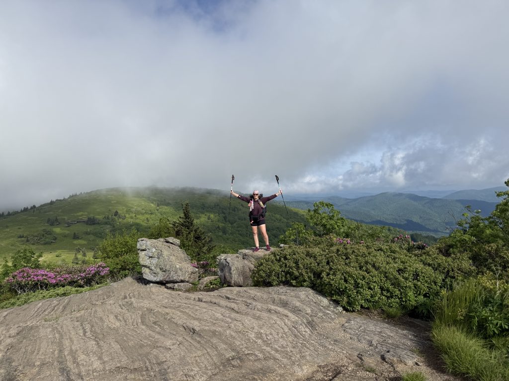
Jane Bald – Mile 382.3
Jane Bald supposedly gets its name from a woman named Jane who died of Milk Sickness while crossing the mountain. The rock here is 740 million-year-old black rock dikes which intrude into 1.1 billion-year-old gneiss, the oldest rocks on the whole A.T., supposedly.
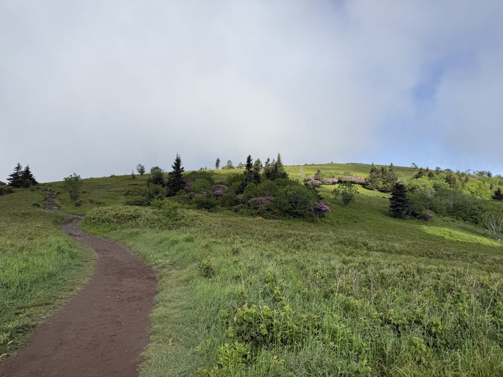
Once we got some pictures at Jane Bald, we headed towards Grassy Ridge Knob.
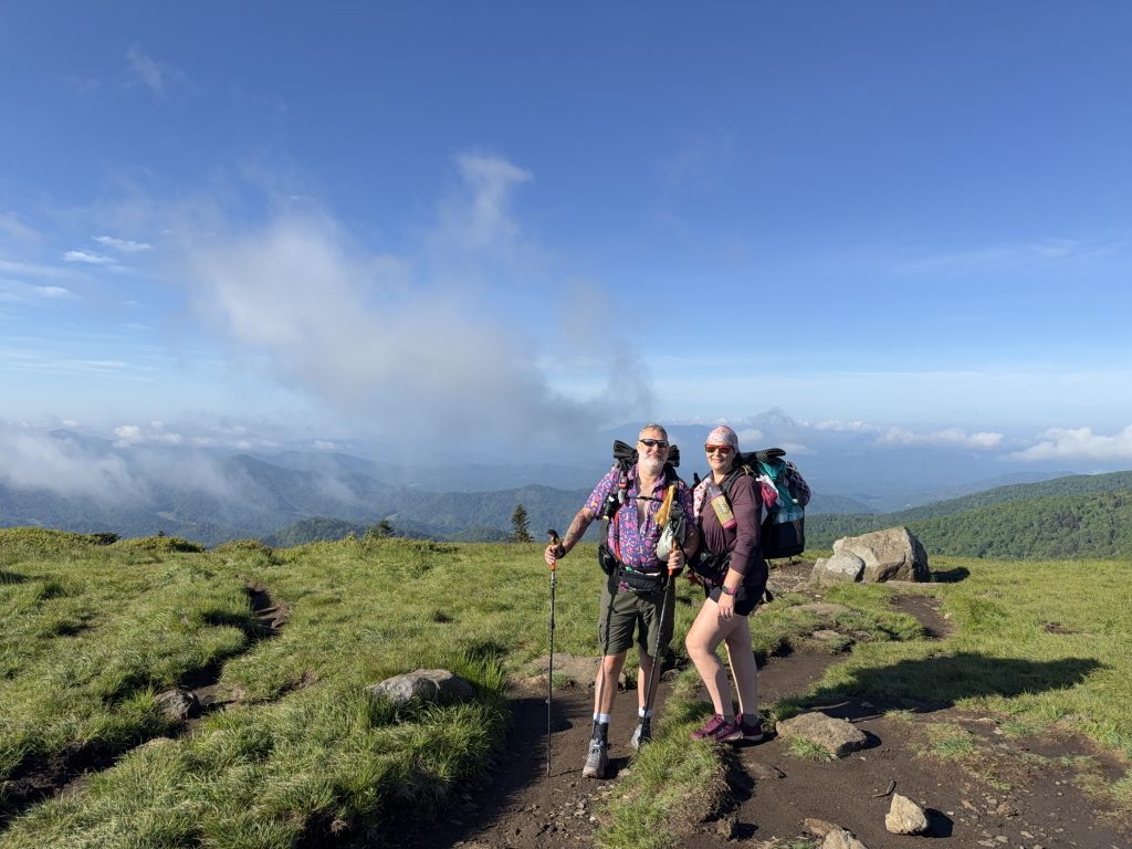
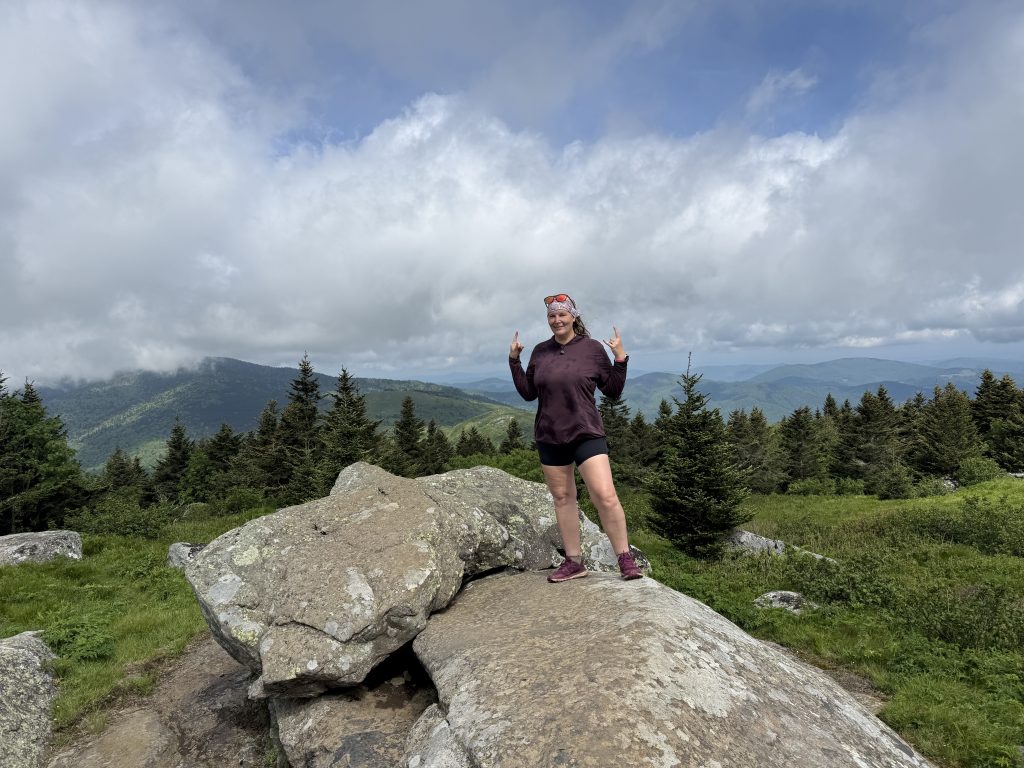
Grassy Ridge Bald – Mile 382.9
Reaching the summit required a Triple B. The 0.6 mile to the summit was steeper than we would have liked, lol. But totally doable and completely worth it.
Grassy Ridge also holds historical significance.
Born in 1887, Cornelious Rex Peake, a farmer and early advocate for the conservation of these mountains, loved the Roan Highlands. Mr. Peake owned the land and kept cattle on the bald and is recognized for operating a farm located at the highest altitude east of the Rocky Mountains. His wish was to be buried at the top of the bald upon his passing. This bald area, one of the highest grassy balds in the Appalachian Mountains, stands at 6,185 feet and covers several hundred acres.
According to local legend (I could not verify this), when Peake passed away in 1964 and the time came for Peake’s burial, the weather turned bad and his body was not able to make it to the top of the mountain, so he was buried below the peak on a small knoll in a pasture. The grave is not far from his birthplace. He was born about 20 yards from the grave in an old log house.
What I did find regarding his grave is that he is supposedly buried at these coordinates 36°04’53.0″N 82°05’34.0″W where other Peake family members are buried. This family cemetery appears to be on private land and is not accessible to the public, but it does line up with the description above.
Once you make it to the top, there is a memorial plaque for him which reads:
“To Honor the memory of Cornelious Rex Peake. A special man who loved God, his county, his fellow men and this land; al legacy from his forefathers. Born in the valley below, April 3, 1887, buried near his birthplace, March 23, 1964. Because of his love of nature, his long and close association with this mountain, no one was better versed on the Roan and it’s people. -Unites States Forest Service”.
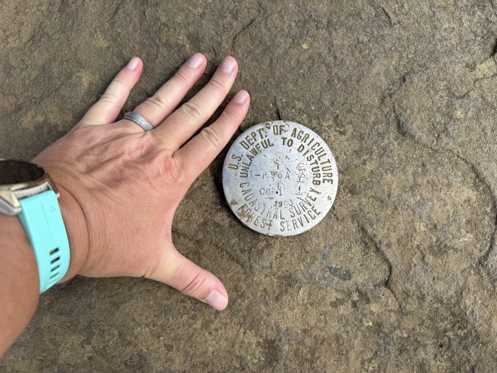
You will also find the USGS survey marker nearby.
The top is absolutely stunning. We had a very friendly deer visit us and hang around until other hikers showed up. You can also see Grandfather Mountain from here.
We had a snack and then decided we needed to start making our way to camp, as we (I), had spent way too long admiring the beauty of the last several miles, plus there was more history to see.
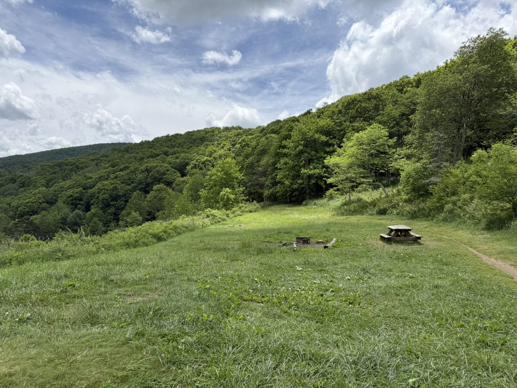
We stopped to have lunch at a really nice campsite before heading on to Yellow Mountain Gap and what once was the Overmountain Shelter.
Yellow Mountain Gap – Mile 386.4
The path through Yellow Mountain Gap was originally known as Bright’s Trace, named after Samuel Bright, an early settler who refused to leave the area after the Proclamation of 1763. Later, the trail took on the name of the mountain it crossed, becoming the Yellow Mountain Road, the main trail into the “Overmountain country” settlements.
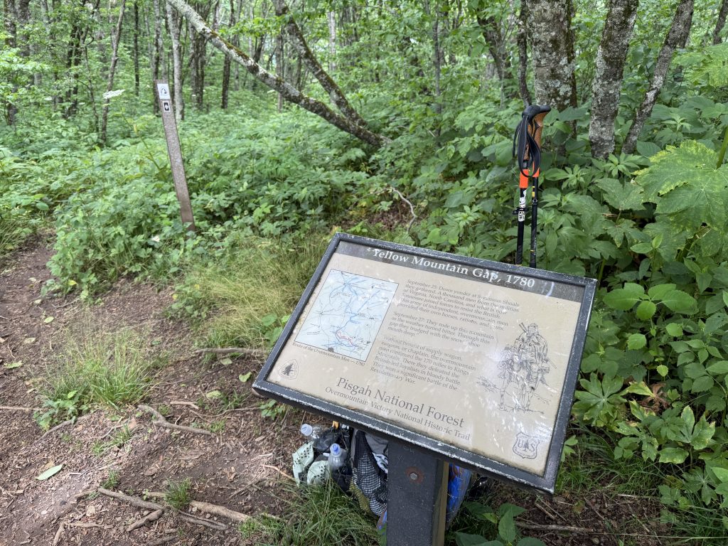
Yellow Mountain Gap was a crucial point along the Overmountain Victory Trail, where the Overmountain Men, a group of Patriot militia, crossed the Roan Highlands in September 1780. They were on their way to engage British Major Patrick Ferguson and his Loyalist forces, ultimately leading to the Battle of Kings Mountain.
The gap is the highest elevation on the Overmountain Victory Trail and was a key location for Revolutionary War activities.
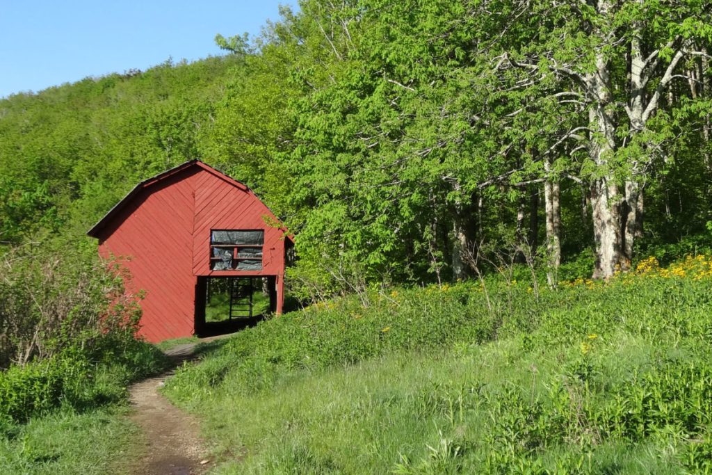
Overmountain Shelter “The Barn”
The side trail at Yellow Mountain Gap led to the Overmountain Shelter, a 1970s barn converted into an AT shelter in the 1990s.
The Overmountain Shelter originally served as a hay barn for a homestead in the 1970s. When the U.S. Forest Service acquired the land, they decided to remove the house but kept the barn intact. With grants from LL Bean, along with support from the Tennessee Eastman Hiking and Canoeing Club (TEHCC) and the Appalachian Trail Conservancy, the U.S. Forest Service converted the barn into an Appalachian Trail shelter in 1983.
It was one of the largest shelters on the Appalachian Trail, with a sleeping capacity for 35 people. However, it was decommissioned in 2019 due to structural issues and has since been torn down. Tenting is still allowed where it once stood.
We opted to fill up on water here as we weren’t sure there would be a water source before our campsite. I carried out 4L while Suspenders carried 3L. Needless to say, the last leg up Little Hump Mountain was rough. Our bags were HEAVY!
Little Hump Mountain – Mile 388
The hike up to Little Hump Mountain seemed to last forever. Of course, that could be because I read the Topo map wrong (I thought the peak was .6 before the actual peak). However, once we reached the summit, it was breathtaking, offering 360-degree views.
We got to the campsite around 4:30 after climbing little hump mountain, which, at the end of the day, with extra water, really sucked. It seemed like we would never reach the campsite.
We got the tent set up right as it started raining. It ended up raining most of the night; thankfully, the tent held up flawlessly.
APPALACHIAN TRAIL DAY 32 VIDEO
AT Gear List
Interested in finding out what I carry on my Appalachian Trail Backpacking Trip? Check out my gear list here:


Leave a Comment or Suggestion