Started off with a short up and over before coming across some SSS (Secret Squirrel Shit), stopped by the iconic Denton shelter, met several thru-hikers and section hikers, and passed by a stolen shelter.
NOBO Section: Mile 971-980.8
| AT Miles | Triple B Miles | Total AT Miles Hiked | Miles Remaining |
|---|
9.8
0
237.7
1,960.7
DAY STATS
| ⏰ TIME TO COMPLETE: 6 hrs 14 min | 👣 TOTAL MILES TODAY: 9.8 |
| 📍 STARTING POINT: VA 602 | 🤠 MOOD: Happy |
| 📍 ENDING POINT: Tuckers Lane Parking | 🤕 INJURIES: None |
| 🏔️ ELEVATION GAIN: 1,819.9 ft | 🐻 WILDLIFE: None |
| 🏔️ ELEVATION LOSS: 2,094.2 ft | 🌡️ WEATHER/TEMP: Partly Cloudy & Humid |
| 📐 TOTAL GRADE: 401.1 ft/mi | 💰 EXPENSES: $75 |
Suspenders dropped me off nice and early, where I began my day by going up…of course! Thankfully, it was a short up and over before getting to an area that I have been looking forward to.
Every vlogger I have watched always passed by this fenced-in area with signs that said “no trespassing” and “U.S Government Property,” but no one ever knew what it was. They always seemed baffled and intrigued.
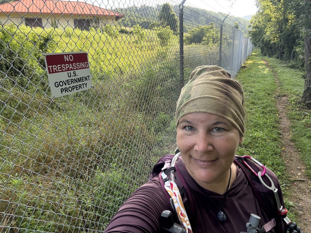
Well, on my journey to find out as much history of every inch of the trail I traverse as I can and share it with you, you know I had to dig around and get to the bottom of this mysterious complex.
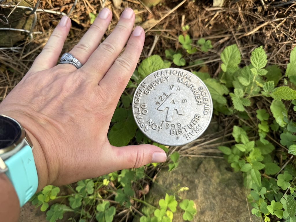
Side note, for those that like finding markers, there is an Appalachian Trail boundary marker along the fenceline!
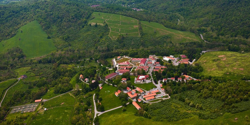
Smithsonian Institution National Zoological Park Conservation and Research Center
That mysterious complex is the Smithsonian Institution National Zoological Park Conservation and Research Center (what a mouthful), also known as the Smithsonian Conservation Biology Institute (SCBI).
WHAT IS THE SCBI
According to the Smithsonian website1:
The SCBI plays a leading role in the Smithsonian’s global efforts to save wildlife species from extinction and train future generations of conservationists. SCBI spearheads research programs at its headquarters in Front Royal, Virginia, the Smithsonian’s National Zoo in Washington, D.C., and at field research stations and training sites worldwide. SCBI scientists tackle some of today’s most complex conservation challenges by applying and sharing what they learn about animal behavior and reproduction, ecology, genetics, migration, and conservation sustainability.
SCBI scientists study and breed more than 20 species at their headquarters, including those that were once extinct in the wild, like black-footed ferrets and scimitar-horned oryx. Its major research initiatives are organized into five science centers.
So basically, we have some Jurassic Park crap going on here; that’s what I interpret that to mean! LMAO!
HISTORY OF THE COMPLEX
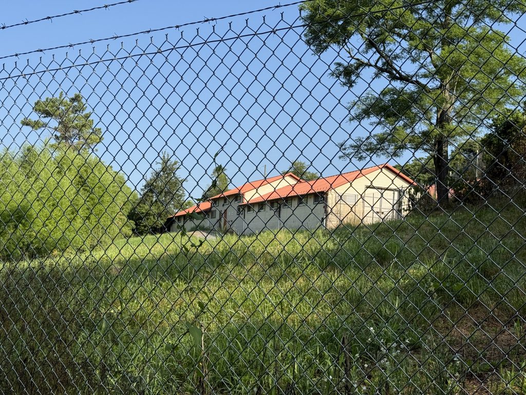
The complex that we pass through in this section includes approximately 3,200 acres of pasture, timber, animal enclosures, and a densely developed core of early twentieth-century buildings in Warren County, Virginia2.
The buildings you see are left over from when the U.S. Army purchased it as the Front Royal Remount Quartermaster Depot in 1911.
The land purchase for the original 5132.84 acres was completed in 1915, and it included part of what is now Shenandoah National Park and some complexes right before the section I am doing today.
The National Zoological Park was granted a temporary use permit for the facility in January of 1974, and permanent use of this facility was given to the National Zoological Park in June of 1975.
Before that, it was used by Native Americans during the Paleo-Indian and Early Archaic periods (evidence of their inhabitation can still be found at archeological sites within the campus).
VISITING
Want to visit and tour the complete? You can’t! It is closed to the public. In 2017, for Conservation Discovery Day, they did open it to the public for a single day,3 but that appears to be the only day they have ever opened it to the public. So if you want to catch a glimpse of T-Rex, you will have to do it from outside the fence.
Mosby Campsite / Old Shelter Area
I continued my way up for what seemed like forever (it was already getting hot) and met Suspenders at the top, where a dirt road intersected the trail at mile 975.5. It is called CCC Road. Apparently it goes through a private neighborhood, but it looked to be a public road. Suspenders said the road is pretty horrible, and there were “No Trespassing” and “Area under Surveillance” signs everywhere. There is also no parking or turnaround area. It is a single-lane “road” and required him to back down a way to a driveway to turn around.
Anyway, I grabbed a cold water and Dr. Pepper, then continued on. I did ask him why he came up if it was that bad, and he simply stated, “Because I told you I would meet you here,” lol.
Before long, I made it to the blue blaze for the Mosby Campground. Unfortunately, I was unable to get any pictures or video footage, as there were several campers at the campsite.
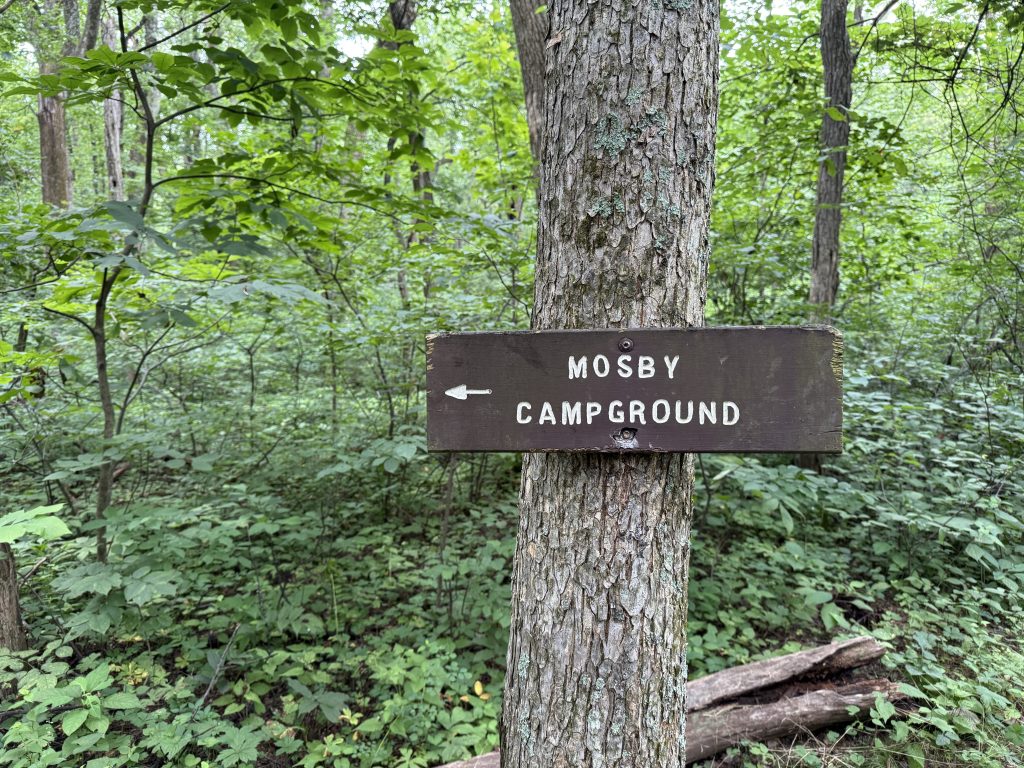
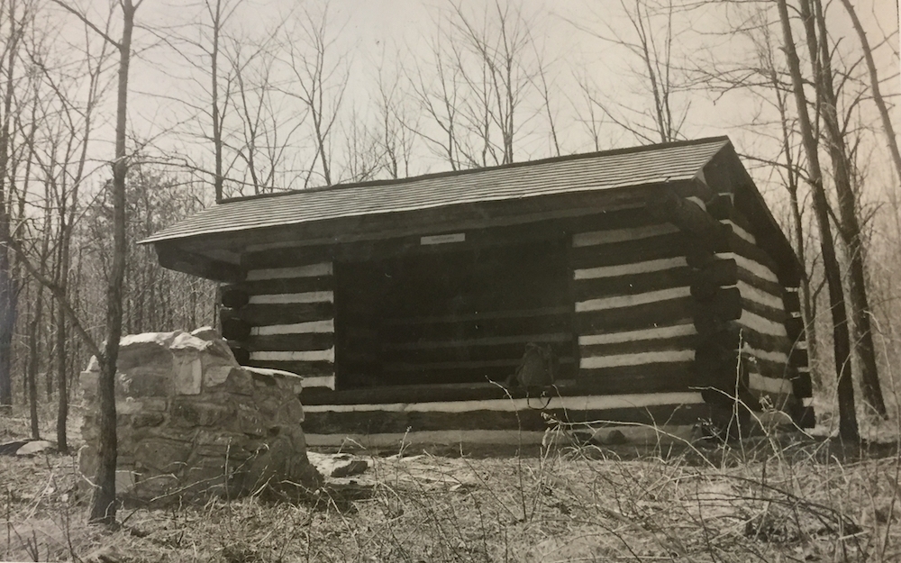
HISTORY
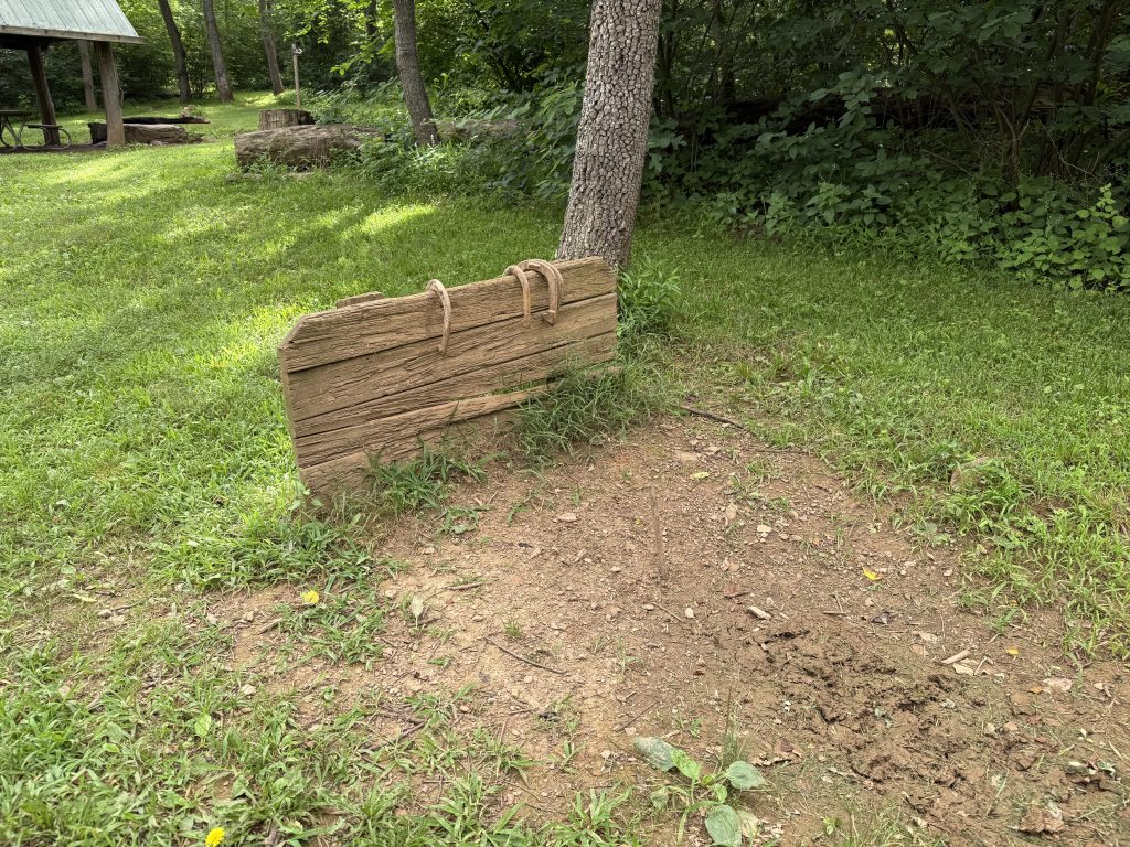
The Mosby Shelter once stood here and was built in 1939 by the Civilian Conservation Corps. However, it was stolen in 1974. YES! Someone came in and took it apart, log by log, and hauled it away, like a thief in the night. However, it wasn’t until the Potomac Appalachian Trail Club’s shelter maintainer visited the site that spring that they discovered the shelter was gone, most likely for its valuable chestnut logs. No one knows when or who stole it, and it was never rebuilt. The shelter and now camp area is named in honor of Colonel John Singleton Mosby, who was nicknamed “The Gray Ghost” during the Civil War. How appropriate, his shelter was taken….by a ghost.
There was also a community at one time nearby named Mosby (probably how the PATC thought to give this shelter/campsite its name), where Mosby’s men had once settled, as Mosby required his men to live in the area.
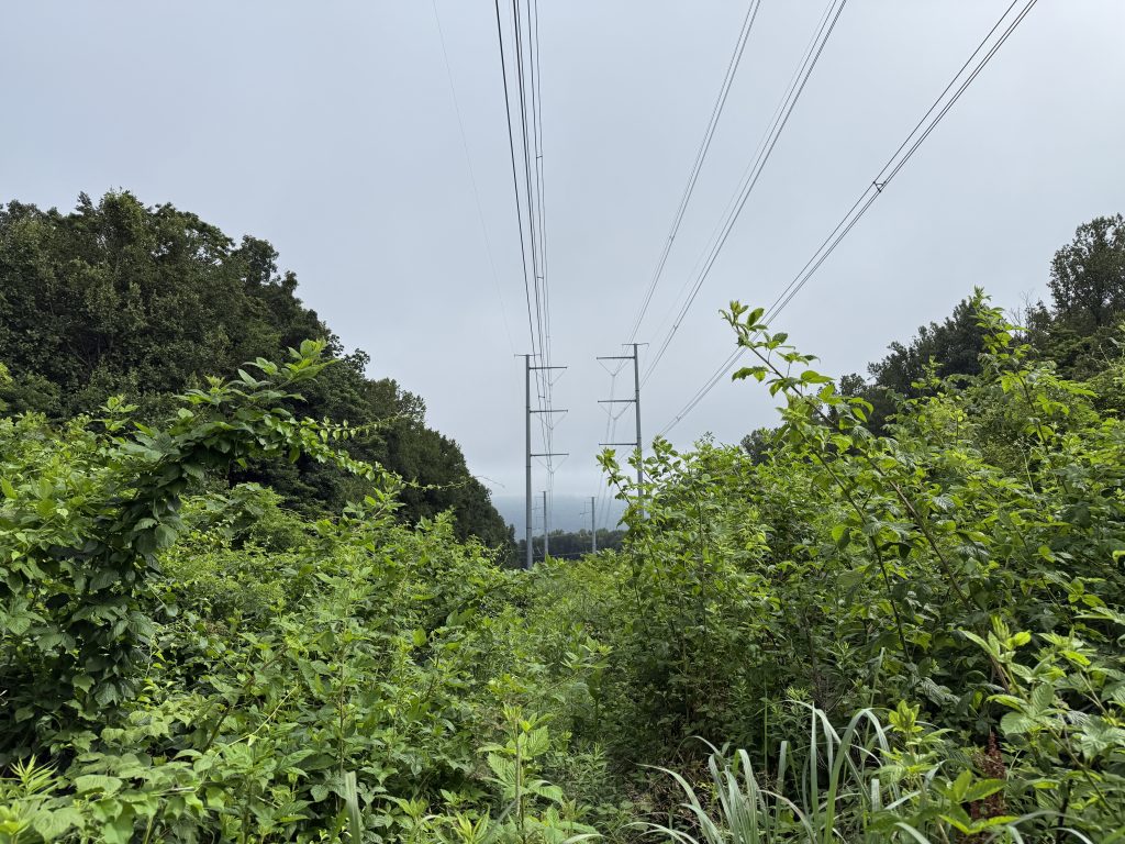
I continued my way down the trail, which was actually pretty easy going for this section. I came upon what looked like an overgrown meadow and heard loud buzzing and popping. It took me only a split second to realize it wasn’t a meadow but power lines cut over the mountain.
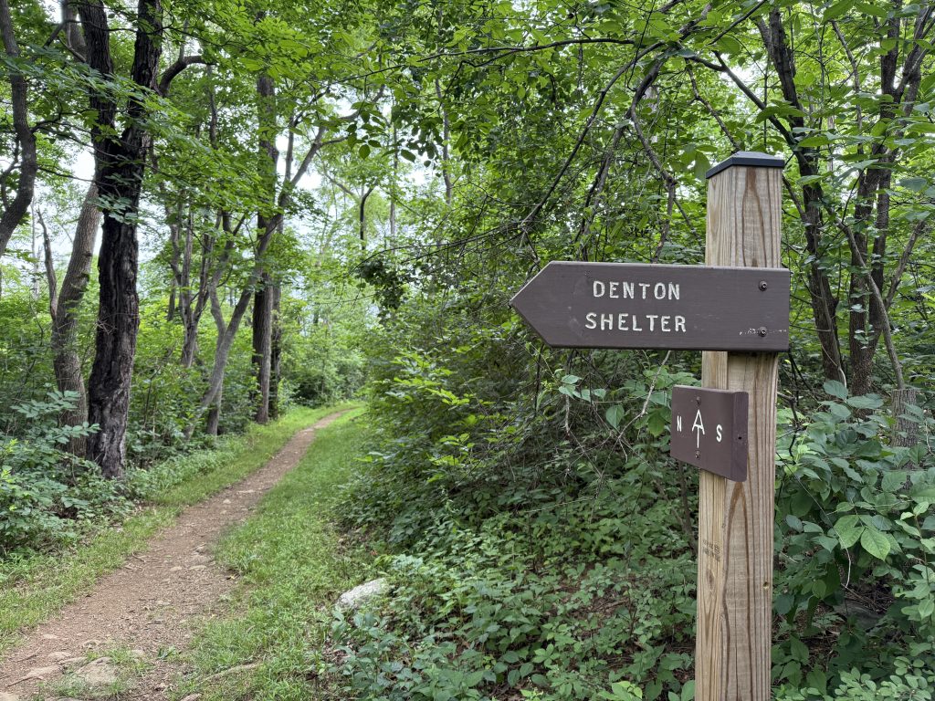
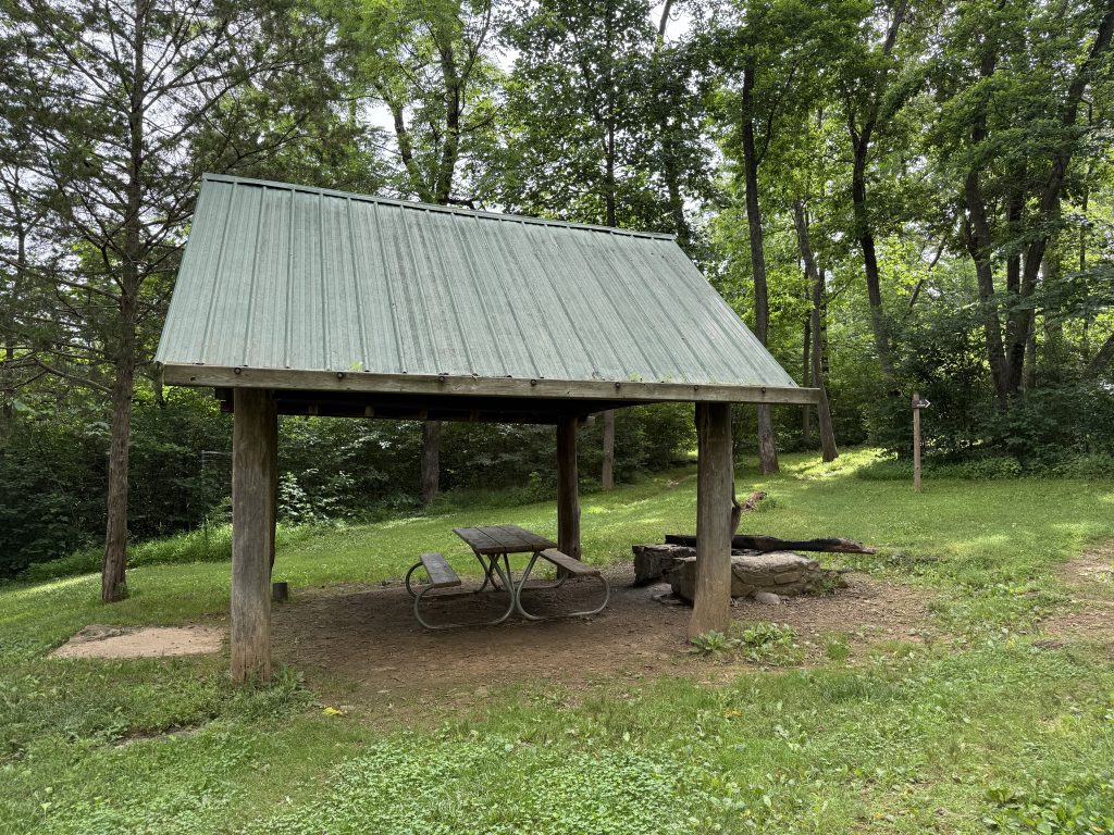
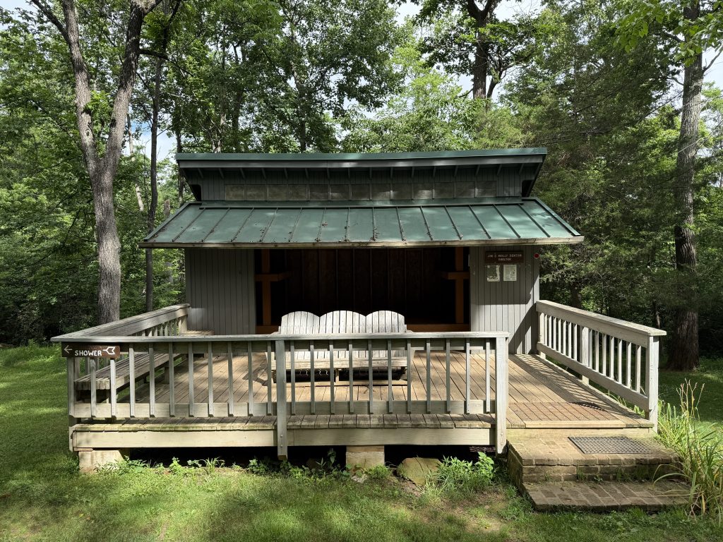
Jim & Molly Denton Shelter
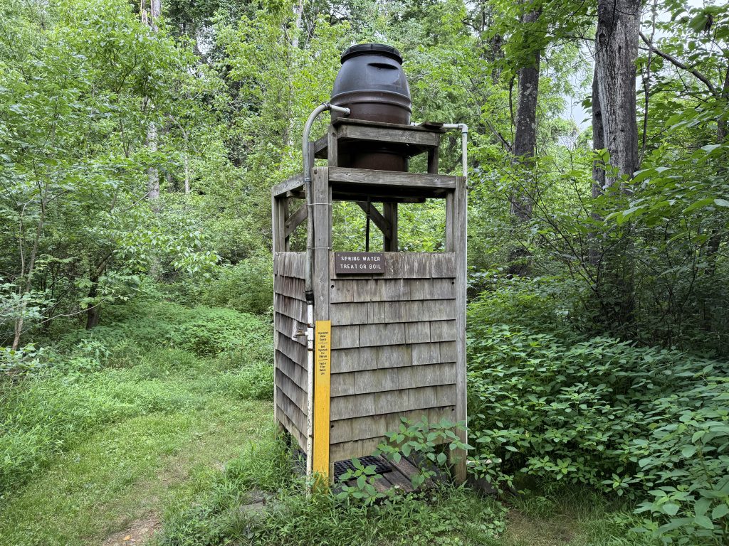
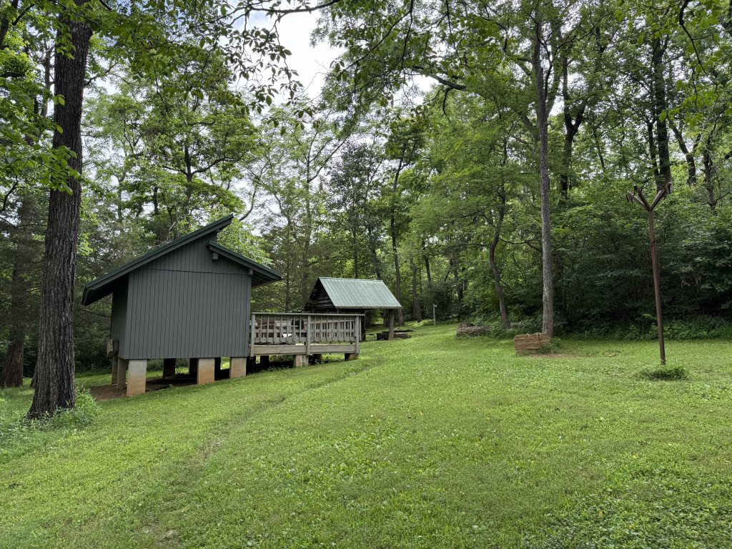
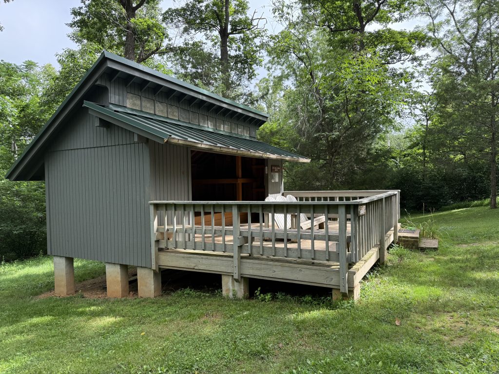
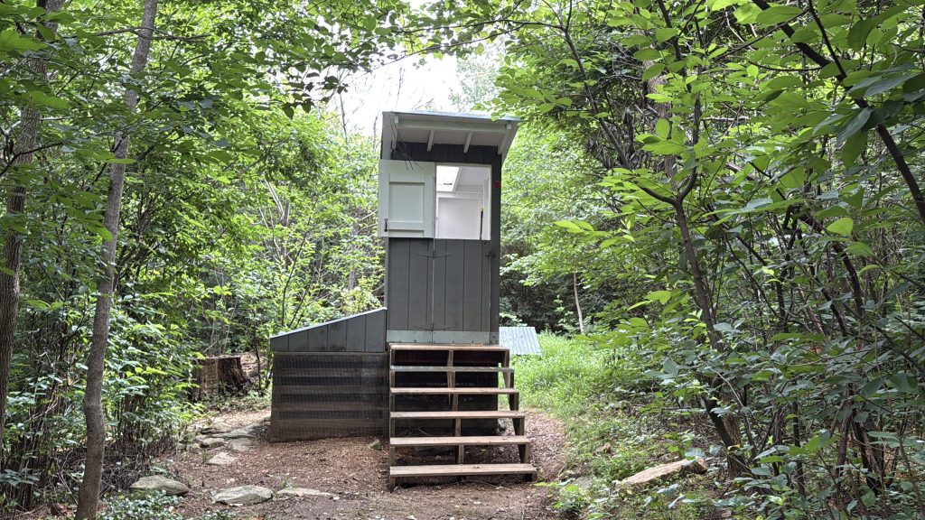
Before long I had made it to the iconic Jim and Molly Denton Shelter. Why is it so iconic among hikers? Well, in addition to the very well-maintained area, it has a horseshoe pit, a covered cooking pavilion, a solar shower, a really nice privy, and Adirondack chairs on the large patio along with built-in benches.
Check out today’s video for a complete tour of the Jim & Molly Denton Shelter.
HISTORY
The longest continuous reroute in Trail history (155 miles) was largely the result of Jim and Molly Denton’s efforts. The trail required a different route after the Blue Ridge Parkway was finished, which was now in the location of the original A.T. route.
Jim Denton oversaw the Roanoke Appalachian Trail Club’s building of the rerouted trail after scouting a new route through the recently enlarged Jefferson National Forest.
Molly led the photography, entertainment, publishing, and fundraising committees. In addition, she would also become the first female president of RATC.
As for the shelter itself, it was built in 1991 and was one of the first shelters to be upgraded.
====
Realizing that I had spent way too long at the shelter, I quickly booked it out of there and continued my way down to the road. I wasn’t 100% sure Suspenders would be meeting me there or not since I would only have about 1.5 miles left to hike.
On my way down, I met another thru-hiker. We chatted for a bit and I let her know my husband should be at one of these road crossings coming up and will have trail magic.
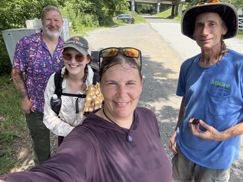
Shortly after leaving her, I came to the road and saw my truck =) It was around lunchtime, so I decided to take a break. It wasn’t long before we had several hikers come out of the woods. Everyone got trail magic. Some were thru-hikers, and some were section hikers. I forgot to get a picture of everyone, but here are the last two to come through.
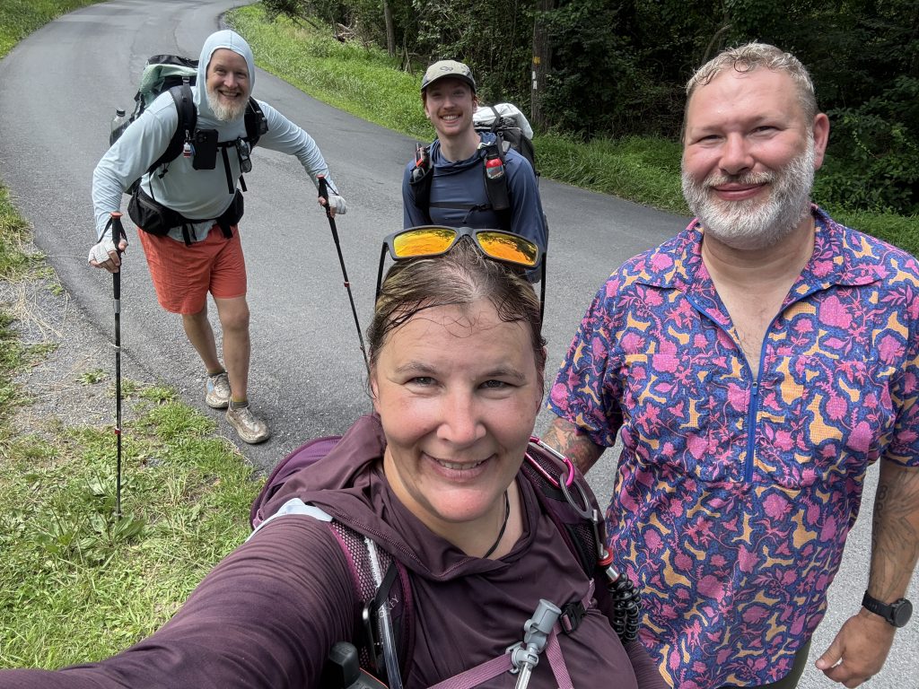
We chatted for a bit, and then we all took off together to get over this small up-and-over to the next road. Suspenders took off so he could meet everyone there.
I was surprised I was able to keep up with the guys for a while (and talk while doing so). The hill, while short, was pretty steep. It wasn’t long before I had to stop and catch my breath. But, I only had to stop once!
I passed by a meadow that had a bench; however, it was super overgrown and looked like tick central, so I opted not to have a mandatory seat.
Mosby Confederacy Sign
At mile 980.4, there used to be a sign on the tree (I completely passed by this tree and forgot to record). From here to 30 miles north, follows the border of Mosby’s Confederacy, a base of operations for Col. John Mosby and his army.
During the Civil War, Col. Mosby was known as the “Gray Ghost.” His unit—Mosby’s Rangers, also called Mosby’s Raiders—blended into local farms and communities, making it difficult for Union forces to track them. This ability to disappear among civilians allowed them to launch daring raids deep behind Union lines. Their swift, surprise attacks kept them one step ahead of their enemies.
I made it to the next road crossing, where Suspenders was waiting for me and had other hikers grabbing some trail magic. Turns out, I was only a couple of minutes behind them.
We waited around and chatted with everyone for a bit. Suspenders wanted to make sure everyone got their fill and was also able to charge up their electronics. After about 1.5 hours, we all parted ways, and Suspenders and I headed back to our hotel.
APPALACHIAN TRAIL DAY 42 VIDEO
AT Gear List
Interested in finding out what I carry on my Appalachian Trail Backpacking Trip? Check out my gear list here:


Leave a Comment or Suggestion