Hiked to another plane crash site, passed an old cemetery and the W.J. Mayo Homeplace…oh and I almost died as well.
NOBO Section: Mile 857.2 to Rockfish Gap
| AT Miles | Triple B Miles | Total AT Miles Hiked | Miles Remaining |
|---|
7.4
2.35
227.9
1970.5
DAY STATS
| ⏰ TIME TO COMPLETE: 5 hrs 13 min | 👣 TOTAL MILES TODAY: 9.75 |
| 📍 STARTING POINT: Mile 857.2 | 🤠 MOOD: Cautious |
| 📍 ENDING POINT: Rockfish Gap | 🤕 INJURIES: None |
| 🏔️ ELEVATION GAIN: 1,086.6 ft | 🐻 WILDLIFE: Squirrel & Turtle |
| 🏔️ ELEVATION LOSS: 1,438 ft | 🌡️ WEATHER/TEMP: HOT! & Humid |
| 📐 TOTAL GRADE: 341.2 ft/mi | 💰 EXPENSES: $30 |
Suspenders joined me for the first 1.5 miles while we searched for another plane wreck, this time on Dobie Mountain. This one was easier to find because it is well known and has a trail leading to it.
We started NOBO on the Appalachian Trail, then took the blue-blazed Jack Albright Loop Trail. It turned out to be 3/4 miles down the trail, so this was going to be a 1.5-mile Triple B for me.
Plane Wreck on Dobie Mountain
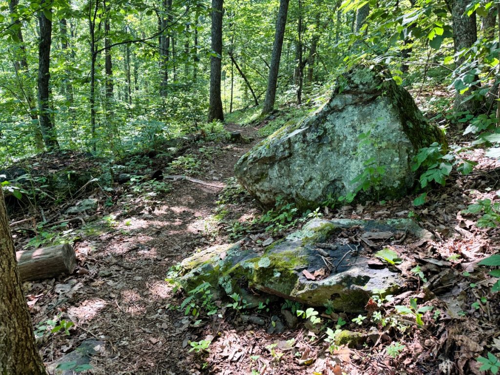
The spur trail off of the Jack Albright Loop was easy to find. If you are coming from the parking lot instead of the AT, look for the large boulder on the right; just past that is a tree with a cairn (although, apparently, the cairn isn’t always there, but it is clear there is another trail there).
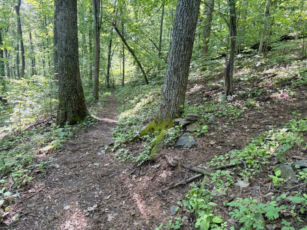
Here are the coordinates: 37.9818665, -78.8906668. From there you will head about 150 feet uphill. Debris from the plane crash is scattered, and not much is left.
What Happened?
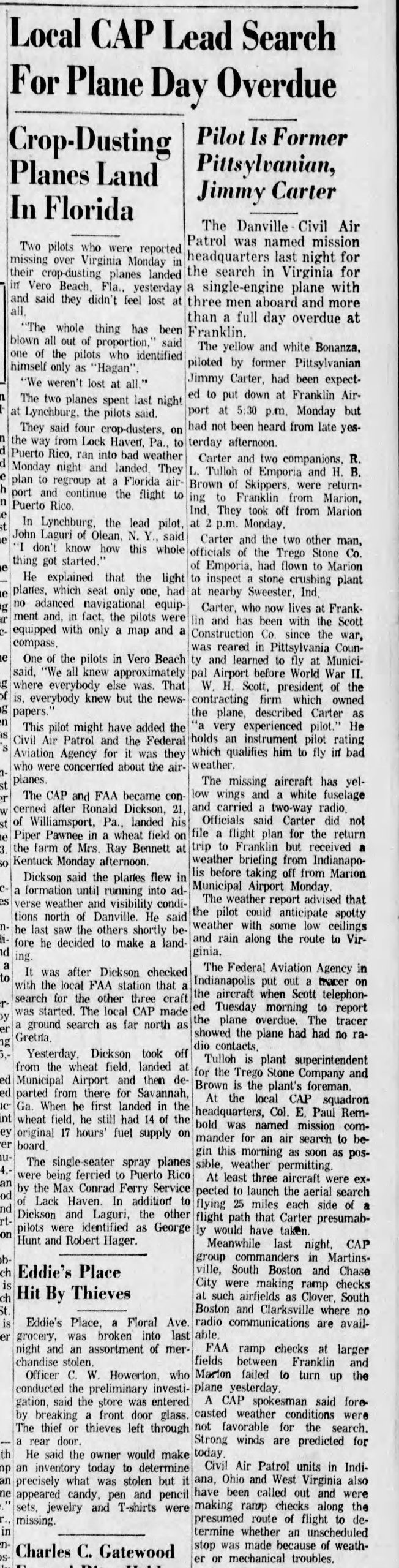
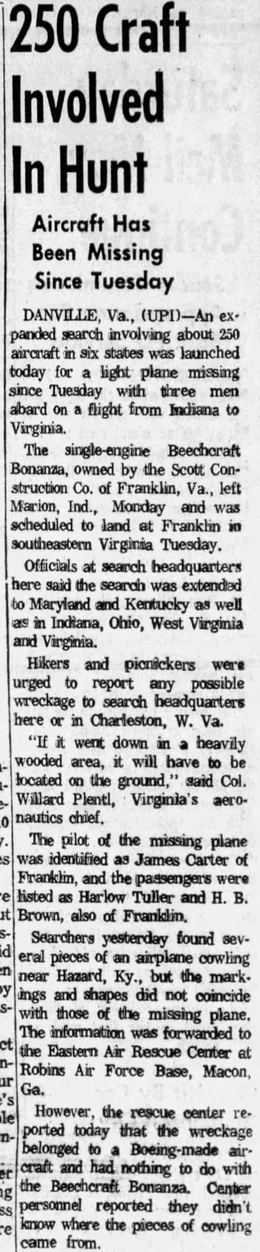
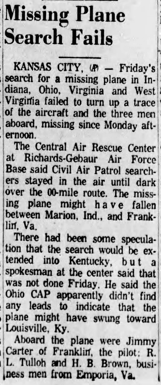
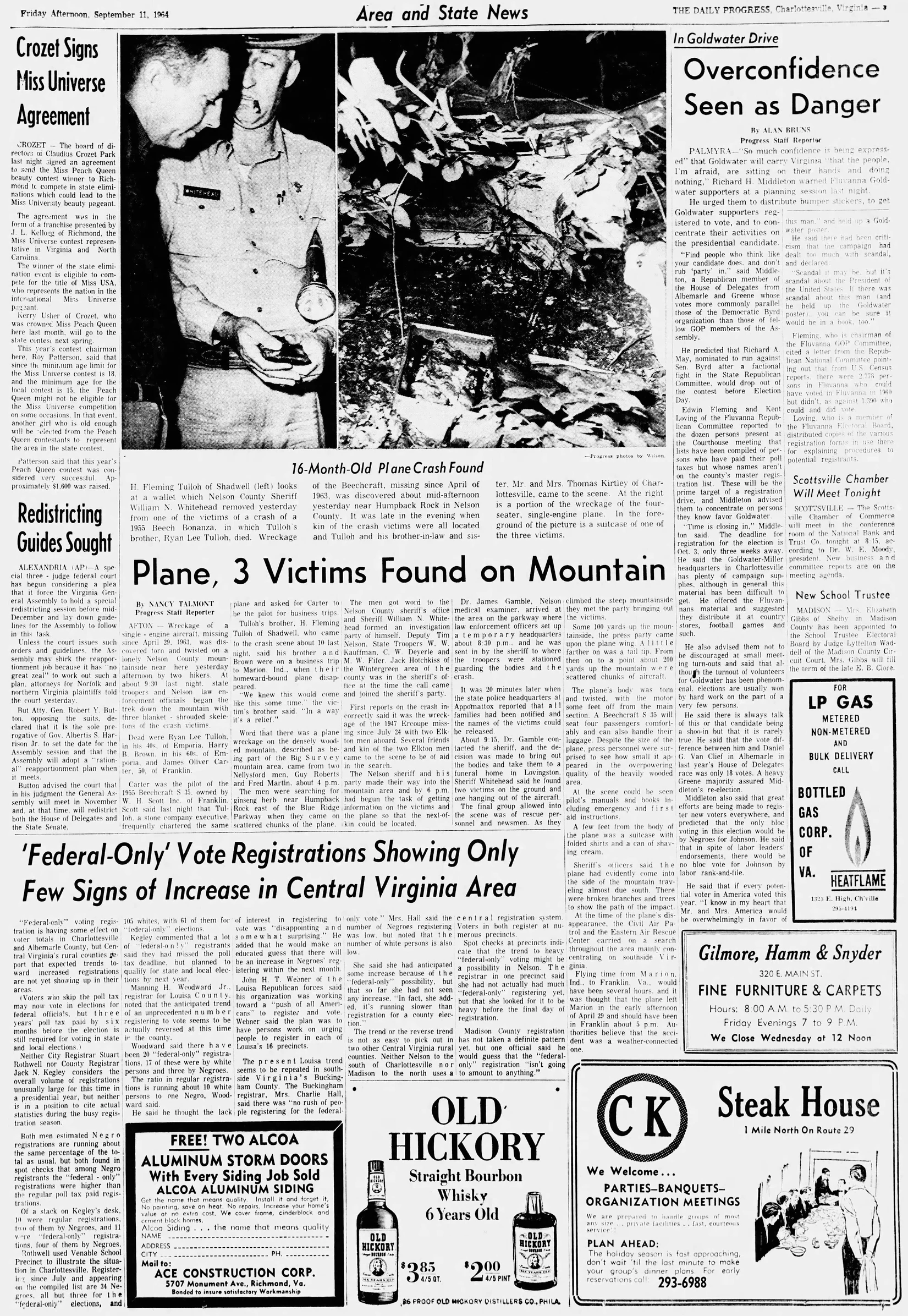
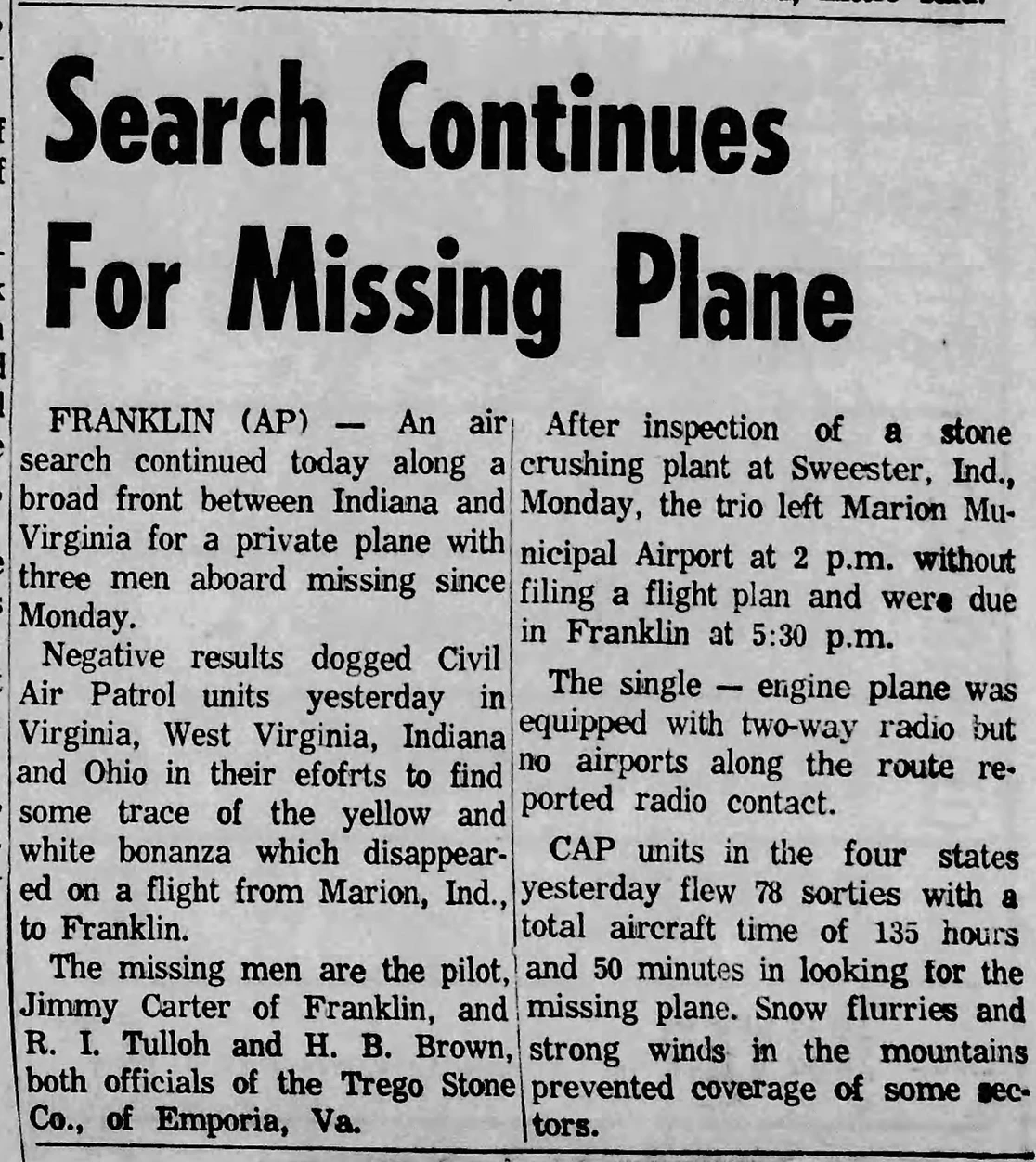
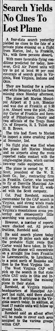
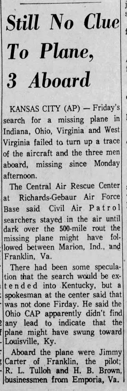
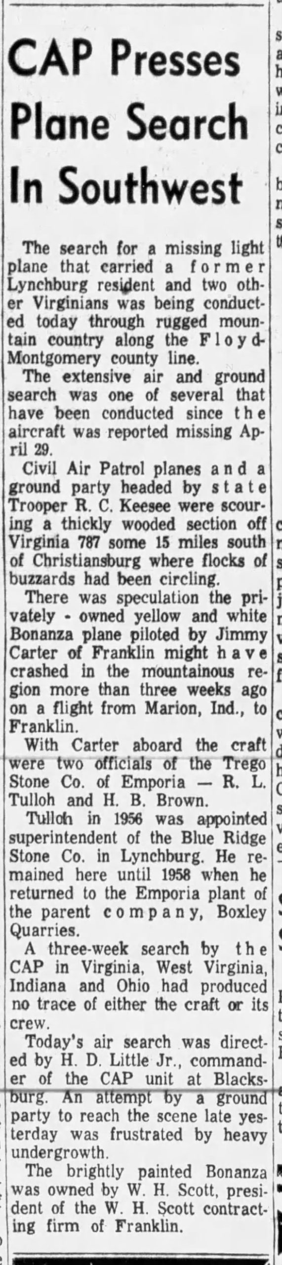
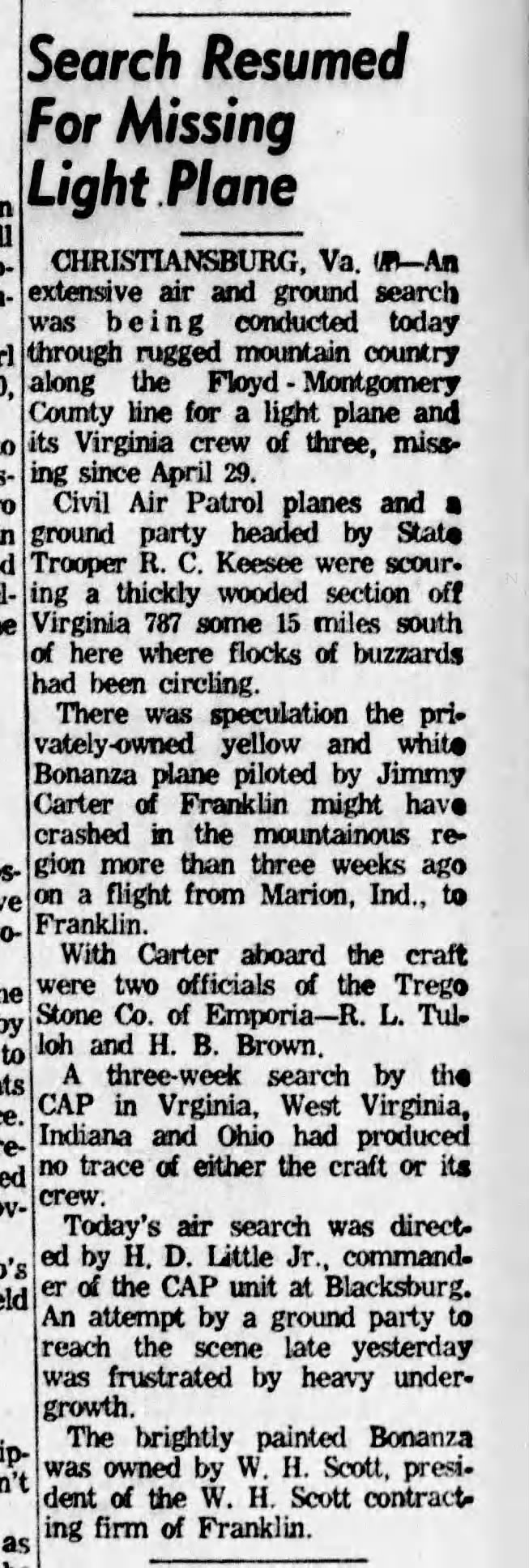
On April 29, 1963, a civilian 1955 Beechcraft Bonanza collided into the mountainside during a return flight from Marion, Indiana, resulting in the deaths of all three occupants: James Oliver Carter (the pilot), Ryan Lee Tulloh, and Harry Brown (both were officials of the Trego Stone Co. out of Emporia, Va). They left Indiana around 2 p.m. after inspecting a stone crushing plant without filing a flight plan. Search and rescue crews were dispatched after the aircraft failed to arrive at its intended destination of Franklin, Virginia, around 5:30 p.m.
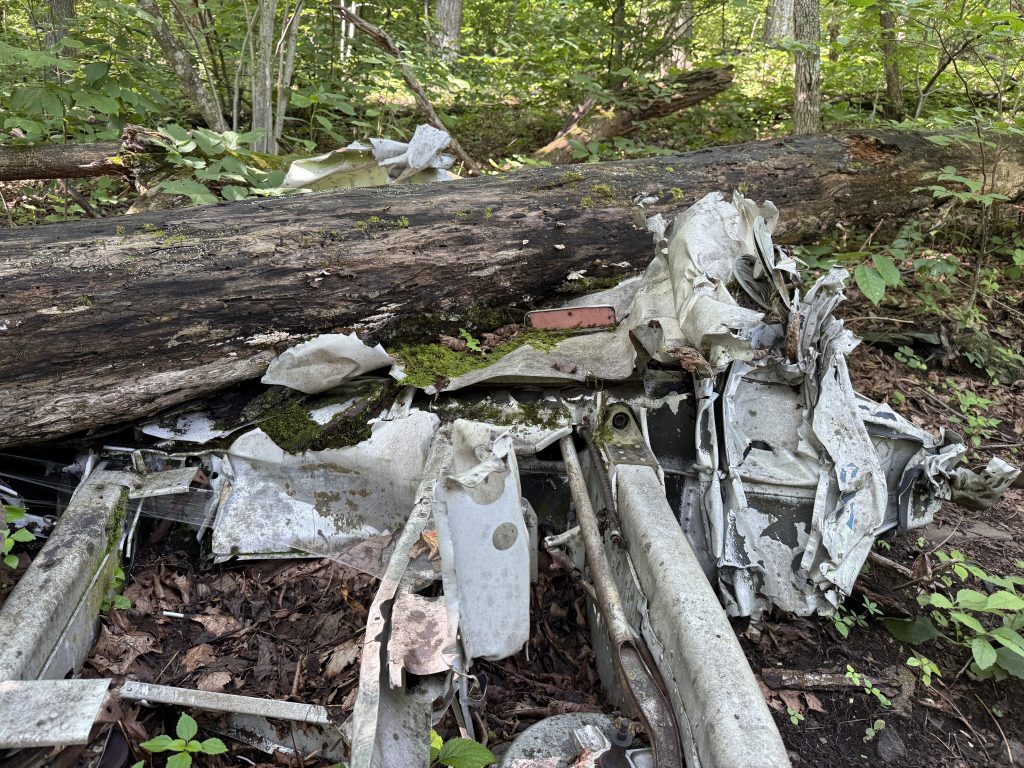
The plane was never located and appeared it never would be, despite the extensive search that took place over the course of several weeks in six different states involving over 250 aircraft.
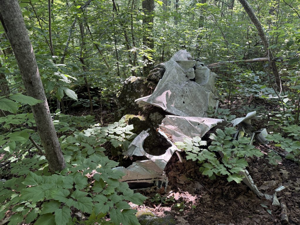
The wreckage was not discovered until September 10, 1964, sixteen months later, when two ginseng hunters were scouring the area near Humpback Rocks and came across the wreckage, at which point they promptly contacted authorities. Recovery personnel found two of the missing men on the ground, while the third was discovered hanging partially outside the aircraft. Weather conditions were suspected to have been a contributing factor.
Newspaper Clippings
Click each picture to enlarge.

Lowe Family Cemetery
After dipping down into the valley, I started a short climb and came up to the Lowe Family Cemetery. I couldn’t find any information about this cemetery.
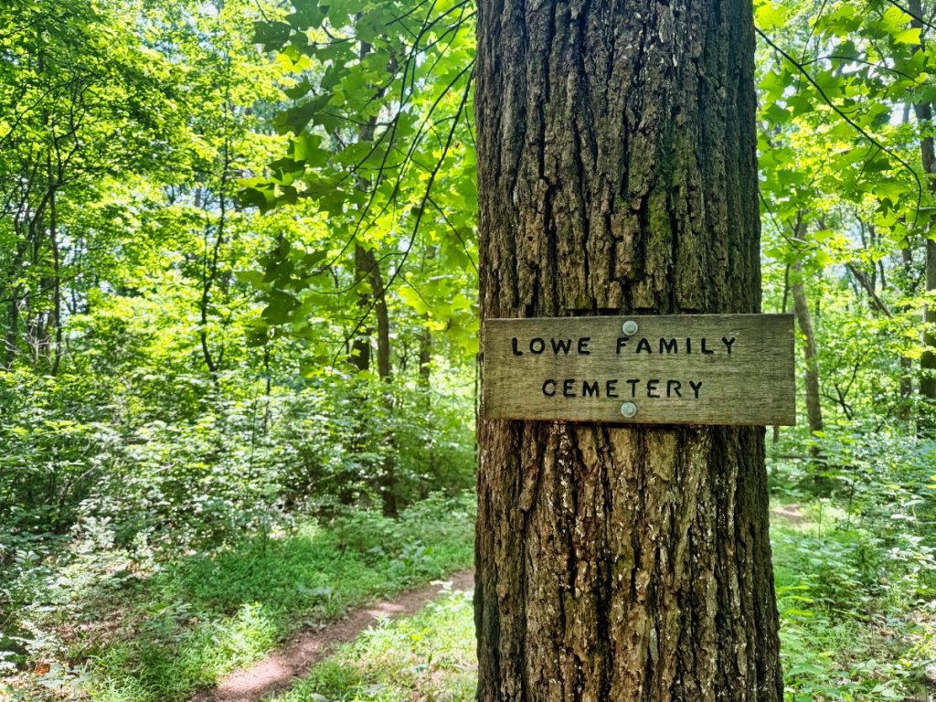
I assume the Lowe family owned this area before it became part of the AT, and this was their family cemetery. It was common back in the day for homesteads/farms to have family cemeteries on their land.
The newest burial, and the only “headstone” that is legible, was buried here in 2016.
Oh, and on my way out, I stopped to take a picture of one of the headstones and heard the unmistakable sound of a tree cracking and falling. I took off running. The tree in question fell directly above me and was caught by another tree’s branches. This, however, wouldn’t be my only brush with death today.
Thunderstorm Incoming
As I started my second “climb,” I could hear thunder rumble in the near distance despite not seeing anything on the radar. I still had three miles left to get to the truck.
Shortly after some loud rumbles of thunder, the forest got super quiet, which is never a good sign.
W.J. Mayo Homeplace – Chimney Ruins
After another dip and another short climb, I came upon the old W.J. Mayo Homeplace ruins. I also couldn’t find out much about this place other than the following comment on a YouTube “Possibly tied to Joseph Thompson Mayo, who settled in the Humpback Mountain region in 1831. He owned 106 acres where the Blue Ridge Parkway intersects the Nelson and Augusta county line. It is speculated that the cabin would belong to him or one of his sons, William Walker Mayo or Joseph Samuel Mayo.”
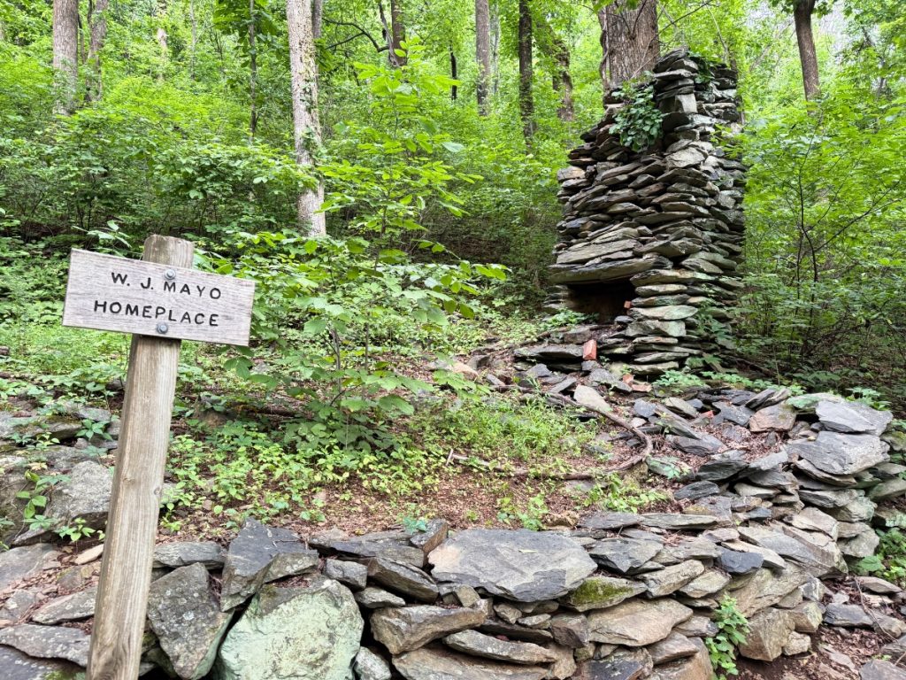
Now, some people believe that these ruins do not belong to the W.J. Mayo Homeplace or the Mayo family; instead, when they refer to the Mayo homeplace, they are actually talking about another cabin located off the Appalachian Trail nearby. I was not aware there was a cabin near here at the time; otherwise, I would have tried to search for it. If you have found it, please leave a comment and let me know.
Almost Struck by Lightning
Shortly after leaving the W.J. Mayo Homeplace ruins, the sky opened up and it began pouring, which actually felt amazing; however, there was lightning and thunder that seemed to be getting closer.
Before I knew it, a super bright flash hit really close next to me (close enough that it temporarily blinded me for a split second and caused my chest to rattle), followed by thunder that sounded like a bomb went off in my ear.
I have chased tornados and thunderstorms for 30 years, and I have never been scared like I was in that instant. I had nowhere to take cover. I actually called Suspenders to tell him that I loved him, just in case I didn’t make it out.
This was one of those freak afternoon thunderstorms that wasn’t in the forecast. When I started this hike today, my gut told me to go back to the truck with Suspenders after visiting the crash site. I didn’t listen. This would make my second brush with death.
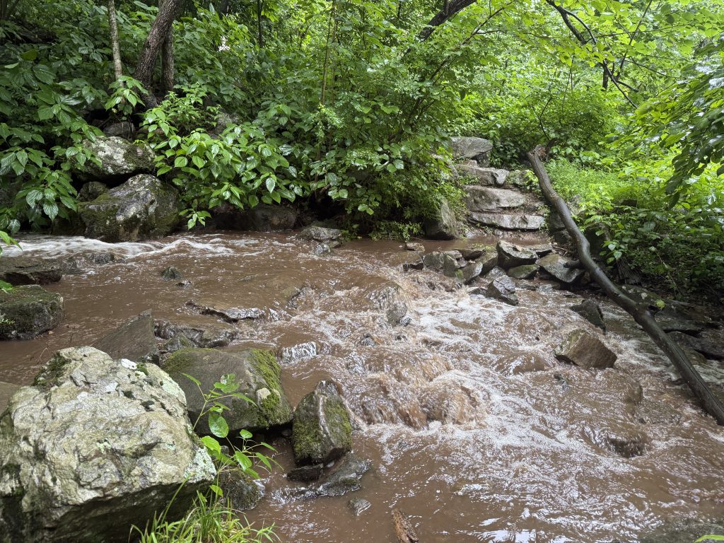
The Trail is a River
That brief, yet heavy, storm transformed small stream crossings into gushing flows of water across the trail. Thankfully, they weren’t more than an ankle deep, but man, it was flowing.
I did get to see my first turtle today, so that was pretty neat!
Man, was I happy to see Suspenders and the truck!
APPALACHIAN TRAIL DAY 41 VIDEO
AT Gear List
Interested in finding out what I carry on my Appalachian Trail Backpacking Trip? Check out my gear list here:


Leave a Comment or Suggestion