Today, there are numerous Triple B’s along Humpback Mountain and a wealth of historical information to share! From stumbling upon a plane wreck to climbing Humpback Rocks, it was a pretty fantastic day, even if I was fogged in for all of it.
NOBO Section: Mile 851.6 to Mile 857.1
| AT Miles | Triple B Miles | Total AT Miles Hiked | Miles Remaining |
|---|
5.7
1.75
220.5
1977.9
DAY STATS
| ⏰ TIME TO COMPLETE: 6hrs 5 min | 👣 TOTAL MILES TODAY: 7.45 |
| 📍 STARTING POINT: Mile 851.6 | 🤠 MOOD: Excited!!!! |
| 📍 ENDING POINT: Mile 857.1 | 🤕 INJURIES: None |
| 🏔️ ELEVATION GAIN: 847 ft | 🐻 WILDLIFE: Deer & Squirrel |
| 🏔️ ELEVATION LOSS: 1,641.7 ft | 🌡️ WEATHER/TEMP: Foggy & Hot |
| 📐 TOTAL GRADE: 413.5 ft/mi | ⏰ TIME TO COMPLETE: 6 hrs 5 min |
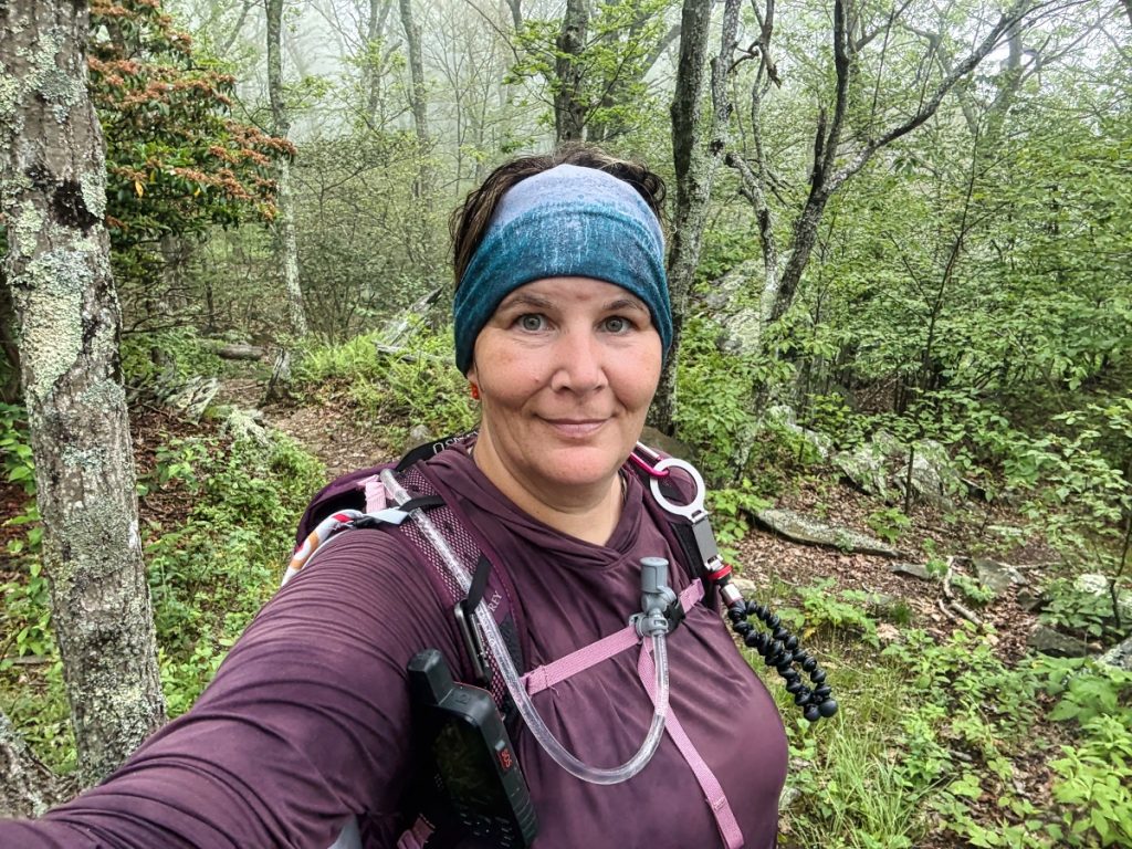
Suspenders started my hike with me today. The plan was for him to hike to the plane crash with me and then hike back to the truck so he could go ahead and get to where he was supposed to pick me up.
The beginning wasn’t too bad, and we were rolling right along, then it started getting steeper the closer we got to Wintergreen View.
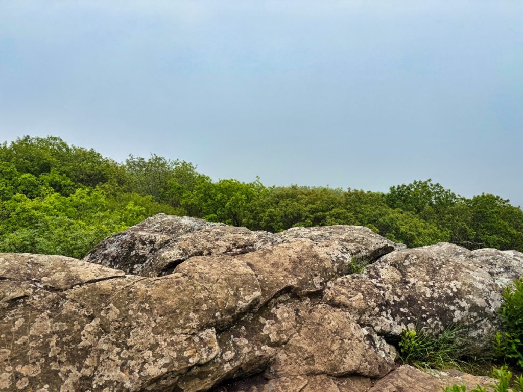
Wintergreen View
Unfortunately for us, we were completely fogged in and had no views once we got to the top of the lookout.
History
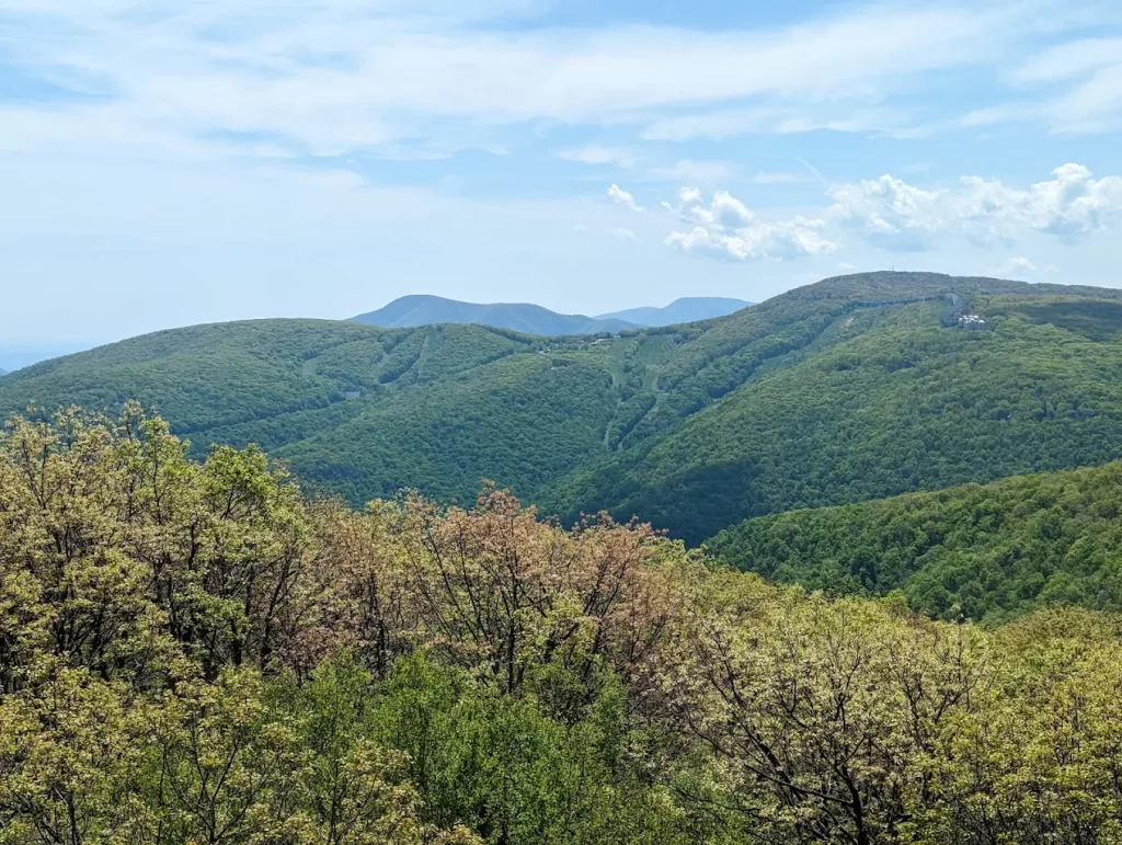
This area on Humpback Mountain offers a panoramic view of the ski slopes at Wintergreen Resort and the prominent peak known as The Priest. The designation “Battery Cliff” originates from the appearance of the condominiums situated on the slopes, which resemble fortifications when viewed from a distance. The rocks comprising the cliffs are Catoctin greenstone, a geological formation resulting from a volcanic eruption in antiquity.
When you look across toward Wintergreen, you are observing a segment of the Appalachian Trail that previously traversed that area of the mountains. Historically, five miles of the Appalachian Trail ran through the resort; however, in 1983, the sale of the land to private developers resulted in the disruption of the trail’s continuity, causing significant challenges for the Appalachian Trail Conservancy.
Fortunately, the organization was able to mobilize expeditiously, raising the necessary funds to safeguard the land across Humpback Mountain, where the trail currently runs. Additionally, an “Old Appalachian Trail” remains within the parameters of the Wintergreen property, accessible via various hiking trails and offering a link to the original Appalachian Trail.
This is what the view looks like when there is one:
Military Plane Crash Site
The one thing I have learned about the Appalachian Mountains is they are notorious for plane wrecks. Although I had heard of a few incidents before starting my hike, it wasn’t until I began researching the history of the trail that I realized just how many there have been over the years.
Granted, most were from the mid-1900s (man, it feels weird to say that), before a lot of the technology we have on planes today existed.
This one was a little more fascinating to me because I had never heard another Appalachian Trail hiker talk about it despite the fact it wasn’t too far off trail. Due to it not being widely known, most of the pieces of the plane are still there.
Here are a couple of pictures of this plane wreck on Humpback Mountain.
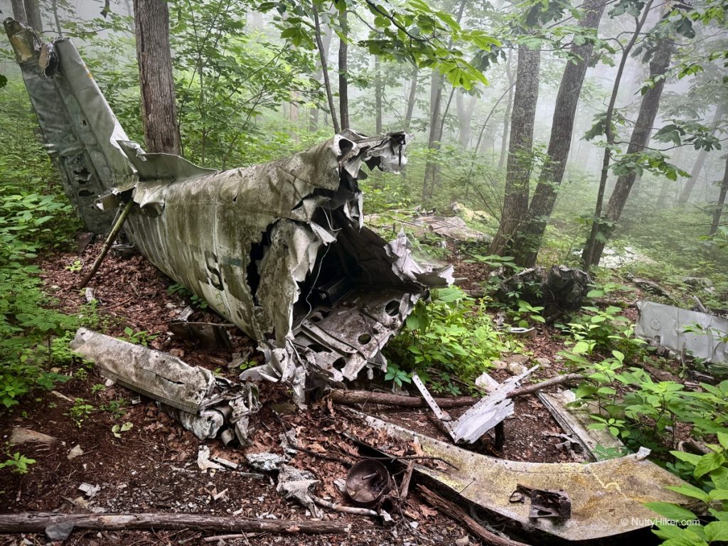
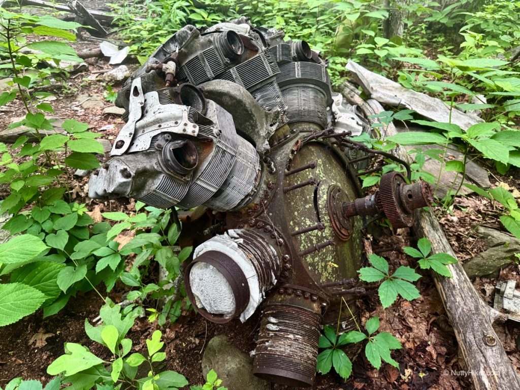
If you’d like to see a full video tour of the site, I made a separate video for it. I also created a separate blog post for it that has all the history, how the wreck happened, and even newspaper clippings. You can check out that blog post here.
Humpback Mountain
After leaving the plane wreck, I started my short climb to the top of Humpback Mountain. My goal was to find the survey marker. I had looked up where it was supposed to be based on the mark description. It wasn’t until later that I learned I could look up the actual GPS coordinates.
Needless to say, after spending about 20 minutes or so at the summit of Humpback Mountain (I lost track of time and honestly have no idea how long I was looking), I gave up. I could not find the survey mark based on the directions. Granted, those directions were made decades ago.
On my way down, I met two other hikers and let them know my husband had trail magic at Humpback Gap if they were thinking of going to the parking lot. I actually ended up hiking with them for a while, until the Triple B came up for Humpback Rocks. I took the Triple B and they continued on the AT.
Humpback Rocks
I took the 0.25/mile Triple B to Humpback Rocks. Shortly before getting there, I ran into a deer that was eating in the middle of the trail. I tried to not disturb him but ended up doing it anyway by accident.
The climb up the rocks was pretty sketchy. They are all positioned at an extremely steep angle. There were no flat spots on these at all.
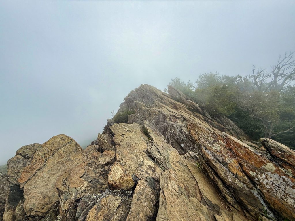
I assume the view would be amazing up here on a clear day. Unfortunately for me, I was fogged in. I spent way too long up here and messaged Suspenders to let him know I was climbing down and headed his way.
History:
Humpback Rocks, which rises to an elevation of 3,080 feet, is named for the distinctive hump shape created on the western face of the mountain. In the 1840s, it served as a landmark to guide wagon trains traveling along the Howardsville Turnpike (more about that below).
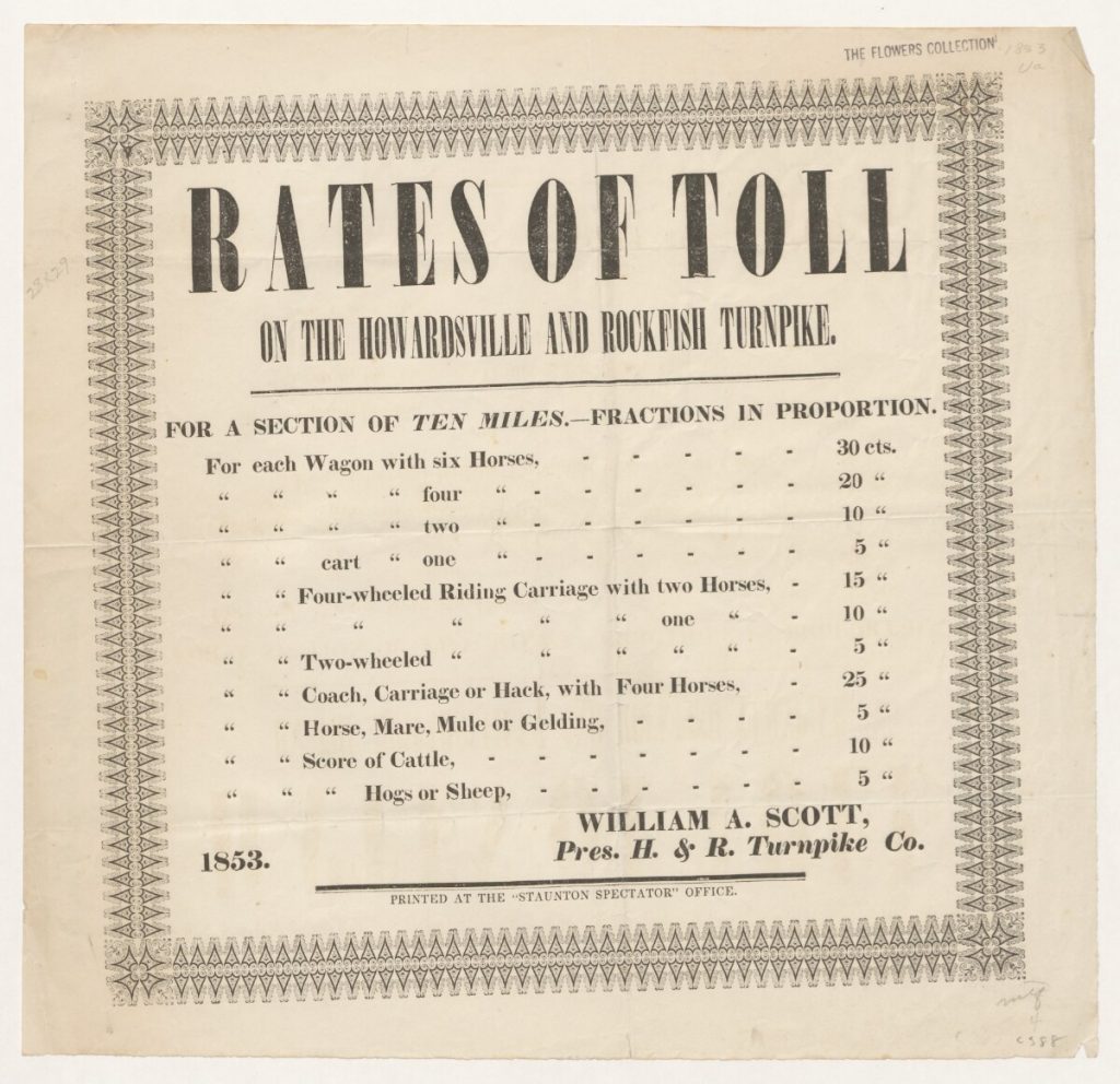
Howardsville Turnpike
I passed the two hikers from before as I made my way down the mountain.
As I reached the bottom of Humpback Mountain, I arrived at the junction where the old Howardsville Turnpike briefly connects to the Appalachian Trail (AT) and continues until it reaches the blue-blazed trail leading to the Humpback Gap parking lot at mile 857.2. From there, the Howardsville Turnpike continues to the parking lot, and the Appalachian Trail continues to the right.
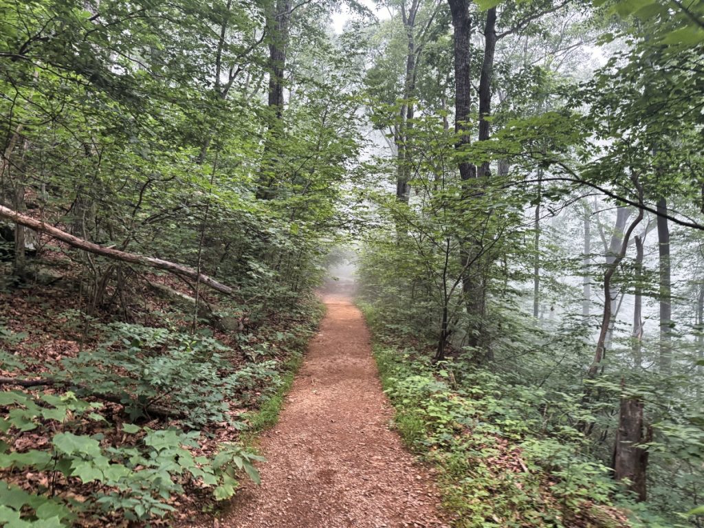
Although most of it in this area has long since been reclaimed by the forest, you can still see original rock walls on the old roadbed where it joins the Appalachian Trail to the east. That section is no longer maintained, and it is not recommended to hike it. However, the wide, flat gravel surface of this part of the trail still retains the unmistakable resemblance of an old roadbed.
History:
The Howardsville Turnpike was an old toll road that was built in 1846 and was heavily utilized for transporting goods before the Civil War by connecting the Shenandoah Valley to the James River Canal system. By the late 1850s the railroad had moved in, and soon these toll roads became obsolete.
Running Into Two Other Hikers
Shortly before coming to the junction where I would turn off the AT and head to the Humpback Gap parking area, I ran into two other hikers that were headed southbound. One had an ankle injury. I let her know my husband was an EMT and only about a mile to the parking lot. They apparently had just been dropped off from being in town several days and resting the ankle, so she declined. Her friend said they were going to try and wrap it but didn’t really have anything. I gave them my ACE bandage since I could easily replace it.
I Was Missing & Didn’t Know It
I reached the turn off and immediately saw Suspenders hiking towards me with a worried look on his face. Apparently, I was overdue and missing and had no idea, lmao!
I am unsure how the miscommunication occurred, but while I was on Humpback Rocks and messaged him that I was heading down, he mistakenly believed I had only a mile left to reach him instead of the 3.5 miles I had left. Knowing I was going downhill, it should have taken me at the most 30 minutes to do a mile.
When I didn’t arrive 45 minutes after messaging him, he started to worry. He checked my Garmin, and it showed I was still at Humpback Rocks. He messaged me several times (I never got it until I got to the truck). After 1.5 hours passed since I last messaged him, and my Garmin was still showing I was at Humpback Rocks, he decided to grab his trekking poles and daypack and hike towards me.
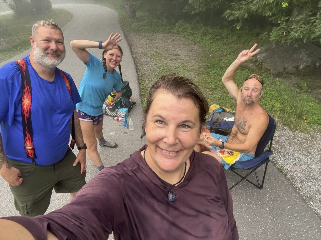
Anyway, we made it to the parking lot and were getting ready to back out when the two hikers I met near the top of Humpback Mountain came into view. Suspenders put the truck in park and did some trail magic.
APPALACHIAN TRAIL DAY 40 VIDEO
AT Gear List
Interested in finding out what I carry on my Appalachian Trail Backpacking Trip? Check out my gear list here:


Leave a Comment or Suggestion