Headed SOBO today. The first 5 miles were foggy and uneventful. However, the next 6 miles were beautiful with some history thrown in. Additionally, I have decided to start numbering my posts more by episode than by day, as this is apparently becoming a LASH instead of a thru-hike.
NOBO Section: VA 625 – VA 623
| AT Miles | Triple B Miles | Total AT Miles Hiked | Miles Remaining |
|---|
10.8
0
199.4
1999
DAY STATS
| ⏰ TIME TO COMPLETE: 6hrs 45 min | 👣 TOTAL MILES TODAY: 10.8 |
| 📍 STARTING POINT: VA 623 | 🤠 MOOD: Excited |
| 📍 ENDING POINT: VA 625 | 🤕 INJURIES: None |
| 🏔️ ELEVATION GAIN: 1,666.7 ft | 🐻 WILDLIFE: Chipmunk |
| 🏔️ ELEVATION LOSS: 3,228.3 ft | 🌡️ WEATHER/TEMP: Foggy then Sunny |
| 📐 TOTAL GRADE: 453.2 ft/mi | 💰 EXPENSES: |
Started the day in a foggy mist heading SOBO: no views or history lessons for the first five miles. I met Suspenders at Walker Gap for lunch. He said that the town nearby had a Long John Silver’s, so I jumped in the truck and said, “Let’s go!”
It turns out that it had been closed for a long time, so we ate at Hardee’s instead. We were trying to wait for the clouds on the mountain to clear out, as I need a clear view for the next section. Why? Well, you will understand in just a bit.
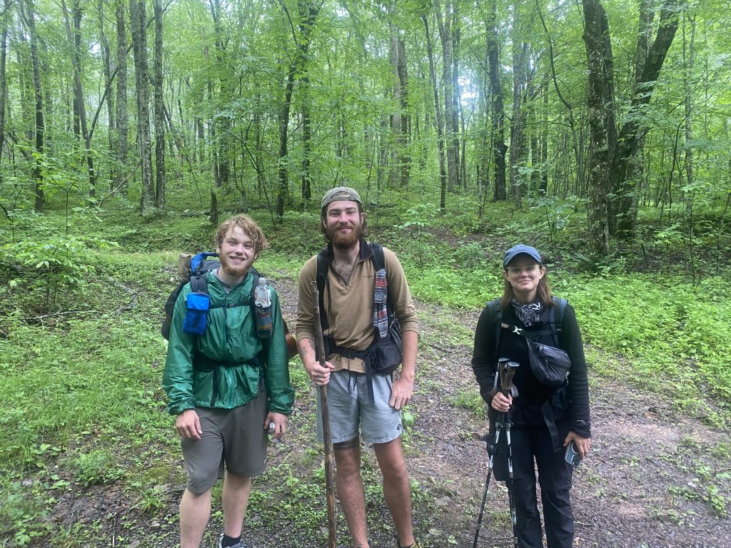
Oh, and he got to perform his first trail magic to a trio of hikers at Walker Gap while waiting for me.
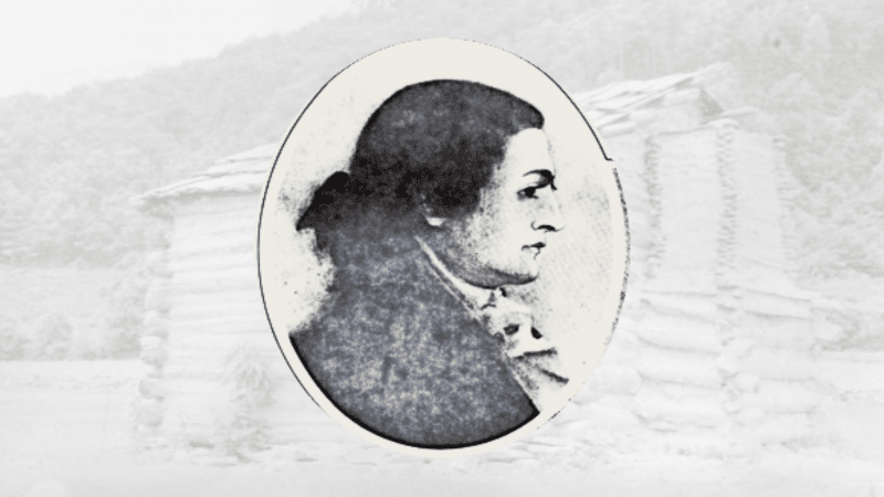
Walker Gap
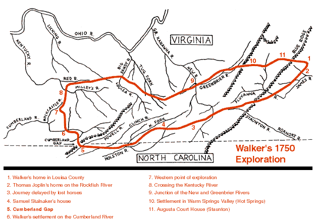
The area is named after Dr. Thomas Walker, a friend and confidant of Thomas Jefferson. Dr. Walker was an explorer who passed through the region in 1749 while searching for a route into Kentucky. He is credited with discovering the Cumberland Gap, building the first cabin in Kentucky, and being one of the first three Virginians to import English hounds. He also contributed to the early breeding of coon hounds in the Blue Ridge Mountains.
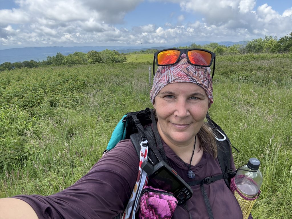
We headed out of Walker Gap (Suspenders decided to join me for the mile up to Chestnut Knob Shelter (ok, it was a tad over a mile), but the view is supposed to be amazing and I wanted a couple’s picture.
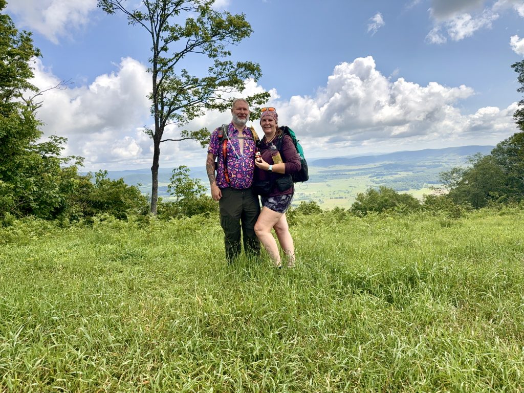
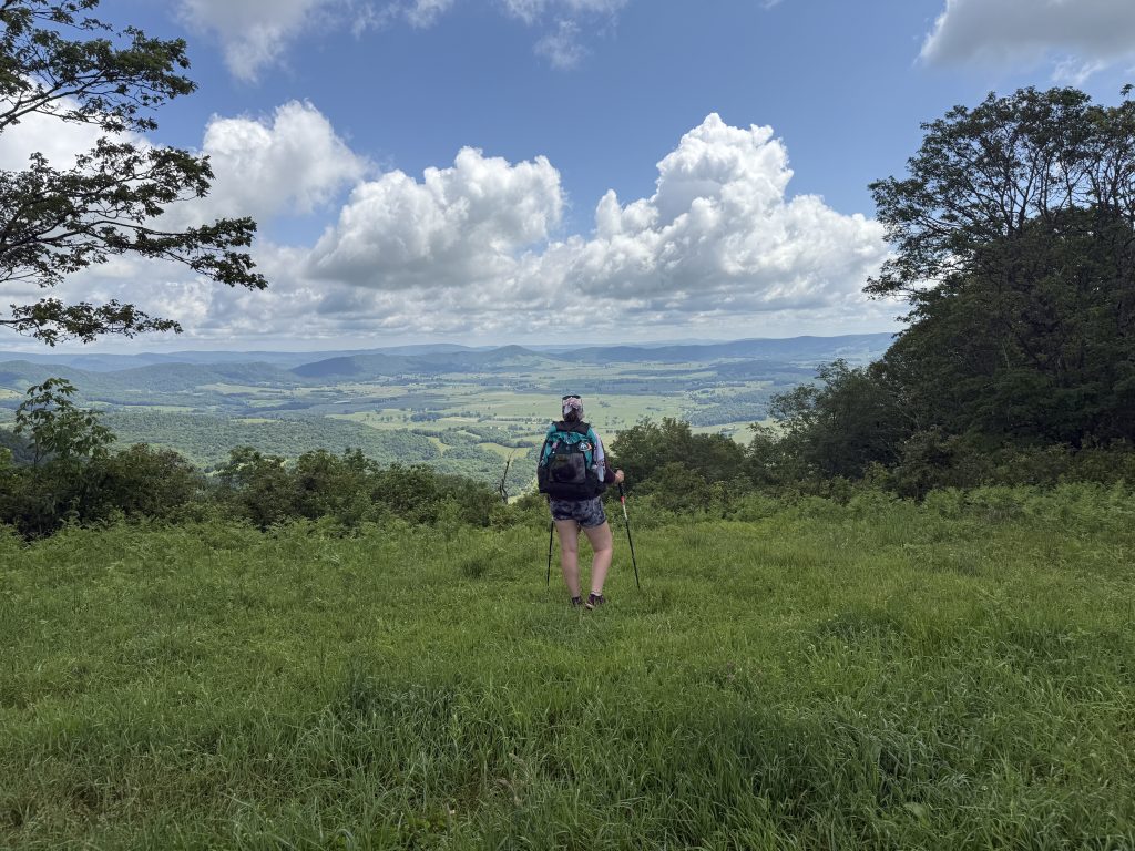
The climb to the top of Chestnut Knob wasn’t horrible, and before long, we were at the summit, gazing out over God’s Thumbprint, also known as Burke’s Garden, and exploring the shelter and old fire tower foundations.
Burke’s Garden aka God’s Thumbprint
Chestnut Knob overlooks the crater-like formation of Burke’s Garden, also known as “God’s Thumbprint.” The valley sits at an elevation of 3,000 feet and is the highest mountain valley in Virginia.
The mountain itself is a continuous ridge system, and Burke’s Garden is believed to have been formed by the erosion of a sandstone cap on a limestone dome, causing a collapse into a valley (a sinkhole, if you will). Burke’s Garden earned the nickname “God’s Thumbprint” due to its bowl-shaped valley, surrounded by mountains, which resembles a thumbprint impression in the earth.
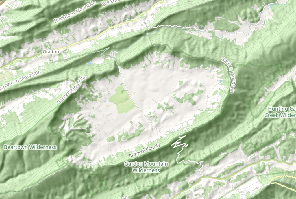
The name Burke’s Garden was given to the valley as a joke in 1748 after James Burke (who was the original surveyor) discovered it in the 1740s while hunting and planted potato peelings by his campfire. The following year, he returned to find that the potatoes had sprouted. Today, the area is believed to have some of the most fertile farmland in the state.
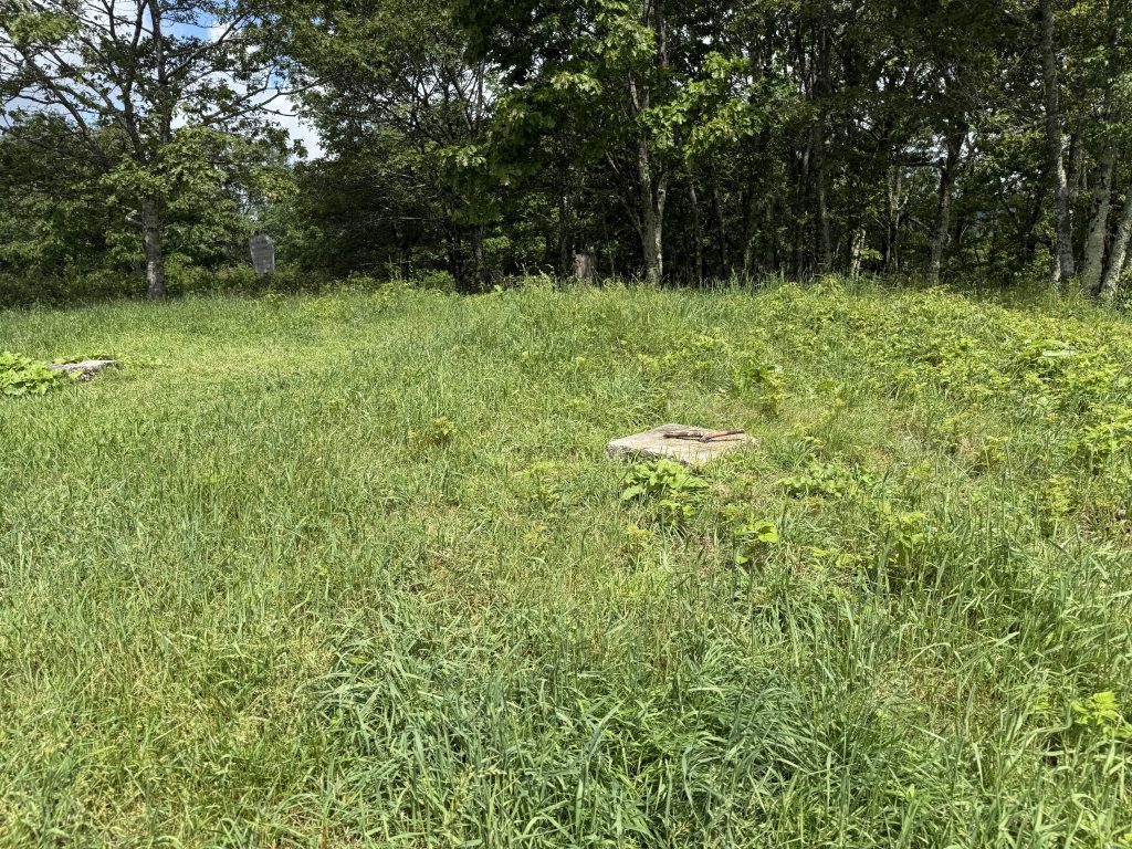
Chestnut Knob Shelter & Fire Tower
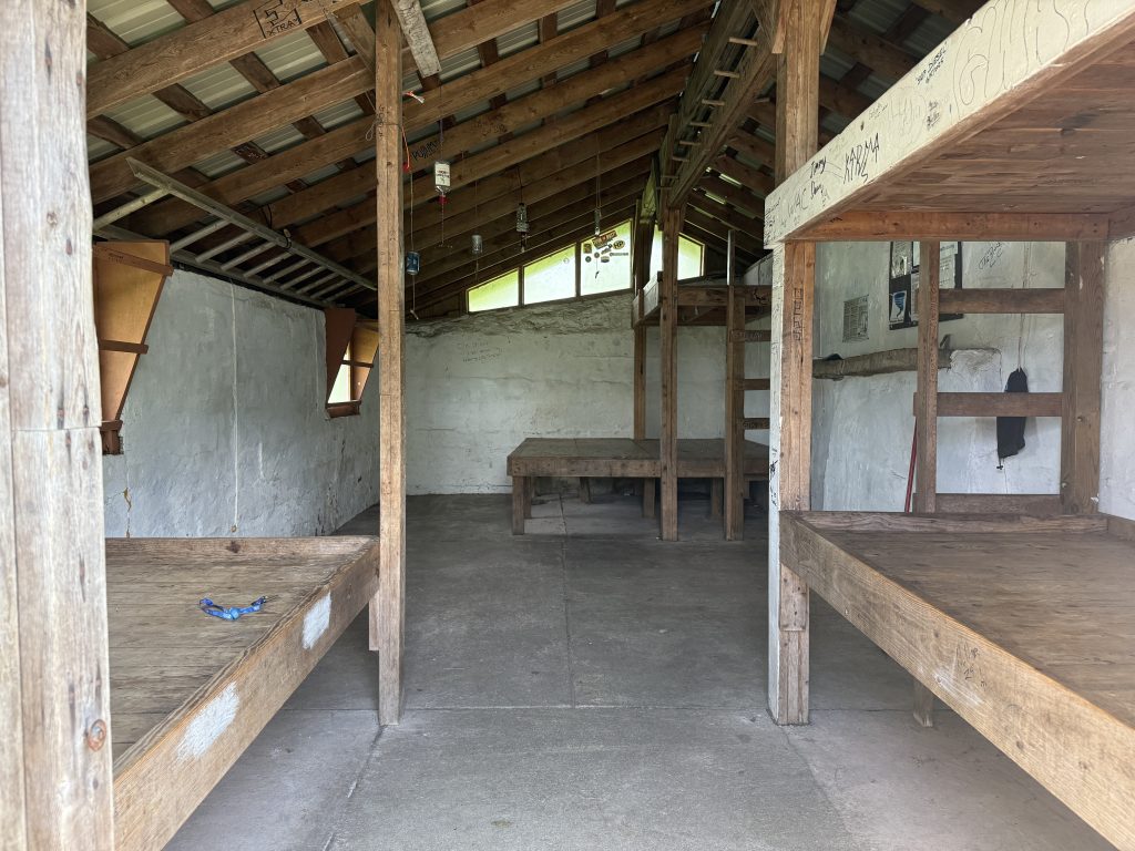
Sitting on top of Chestnut Knob is the Chestnut Knob Shelter. What most don’t know is that this used to be the site of a Fire Tower, and the shelter was the fire warden’s cabin. It was
built around 1929 and was rehabilitated in 1994. It is a fully enclosed stone shelter with plexiglass windows and three sets of wooden bunks.
Just a tidbit of information for those who choose to stay in the shelter: according to a FarOut user who commented, the bunk on the left side, when you walk in, leaks a tad when it rains.
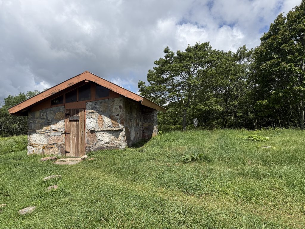
The original tower stood 48 feet tall, but was removed and a new tower erected in 1961. That tower was removed in the 1980s, but its foundation can still be seen if you take the time to look for it.
Unfortunately, I couldn’t find an old picture of the tower, but here is a photo of its footing.
As we were hanging out, two other hikers showed up, heading NOBO—Miss Congeniality (she was an IRS agent) and Ridge. We talked with them for a bit, then Suspenders headed back to the truck, and I continued SOBO.
The view going SOBO was absolutely stunning. It led through a meadow for a couple of miles before going back into the woods.
Thanks to being downhill for the rest of the day, I made great time. I had texted Suspenders to let him know when I was 2.5 miles from the pick-up spot (thinking he would be there). It turns out he was still 1.5 hours away!
Even though the distance from Walker Gap to where he was picking me up at VA 625 was relatively short, it was all on curvy mountain dirt roads.
I arrived at VA 625 about 10 minutes before he showed up.
APPALACHIAN TRAIL DAY 37 VIDEO
AT Gear List
Interested in finding out what I carry on my Appalachian Trail Backpacking Trip? Check out my gear list here:


Leave a Comment or Suggestion