We decided to take 2.5 days to do the Goodwater Loop Trail that goes around Lake Georgetown. The first day was a short hike to Cedar Hollow campground where we arrived around 2 pm. This gave us time to get a good spot, set up camp, and just enjoy a really relaxing afternoon and evening. The 2nd day was from Cedar Hollow Campground to Willow Creek Campground. The final day (and longest) was from Willow Creek Campground back to the Cedar Breaks trailhead parking lot.
Water Situation on the Goodwater Loop Trail
We were able to fill up with potable water the entire length of the trail which means we did not need to filter lake water. We each carried 4L of water and it worked out great between fill-ups. This was done during Springtime; if you plan on doing the Goodwater loop during the summer you may need to filter lake water once (between Mile 1 and Tejas Park) otherwise 4L each got us through the first night and to Tejas park the next day.
Trip Overview
The first day of our Goodwater Loop hike listed below was actually from our first trip, but I decided to leave it instead of rewriting it. Both my husband and my teenage son (I call him “The Boy”) accompanied me on both of my trips. The original trip was 4.5 miles to Cedar Hollow Campground where we spent the night, then headed back to the car. On the 2nd trip, we decided to do the entire loop.
DAY 1: Cedar Breaks Trailhead to Cedar Hollow Campground
We began at Cedar Breaks Trailhead and headed west towards Cedar Hollow Camp, which is about 4.5 miles from the trailhead.
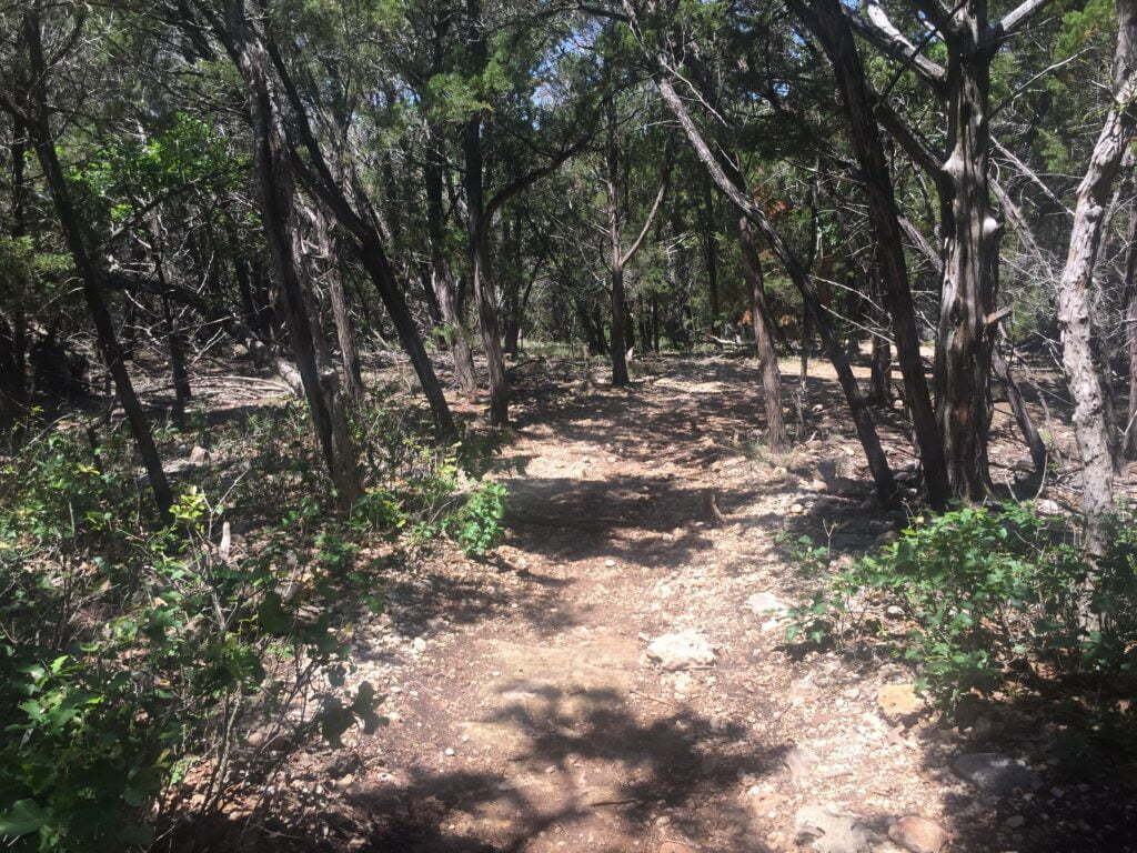
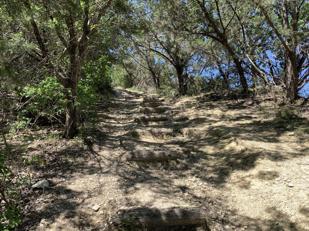
The trail was a lot different than I expected. It borders a cliff for pretty much this entire section and was rocky in most of the locations.

The scenery changes constantly from being in the woods, to completely open fields, to a little bit of in between. I highly suggest bringing sunscreen!
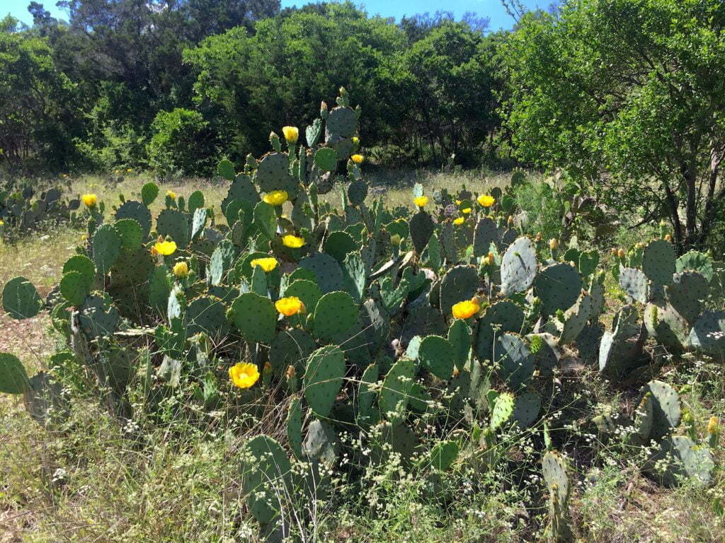
If you hike Goodwater Loop in late Spring, the cactuses and wildflowers will be in bloom which makes for some beautiful scenery!
Cedar Hollow Campsite
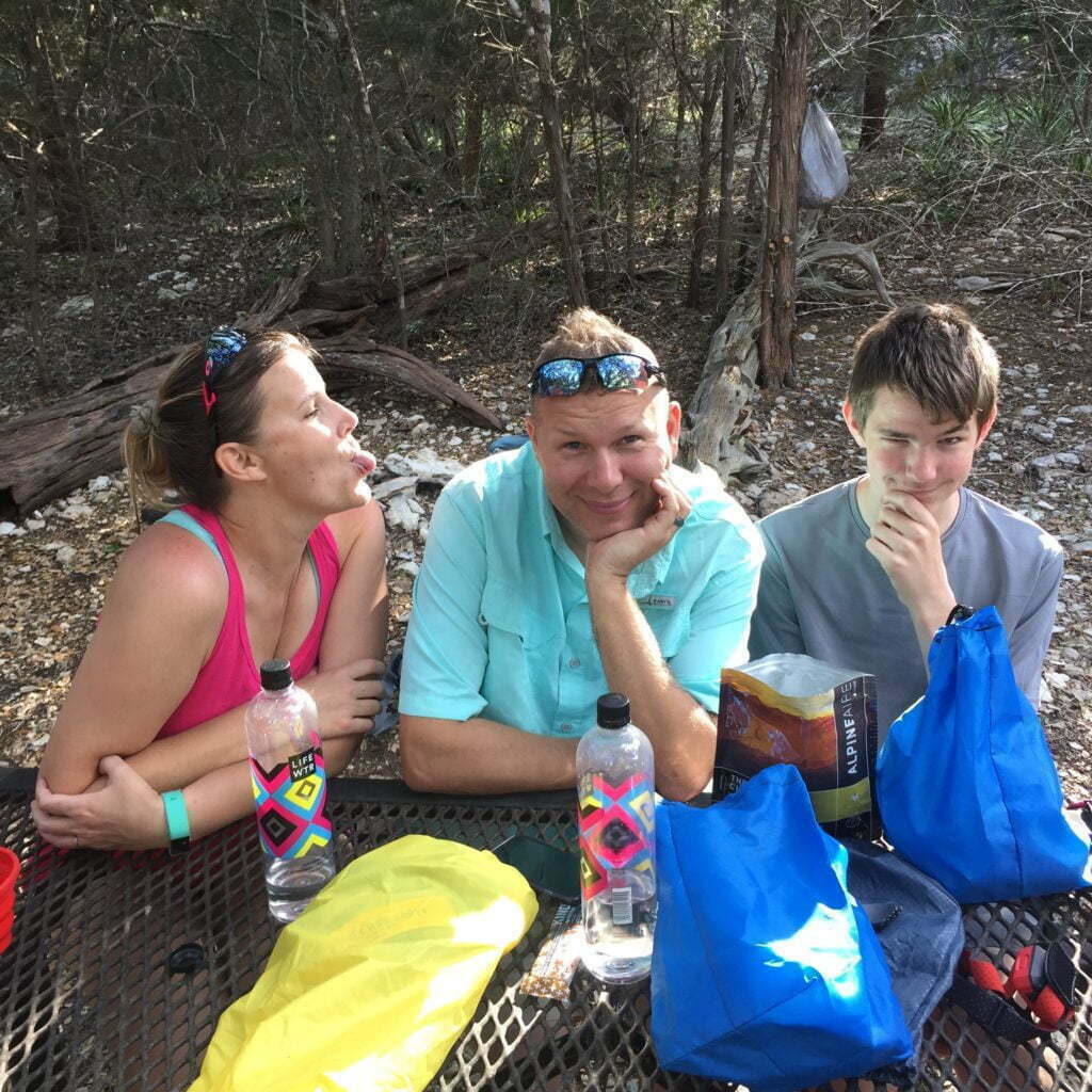
Note: this is from our first experience at this camp (a year before we did the entire loop). We actually got to the campsite around 2 pm this go around and were the only ones there until later into the night and we had no issues with anyone being loud.
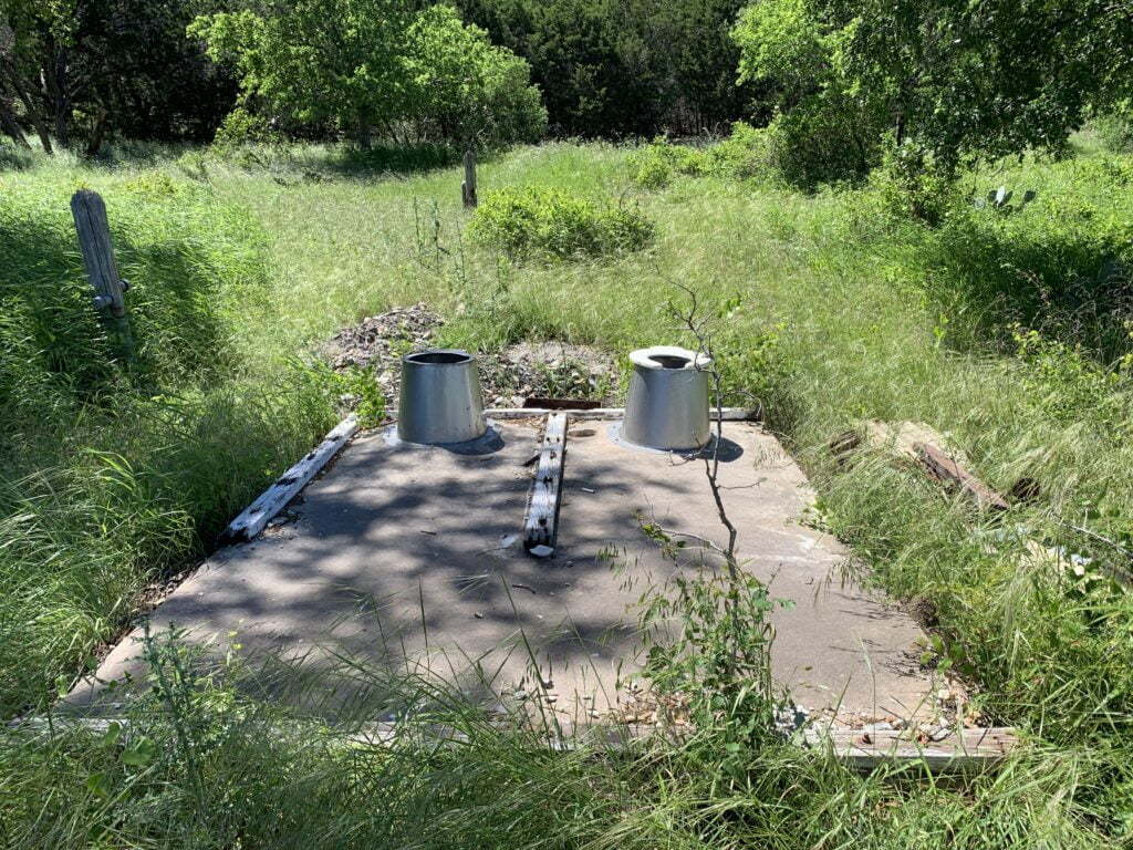
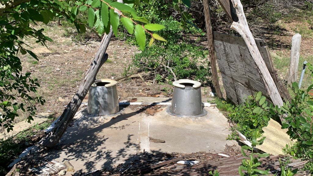
We arrived at Cedar Hollow Camp around 4:30 p.m. and were pooped. This is a primitive campground, however, it does have open privies! What I mean, is there are two toilet pits that are literally out in the open in the middle of the camping area.
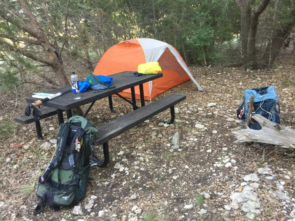
The campsites are first-come, first serve and most have a fire pit, picnic table, and lantern/trash holder. By the time we got there, all the better spots were taken.
We ended up finding a secluded spot and put our tents upon the most level ground we could find. Funny how “level” as seen to the eye is not the same as laying down trying to sleep! We didn’t sleep well at all. To make matters worse, the rest of the campers all decided to have a big ole’ party until about 3 am and their freaking dogs barked ALL NIGHT LONG!!!!
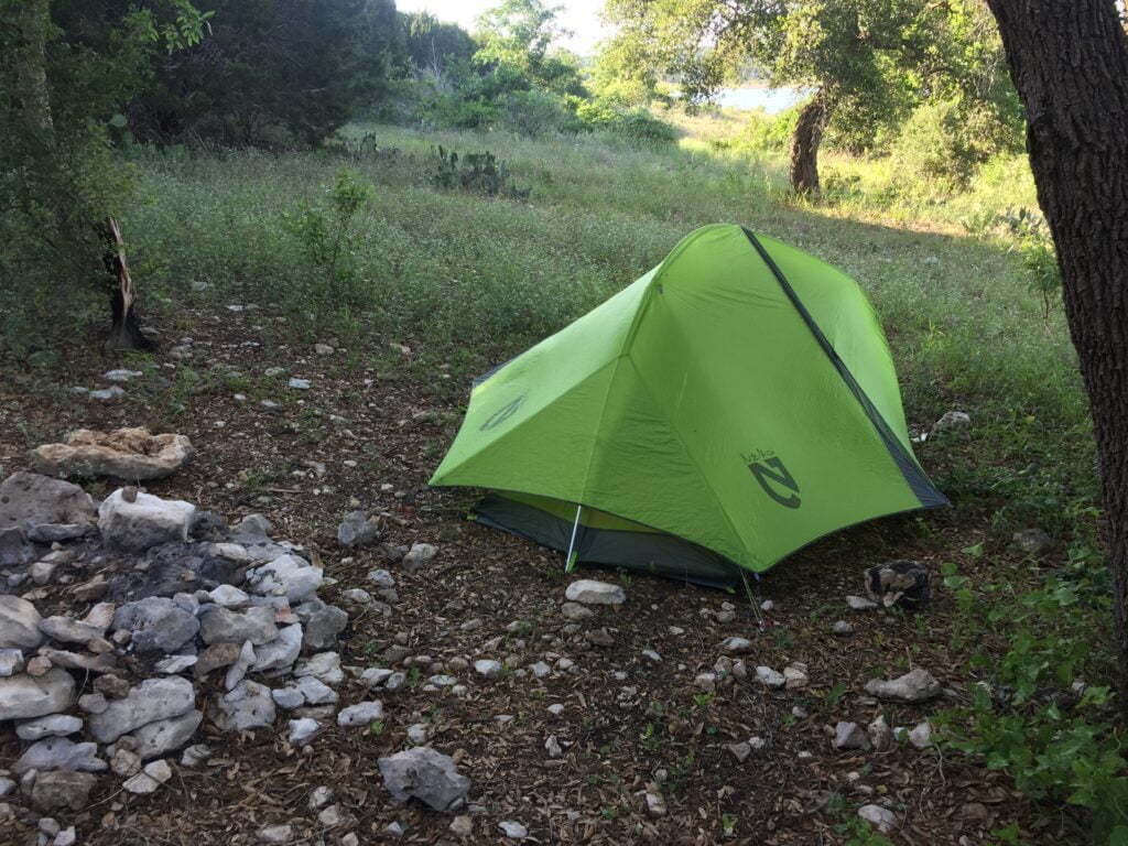
The ground, at most of the sites, is at a slant (as you can tell from the picture below). Great for hammocks, but horrible for tents.
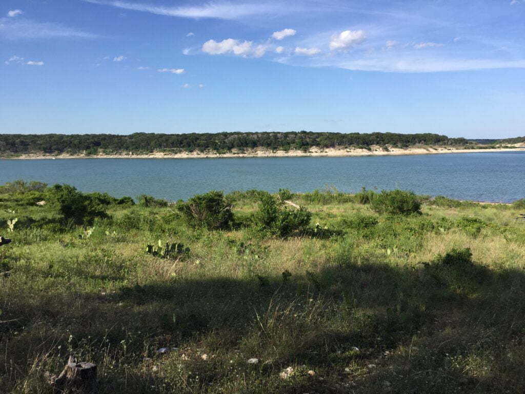
The one major bonus, though, is it has easy access to the lake for swimming or fishing or just lounging around. The beach is VERY rocky, I would suggest packing water shoes!
TIPS
If you plan on staying that this campground, get here early and avoid weekends. Be prepared that this is more of a party spot. The area isn’t that great for tenting, but great for hammocks. Also remember that even though the map says there are bathrooms, that it is just privies with no walls that sit next to each other.
Day 2: Cedar Hallow Campground to Willow Creek Campground
We got a later start than originally planned due to leaving our rainfly off our tents. Dew settled on everything inside the tent, so we waited around for the sun to dry things out before packing our gear away.
There is a nice climb out of Cedar Hollow campground and then again on the main trail as you head towards Tejas Park.
Sawyer Campground
We stopped at Sawyer Campground to have a snack and check out the campground. None of the sites have a picnic table or fire ring. It appears that there is a communal fire ring and picnic table in the middle of the sites. The privy (bathrooms) are also without walls and the ground is not very level. There is access to the lake though. This campground would be great for large groups.
There is another nice climb out of Sawyer Campground and again on the main trail.
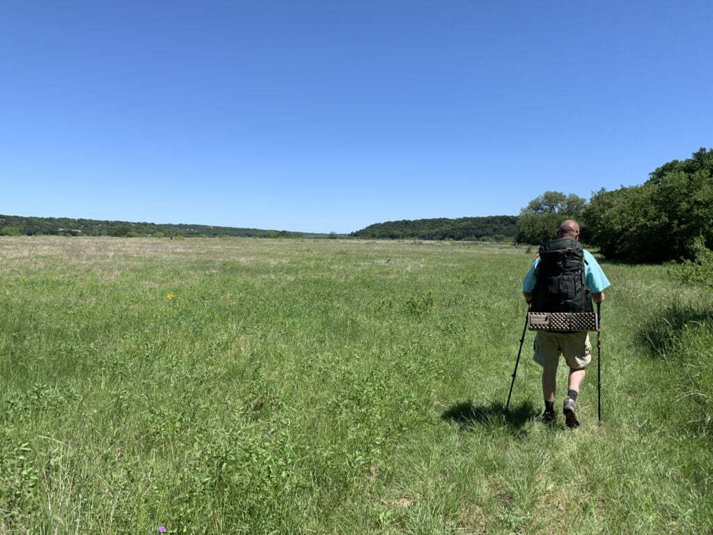
Pretty soon the Goodwater Loop trail opens up to Prairie and near mile 8 you will cross over a small cold stream (great for filling up on water or dipping a rag in to get your head wet).
After mile 8, you encounter a steady incline that will lead you back into a wooded area. Shortly before mile 9, you will encounter a steep incline and then after a short little hike on a pretty steep cliff, the trail drops back down into open prairie where it will remain until you get outside of Tejas Park.
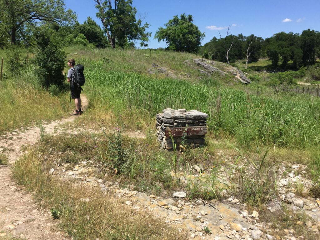
The trail will split around mile 10.5 and you will need to stay right (there is no sign) and then turn immediately left. If you stay straight it will still lead you into Tejas Park, but appears to dump you into the back of the campground.
Tejas Park
You will come to the Tejas Park trailhead entrance on the left. Take that and head straight back towards where you see a picnic table (this is the camp host picnic table, but there was no camp host when we were there so we used it to eat). The water faucet to fill up your water and trash cans are located near the picnic table.
Once you leave out the same way you came in, you will take a left and follow the trail to the road where you will take a right and go over the bridge. The trail will start again after the bridge on the right.
You will cross over a stream and then the trail becomes what looks like an old fire road. You will stay on this fire road and in the open prairie until you reach Walnut Creek campground. It is a long hike with the sun beating down on you. This is where a trekking umbrella comes in very useful!
The trail does split before mile 12 and you can choose to either stay straight or go to the right. They both meet back up. We stayed straight.
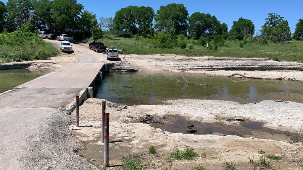
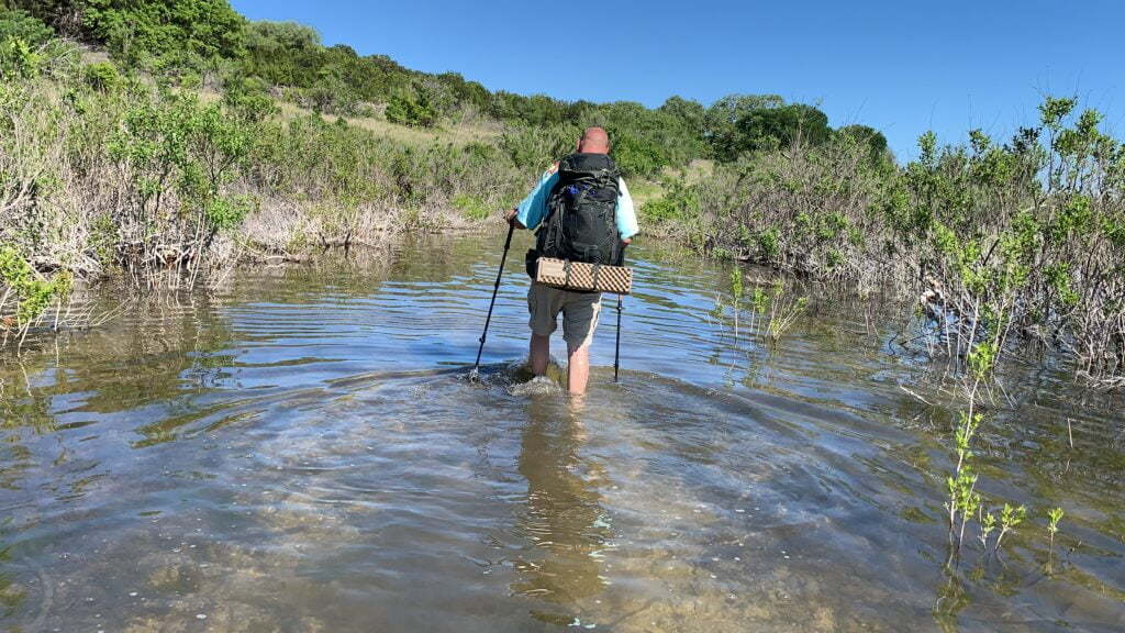
Shortly after mile 14 the trail runs through the lake and is about calf-deep, but is clear so you can easily see where you are walking. You can alternately choose to skip the water by taking the alternate trail right around mile 14, which is a detour around the water. We like adventure, so we chose the water route!
Shortly after the water crossing (about 1/4 mile), you will come to Walnut Creek campground on your right.
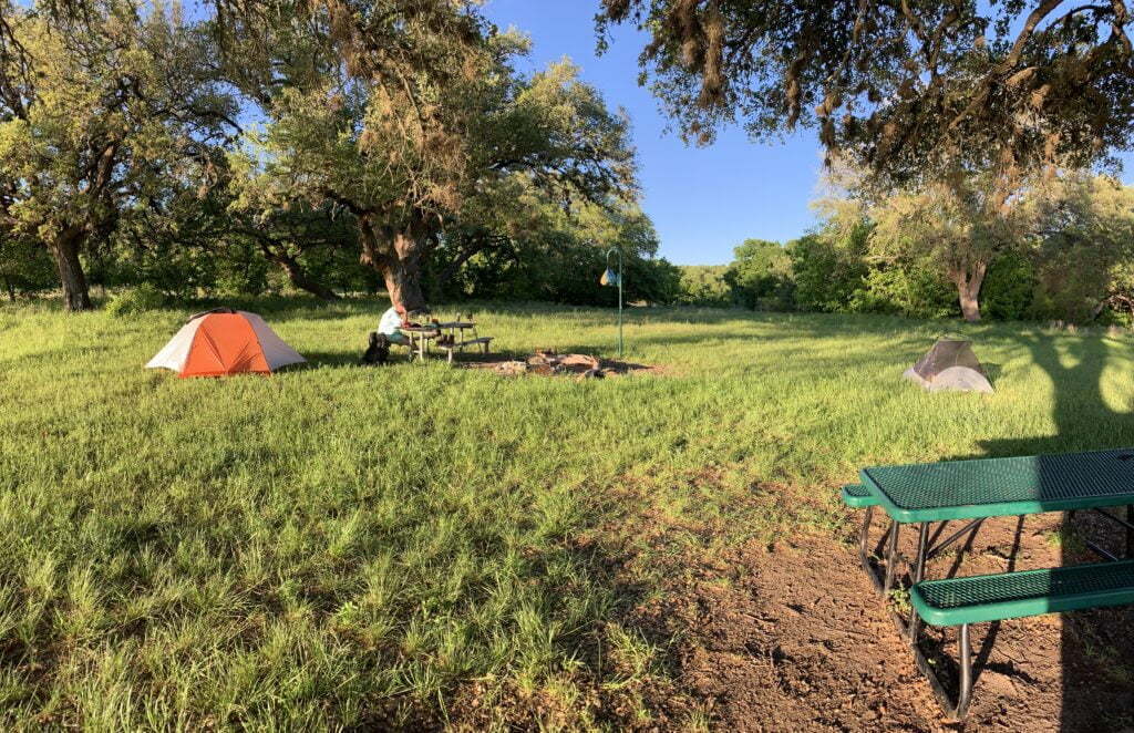
Walnut Creek Campsite
Walnut Creek Campground is a primitive campground with no privy. There are 6 campsites with picnic tables and fire rings, and plenty more space to set up extra tents. There is also access to the lake and the ground here is more level than at the other two primitive campgrounds.
Day 3: Walnut Creek Campground to Cedar Breaks Trailhead
We decided to get an early start in hopes of getting back to the truck by 4 pm. After calculating the distance we had left, we realized that today was going to be the longest day on our Goodwater Loop trip.
Although we got up a 6am, we didn’t leave the campground until 8am, which was about 30 minutes later than anticipated, but still earlier than we usually do!
The trail goes through prairie as it did the day before, for about half a mile after the campground; then it goes back into the trees after a little climb and remains in this type of terrain until you get closer to Overlook Park.
Our first stop for the day was 2 miles down the trail at Russell Park so we could fill up on water.
Russell Park
Once you get to Russell Park you can either continue on or take a short detour to potable water and a restroom. To get to both, you will need to turn left at the parking lot the Goodwater Loop trail dumps you in at and go straight. At the stop sign take a right and go past the gate attendant. The trail to continue on will be located on your left OR to fill up on water stay straight on the road and restrooms and water fountain will be right after the boat ramps. There are also trashcans as well if you need to dump some trash.
Our next stop was Jim Hogg Park for lunch. You can also fill up on potable water here as well, however, the detour is much further than at Russell Park.
Once you hit mile 20 (shortly before Jim Hogg Park) the trail becomes a tad confusing and is not marked very well at all, so make sure you are paying attention. You will then come to a trail where you can go left to a road or right to continue on. You want to go right and continue on the trail (there is no sign telling you which way to go here). This will dump you out into Jim Hogg Park at an information sign. We decided to use the shade of the sign to sit down and eat lunch (there is also a trashcan for trash).
To continue on the trail, you will take a left at the sign and the trail continues on near the RV dump station. While there is a water faucet at the RV dump station, you DO NOT want to use it. If you want potable water take a right on that road and continue on to near the boat ramp where there is a bathroom.
Overlook Park
Our last stop was at Overlook Park to fill up on water and take a break before starting our road walk across the dam.
The trail will dump out into a parking lot, turn right towards the white building. On the backside are 2 benches to rest, or continue on the concrete path to the restrooms. Once at the restrooms turn left and continue to follow the concrete path to the road for the dam.
Crossing the Dam
The road is closed to vehicular traffic which makes the road walk a lot more pleasant. There is obviously no shade, so again a trekking umbrella comes in really nice here OR a large brimmed sun hat.
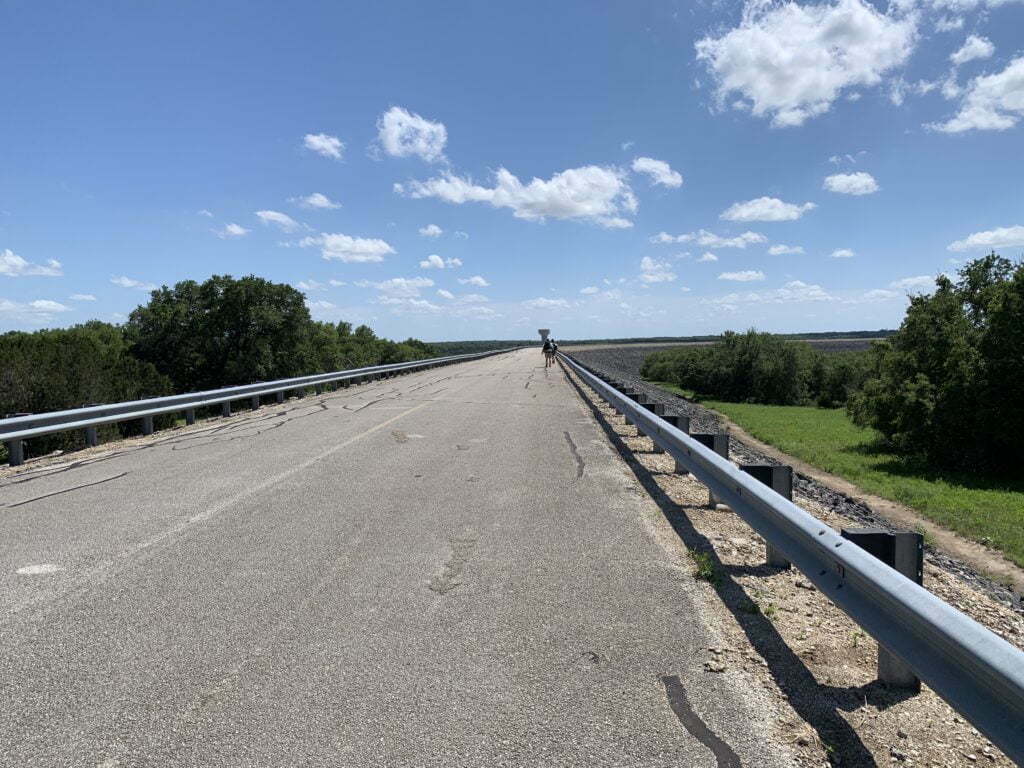
Once you leave the dam, you will climb a hill, follow the road past the gate attendant and the Cedar Breaks Trailhead parking lot where you parked your car will be on your left!
Watch Our Goodwater Loop Video
I filmed our entire 2.5 day journey along the Goodwater Loop Trail around Lake Georgetown and made it a mini movie. So grab some popcorn and a comfy seat.
Goodwater Loop Trail Tips & Need to Know
Stealth Camping is Prohibited– it is required that you stay at either one of the established campgrounds or one of the primitive campgrounds. Stealth camping is prohibited along the trail.
Bring plenty of water – Depending on the section you will be hiking and time of year, water sources could be 10 miles apart.
Wear good boots – The trail is rocky, good ankle support is needed unless you have really strong ankles.
Bring your camera – The trail offers some beautiful views and beautiful scenery.
Bring a map & compass – The trail is not marked well at all and it is easy to veer off the trail onto what will look like other trails.
Don’t Forget the 10 Essentials – As with any hike, always make sure you are carrying the 10 Essentials.
Maps & Info
TRAIL MAPS: Trail Map || Topo Trail Map
CAMPGROUND MAPS: Cedar Breaks || Jim Hogg || Russell Park || Tejas Park
WEBSITE: COE Lake Georgetown Website


Great trail recap! Best I’ve found so far thank you!
This is really helpful. Do I have to reserve a primitive site ahead of time or can we just walk until we get tired and see which site we end up at?? I’m thinking we park the car at Cedar Breaks and do up to 8 miles with taking some time to swim somewhere.
The 3 primitive campgrounds are walk-up and first come first serve only. The non-primitive campgrounds like Tejas Park, Jim Hogg, and Russell are regular campgrounds that would more than likely require a reservation depending on the time of the year (you can however walk into those parks without having to pay in order to fill up on water and use the restrooms). Enjoy your trip! It is one of my favorite trails in the area!
Also, I need to add this to the post, but it is required that you stay at either one of the established campgrounds or one of the primitive campgrounds. Stealth camping is prohibited along the trail.
Thank ou for such a great write up!
Nice write up. You must have made it out there in 2019 before I did. By the time I started hiking there, the water was just lapping up to the edge of the road. It hasn’t been close to covering the road again until early 2022. At that time, it was probably 7 feet away.
The water crossing is not part of the trail, it is actually the detour/shortcut and cuts 0.2m off the trail. When going clockwise around the lake, the real trail runs off to the left of the double track track road just before the descent to the low water crossing area. It is on that trail where you will find mile marker #15.
There are mile markers for every mile on the trail, If you missed one, that means you probably left the trail. The most common ones people miss (going clockwise) are:
#10 – You just cut 0.5m off the trail. You were meant to go straight and stay on the double track, not the single track down close to the river.
#11 – Not located on a post like the others. You still passed it though.
#12 – You choose to stay by the river rather than to continue to hike the road. No mileage lost or gained. I believe this one to be misplaced.
#15 – You took the low water shortcut. You just cut 0.2m off the trail.
#24 – You took a left off trail and hiked back by the houses, rather than the lake. Congratulations you added 0.7mi to the trail.