Today was our first day of driving Route 66, and, as usual, Murphy Law Shenanigans were aplenty! Chicago downtown traffic wasn’t too terrible; however, once you get to the suburbs, traffic changes, and it will test even the most easygoing person.
| 📍 STARTING POINT: Chicago, IL | 📅 DATE: July 9, 2026 (Thursday) |
| 📍 ENDING POINT: Willowbrook, IL | 🛣️ ROAD CONDITION: Asphalt |
| 🚘 TOTAL MILES: 25 | 🌡️ WEATHER: Cloudy & High of 89 |
| ⛽ FUEL COST: $0 | 💮 TOTAL STAMPS COLLECTED: 3 |
Chicago
We started in downtown Chicago at the traditional start here sign, where we took pictures yesterday. We followed the original alignment through downtown Chicago and into the suburbs. Once we passed S. Jefferson St., it was all new territory for us.
Old St. Patrick’s Catholic Church
Our first “attraction” was Old St. Patrick’s Catholic Church, which was established in 1846, making it the oldest surviving parish in Chicago. Built to serve the city’s growing Irish immigrant population, the original church stood through the Great Chicago Fire of 1871, miraculously surviving when much of the surrounding area was destroyed.
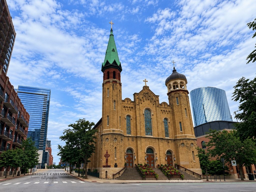
Located along the original Route 66 alignment, this historic church has witnessed the evolution of Chicago from its earliest days through the bustling era of America’s Mother Road.
It’s a shame we forgot to walk over and visit when we were at Lou Mitchell’s yesterday. I had to take a picture from the truck because we couldn’t find parking. The street only looks empty because I removed all the distractions post-edit.
Hotel Chicago / Rosemoor Hotel
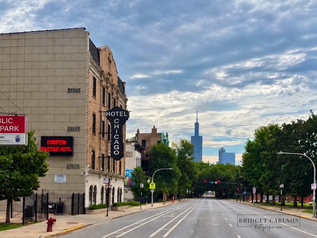
We passed by an old Amaco Service Station (now turned Mexican restaurant) before turning on Jackson so we could pass by the historic Hotel Chicago, which was originally called the Rosemoor Hotel.
The building dates to the late 1920s and was built during an era when residential hotels provided lodging for both travelers and city residents.
However, the land’s history at 1622 W. Jackson Boulevard goes back much farther than the Rosemoor Hotel itself. In August 1902, decades before the Rosemoor was built, Chicago police officers Timothy Thomas Devine and Charles F. Pennell were ambushed by two burglary suspects near an alley at this address. Both officers were mortally wounded, with Devine dying at the scene and Pennell succumbing to his injuries the following day.
The Rosemoor Hotel was built around 1928 as a residential hotel, and its location would soon put it alongside one of America’s most famous highways.
The hotel also has a fascinating connection to Chicago’s Prohibition-era history. Historical research places a young Tony Accardo at the Rosemoor in the 1930 census, where he was listed under the name Joseph Batters, an alias he used at the time. Accardo would eventually become one of the most influential figures in the Chicago Outfit.
During World War II, the address appears again in War Relocation Authority records, which document Japanese American individuals relocating to Chicago and using 1622 W. Jackson Boulevard as their address. One such record lists a resident who had previously been in the Gila River relocation project in Arizona.
The Rosemoor Hotel had its share of darker chapters, particularly during its later years as a single-room-occupancy hotel. By the time the building changed hands in the 2010s, it had developed a reputation as a run-down SRO that was home to poverty, deteriorating conditions, tenant displacement, and alleged criminal activity. In court testimony, owner Joe Perillo described the former Rosemoor as having “unsavory customers,” including alleged drug dealers and prostitutes.
The building was later renovated in 2016 and given new life as Hotel Chicago and it looks fantastic!
What I find most fascinating about the Rosemoor is how many different chapters of Chicago history intersected at one address: a deadly police ambush before the building even existed, the birth of Route 66, Prohibition-era Chicago, wartime relocation, and generations of travelers and residents. Today, the building still stands as Hotel Chicago, giving Route 66 travelers a chance to look beyond the neon and nostalgia and see the much deeper history hidden along the Mother Road.
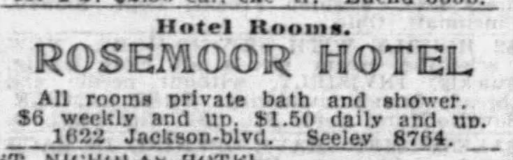
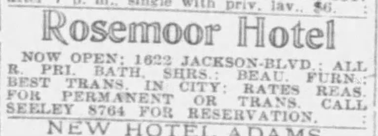
Fun Fact: In 1933, it cost $1.50/day to rent or $6/week.
For fun, here are some old newspaper clippings!
After passing Hotel Chicago, we looped back around and soon made our way past a pretty neat mural and old Mercury Oil Service Station (now an auto repair shop). It wasn’t long before we made it to our next quick picture op…the Castle Car Wash.
Castle Car Wash
One of the more unusual stops along Chicago’s Route 66 is the old Castle Car Wash. Built in 1925 by Louis Ehrenberer as a gas station and garage and known as Murphy’s Filling Station, this little stone “castle,” complete with a crenellated turret, was already standing when Route 66 was established in 1926. It was originally run by Ehrenberer’s business partner, John Murphy, who later purchased the building and called it John J. Murphy’s Standard Oil Station. In the mid-late 1960s, it became an S&B Standard Service station, and in 1971, it became Gas Village (possibly Gas City). The building began operating as the Castle Car Wash in the 1980s.
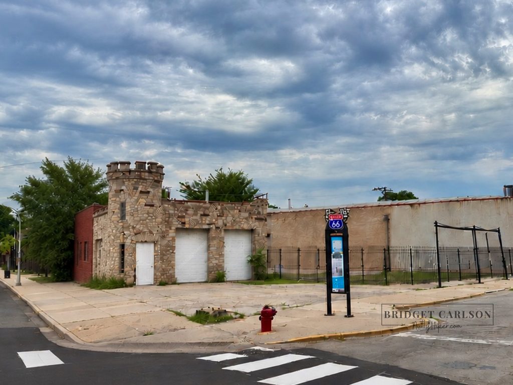
Over the years, it became part of the colorful history of the Mother Road, and it even carries a bit of Chicago gangster lore. There’s a long-standing story that the building was once used as a hideout by notorious gangster Al Capone. While that connection has never been definitively documented and is generally considered part of the building’s legend, it certainly adds another layer of intrigue to this already unusual roadside landmark.
Make sure you also check out the Route 66 Centennial Sign about the building.
Cicero
Hawthorne Works
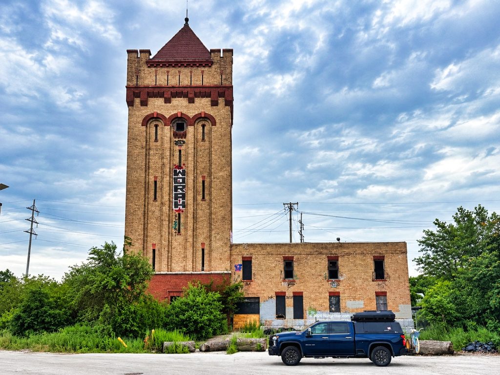
I found this place at random while researching Route 66 and its history. Funny that so many Route 66 travelers pass by here and have no idea it’s here and no one ever talks about stopping. The only thing left here is one of the towers that is starting to look rough (definitely don’t recommend exploring it). It was still really neat to see, stand there, and wonder what the complex looked like back in the day!
This is proof that Route 66’s history isn’t always preserved in neon signs, vintage motels, or old pavement. Sometimes all that remains is a tower beside a shopping-center parking lot and the realization that an apparently ordinary place once shaped the lives of thousands of people.
History
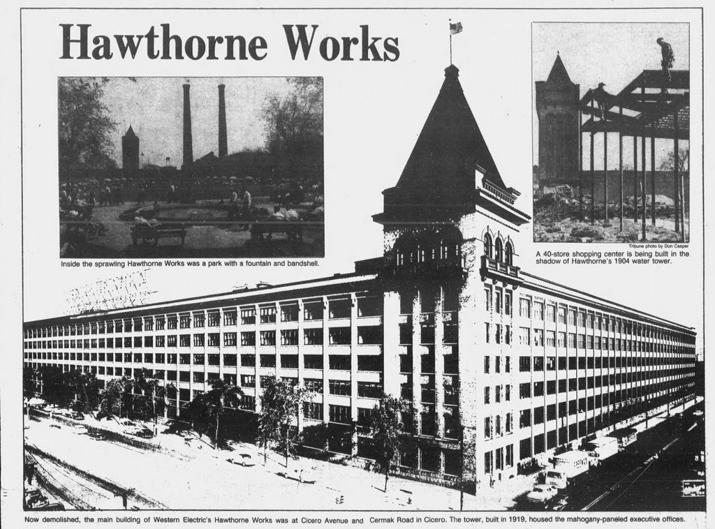
Western Electric purchased land for the enormous 141-acre manufacturing complex in 1904, and the plant opened in 1905 at Cicero Avenue and 22nd Street (now Cermak Road). What began with roughly 2,000 employees grew into a massive industrial city of its own (it even had its own hospital). By 1915, more than 14,000 people worked there, and by the 1920s, World War II, and early postwar years, Hawthorne Works had reached its peak, employing as many as 45,000 workers.
The complex manufactured telephone equipment and electrical products, but its importance went far beyond manufacturing. It was home to the famous Hawthorne Studies, which helped give us the term “Hawthorne Effect,” and during World War II the plant shifted much of its production toward military equipment, including radar and communications equipment.
Ogden Avenue, which carried Route 66 through this part of the Chicago area, passed through a heavily industrialized corridor where thousands of workers lived and worked. The Illinois Route 66 Historic Preservation study specifically identifies Hawthorne Works as representative of the industrial development that grew along the Mother Road. By the postwar years, Route 66 traffic and the enormous workforce at Hawthorne Works were both helping shape the businesses and neighborhoods around Cicero.
By the 1970s, however, the aging, multi-story complex was becoming increasingly difficult to adapt to modern manufacturing. Employment had fallen to around 25,000 by 1970, and by the early 1980s only about 4,200 workers remained. On June 24, 1983, Western Electric announced that Hawthorne Works would be phased out.
The final operations wound down over the following years, and the complex was closed by 1986. Portions of the massive complex had already been demolished beginning in the 1970s, and the remaining major buildings were torn down in 1986–1987.
Today, almost all of Hawthorne Works is gone. The former factory site was redeveloped into the Hawthorne Works shopping center beginning in the late 1980s. The only thing that remains is one of the original towers. The Hawthorne Works Museum at Morton College preserves the stories of the workers, inventions, experiments, and community that made this place so significant.
Henry’s Drive-In
We passed several old service stations and finally ended up at Henry’s Drive-In. Good thing too because we were HUNGRY and it was lunchtime. Believe it or not, there is a hotdog somwhere under those fries!
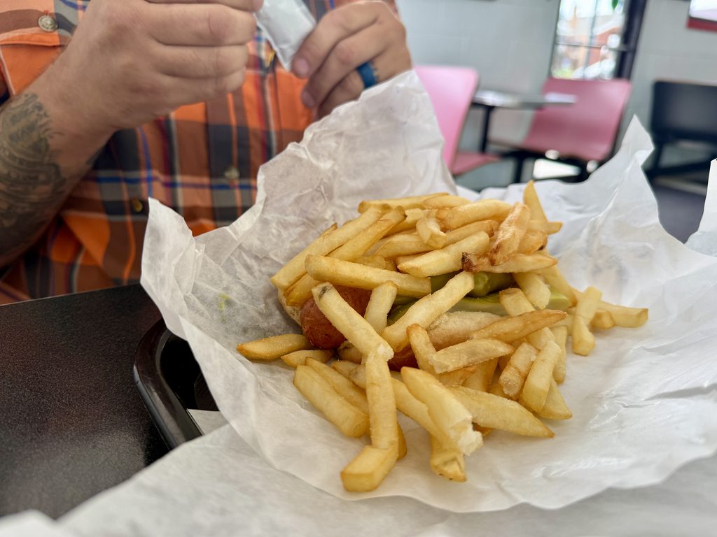
In the late 1940s, Bill Henry started selling hot dogs from a portable wagon on Austin Boulevard. As postwar traffic surged along Route 66, he saw an opportunity and, in 1950, bought a plot of land to build a permanent drive-in. Their standout item was the classic Chicago dog, loaded with toppings and heaped with freshly cut fries, all wrapped together in a paper bag, for just 35 cents. The diner’s neon sign proudly proclaimed its slogan: “It’s a meal in itself!”
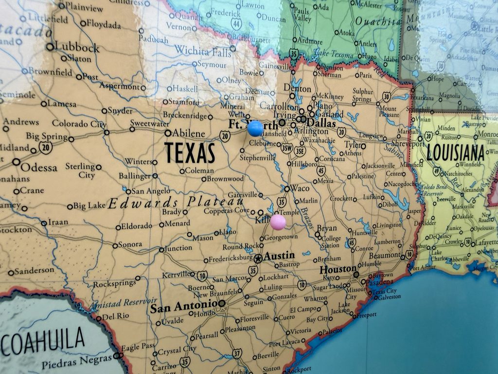
When you walk in, they have a map on the wall so you can pin where you are from. We placed our pin and ordered lunch, which was fantastic.
Berwyn
“The Spindle”
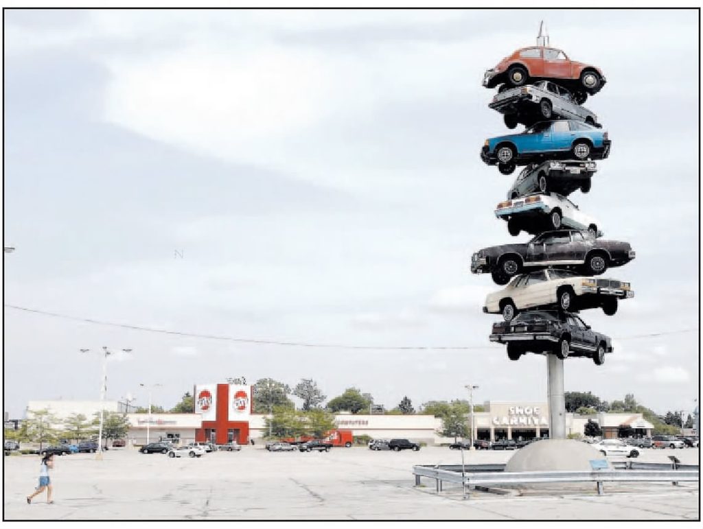
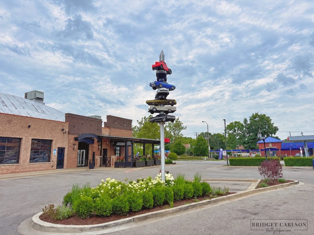
Our next stop was a photo op of where a HUGE car spindle used to be. Only a replica remains, but it makes for a neat oddity to take a picture with.
Known as “The Spindle,” the original sculpture by artist Dustin Shuler (1948–2010) was installed in 1989 at Cermak Plaza in Berwyn, just a mile north of Ogden Avenue. Soaring 50 feet into the air, the Spindle featured eight cars dramatically skewered on a single metal spike, and if you’ve seen Wayne’s World, you might remember it from the film.
In 2008, the original sculpture was removed to make room for a Walgreens, but in 2022, a 23-foot mini spindle displaying seven fiberglass go-karts in tribute to the original was erected next to the Pizzeria’s neon sign.
Berwyn’s Toys & Trains
Our next main stop was at Berwyn’s Toys & Trains. The main reason for the stop was the really neat sign out front.
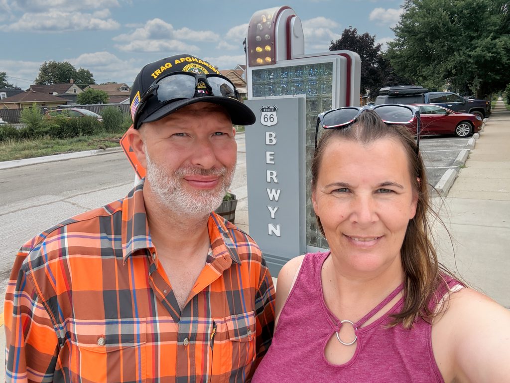
Berwyn’s Toys & Trains doesn’t date back to the Route 66 days (it moved to this location in 1998), but the building is from the 1950s, when it was a Chevrolet dealership from 1950 to 1998.
You will want to add this place to your list of stops, and don’t forget to go inside to see their model train set. Spoiler alert: we bought a Route 66 gas station for our upcoming Route 66 model train room.
McCook
Whoopee Auto Coaster
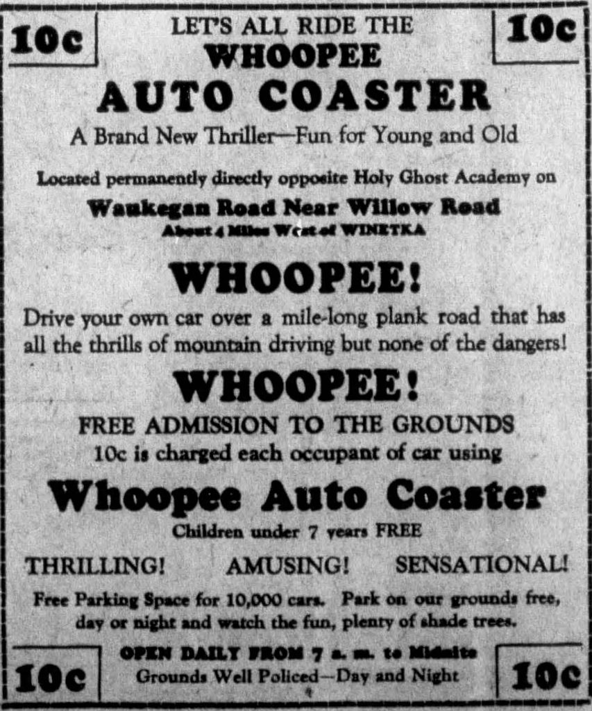
On our way to McCook, we passed the area where the old Whoopee Auto Coaster once stood. Can you imagine the absolute fun it would have been to take a lap? The Whoopie Coaster opened in July 1929 as a wooden, roller coaster-style driving track where patrons paid 10 cents per occupant of the car to drive their cars over hills and dips. Built by the Coaster Construction Company, it quickly lost popularity, especially after the 1929 stock market crash. By 1930, the track had closed, lasting only one season.
Here is a newspaper clipping for an ad for a Whoopee Auto Coaster (not sure if it is for this exact one) as well as a picture from the Chicago Tribune (click image to enlarge).

Fabulous McCook Sign
Our first stop in McCook was the Welcome to Fabulous McCook sign. What makes this sign so special? It’s a replica of the famous Las Vegas sign and makes for a pretty cool photo op.
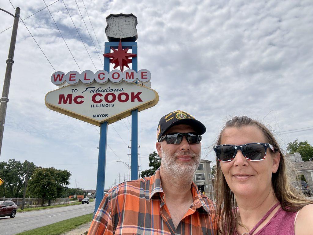
It’s in the parking lot of what is now the Steak & Egger which is the location of the former Snuffy’s Restaurant. Local lore claims it once housed gambling rooms in the back.
Speaking of local lore, near here was the site of Matilda’s Bar, which is supposedly where The Outlaws Motorcycle Club was founded by John Davis in 1935 as the McCook Outlaws Motorcycle Club.
Vulcan Quarry
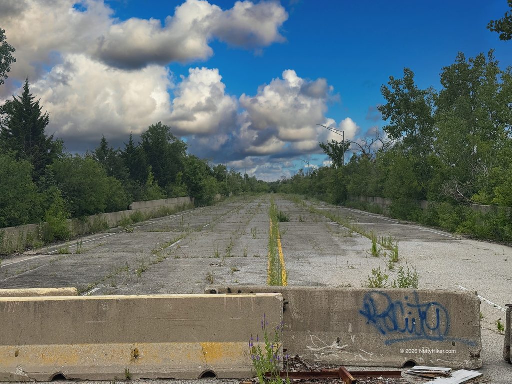
Our next pit stop led us to a blocked-off part of the original alignment near Vulcan Quarry.
In 1998, this mile-long stretch of Route 66 buckled and broke due to quarrying by Vulcan Materials Co., which had undermined the road’s limestone foundation. The highway, perched on a narrow limestone ridge with steep drops on both sides, was closed, and traffic detoured. The Illinois DOT sued Vulcan, resulting in a $40 million settlement (without Vulcan admitting liability).
If you go to the western side of the section, there is an area where you can pull up to it and take pictures.
Stinson Airport Site
Also in this area was where Stinson Airport once stood.
This airfield began operations around 1930, originally featuring two grass runways, each stretching 1,000 feet, along with three hangars. As aviation needs evolved, the 1940s saw the addition of a third, longer runway surfaced with crushed stone.
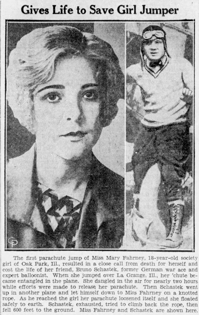
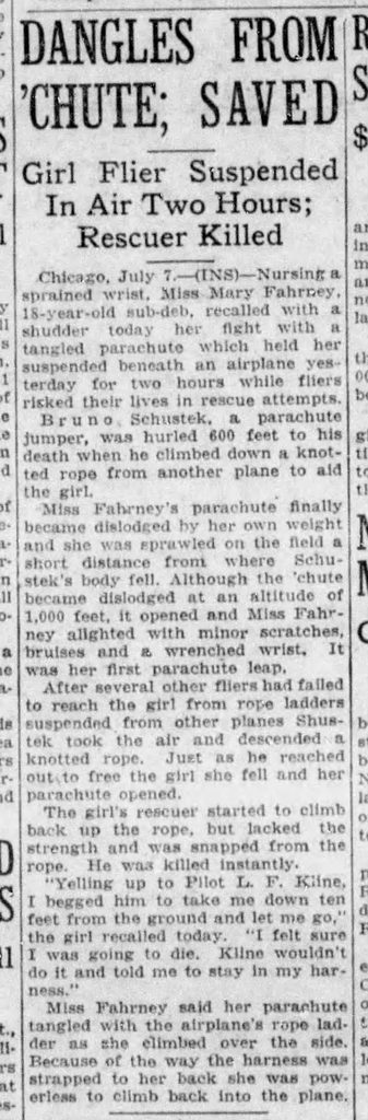
Stinson Airport is best remembered for a harrowing event on July 6, 1930. During a parachute jump, 20-year-old Mary Fahrney became ensnared on the wing of a departing aircraft—left dangling high above the earth for hours as rescue efforts unfolded. Ultimately, World War I pilot Bruno F. Schustek risked everything to save her, freeing her parachute so she could descend safely. Tragically, Schustek lost his own life in the process. A pond in Burr Ridge, near Route 66, now bears his name in honor of his heroism.
Click picture to enlarge:
The airport’s story ended in 1958 when the landowner, a quarry company, halted aviation activities and began mining the site, which is still in operation today.
Countryside
Marx Brothers Farm
There’s nothing left of their farm, just a historical marker several miles from the location. A subdivision now sits where their farm once sat.
History
This area was originally open country, with farms and fields. In 1917, the Marx Brothers began chicken farming near here to avoid being drafted into World War I. Their farm, from the information I could gather through historical records, was a 5-acre property situated near LaGrange Country Club and was not 27 acres, as many of the historical markers claim.
Minnie Marx, their mother, purchased the farm hoping it would keep her sons out of the draft, since farmers were considered essential. However, their interest in farming was minimal; they preferred catching the train into the city to watch the Chicago Cubs at Wrigley Field rather than working the land, leading to the farm’s inevitable failure.
Burr Ridge
One of the last stops for the day was into Burr Ridge for a couple of photo ops.
History
Burr Ridge has a bit of interesting history. In 1917, the International Harvester Company set up an experimental farm in this area to test the world’s first multi-purpose tractor, the Farmall. That same year, Cook County opened the Bridewell Prison Farm nearby.
Post-World War II, a former pig farm was transformed by developers into a suburb that became the village of Harvester in 1956. Meanwhile, the Burr Ridge dairy farm was redeveloped into Burr Ridge Estates. The two communities merged in 1961, forming the present-day Burr Ridge.
Harvester Park – Route 66 Themed Playground
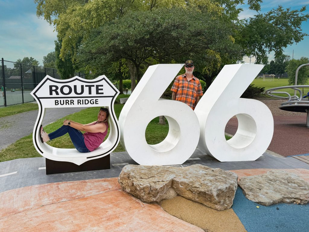
While this playground is not on Route 66 or was even around during its heyday, it opened in 2024 and has children’s equipment inspired by classic Route 66 attractions, such as Catoosa’s Blue Whale and the Cadillac Ranch from Amarillo.
There is also a large US 66 shield at the base, marked “BURR RIDGE,” along with oversized “66” numerals—perfect for selfies and photos. Definitely worth the small detour if you have children, and even if you don’t!
Willowbrook
We are coming to our last stop of the day. Are you as worn out as we are? Man, what a long day of stopping what seemed like every 5 feet!
Dell Rhea’s Chicken
By the time we made it here, we had already eaten, and we were completely wiped out and ready for bed, so we grabbed our stamp, some drinks, souvenirs, and pictures. A ton of photo ops are here, and since I am a crazy chicken lady myself, I was in heaven!
History
In the late 1930s, Erwin “Irv” Kolarik opened a gas station south of Hinsdale, surrounded by farmland. Besides fuel and auto repairs, he set up a small lunch counter where he served fried chicken, made from a recipe traded to him by two local farmers in exchange for buying their chickens.
As traffic increased, Kolarik expanded his original garage into a larger dining space. By 1946, he had constructed a completely new restaurant on an adjacent lot. A lounge wing followed in 1956.
Kolarik sold the business in 1959 after learning that I-55 would soon cut through the area. The new owners struggled as traffic dwindled with the freeway’s arrival in 1962. In 1963, Delbert “Dell” Rhea purchased the restaurant, recognizing its potential, and built it into a thriving, family-run business that continues to operate today, where it is a must-stop for Route 66 travelers.
Journal Entry
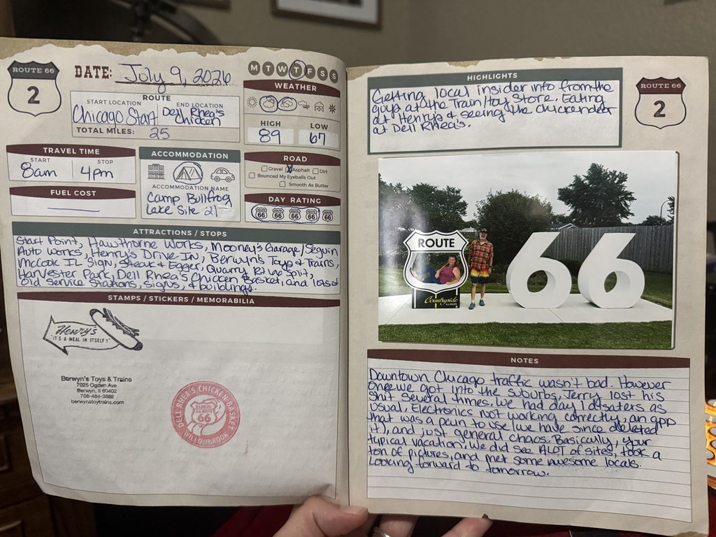
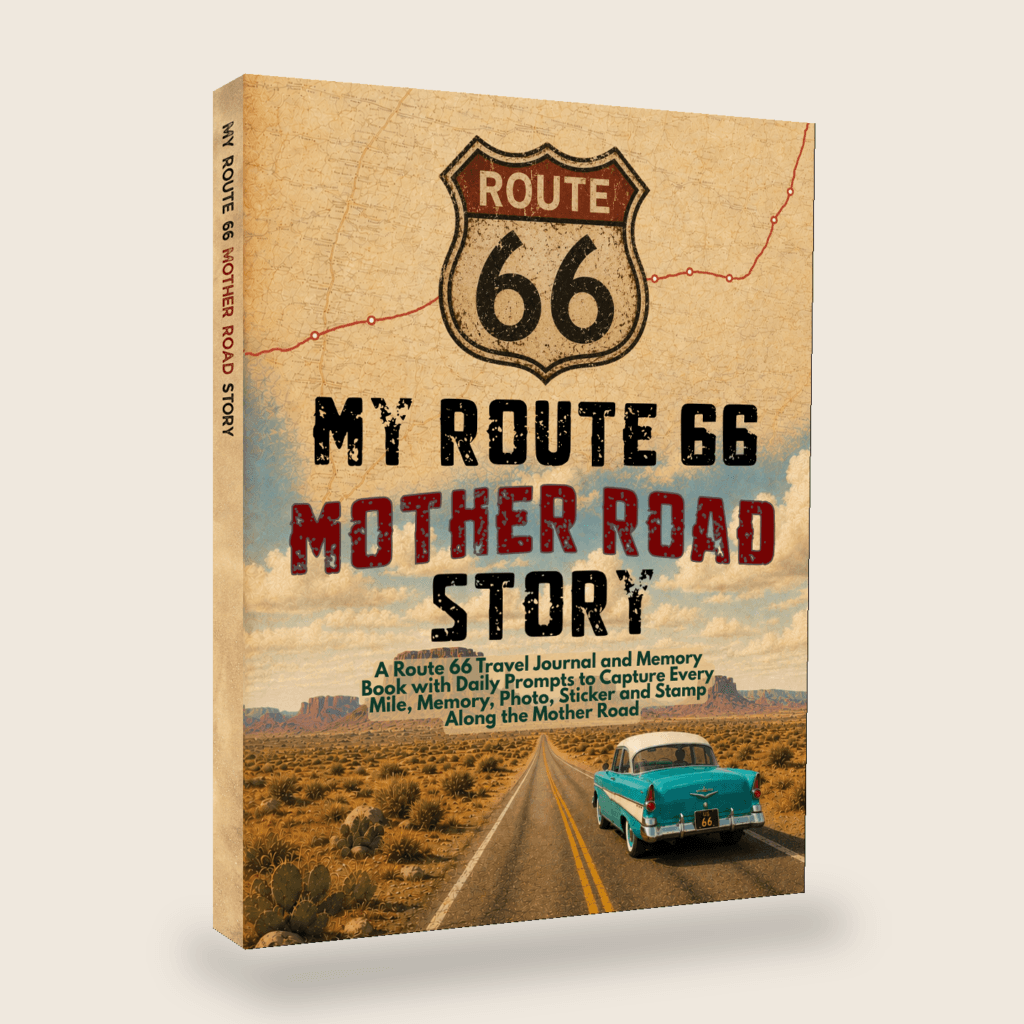
My Route 66 Mother Road Story
A Route 66 Travel Journal and Memory Book with Daily Prompts to Capture Every Mile, Memory, Photo, Sticker, and Stamp Along the Mother Road
Map of Our Route
Route 66 Day Video
Coming soon! Keep an eye on my YouTube channel, and make sure to subscribe and click the bell to be alerted when I post a video!
Popular posts:






Leave a Comment or Suggestion