• Skip to primary navigation
  • Skip to main content
  • Skip to footer
Nutty Hiker Adventures Logo

Nutty Hiker Adventures

Hike Every Hike Like It Is Your Last

  • Hiking >>
    • Hiking Articles
    • Hiking 101 >
      • 10 Essentials of Hiking
      • Types of Hikes
      • Trail Etiquette
      • Hiking Terms & Jargon
      • Hiking First Aid Kit
      • What to Bring On Every Hike
      • Pre Thru-Hike Checklist
      • Hacks to Lighten Your Backpack Weight
      • How to Avoid Norovirus While Backpacking
      • Choosing a Sleeping Bag Liner
      • How to Poop in the Woods
      • Gift Guide for Hikers
      • Books for Hikers & Backpackers
      • Movies About Hiking
      • Subscription Boxes for Hikers
      • Thru-Hiking Trails Bucket List – USA Edition
      • Your Hiking Questions Answered
    • Long Trails >
      • Appalachian Trail
      • BamatoBaxter
      • Greenbrier River Trail
      • Lone Star Hiking Trail
      • Pinhoti Trail
    • Rails To Trails >
      • Greenbrier River Trail
    • Gear Reviews
    • Ask Nutty Hiker
  • Camping >>
    • Camping Articles
    • Camping Gear Reviews
  • Survival >>
    • Survival Articles
    • Survival Gear Reviews
  • Destinations >>
    • By State >>
      • Arizona
      • Arkansas
      • Colorado
      • Georgia
      • Idaho
      • Kansas
      • Kentucky
      • Louisiana
      • Maryland
      • Nevada
      • New Mexico
      • North Dakota
      • Oklahoma
      • Pennsylvania
      • South Dakota
        • Black Hills National Forest
      • Tennessee
      • Texas
        • North Texas
        • Central Texas
          • San Antonio
        • East Texas
        • South Texas
        • West Texas
        • Texas State Parks
        • Guadalupe Mountains National Park
      • Utah
      • Virginia
      • Washington
      • West Virginia
    • The Ultimate Road Trip Checklist || Adventure Safely
    • Road Trips >>
      • The Ultimate Road Trip Checklist || Adventure Safely
      • Road Trip Ideas
    • State Highpoints
    • National Parks & Forests >
      • Black Hills National Forest
      • Guadalupe Mountains National Park
  • Motorcycle >>
    • Sturgis 2024
  • Photography >>
    • Latest Work
    • Photography Gear Reviews
    • Portrait Portfolio
  • ✎ Logbook >>
    • My Daily Antics
    • Ask Nutty Hiker
    • News >>
      • Outdoor News
      • Interviews
    • Resources >>
      • Recommendations
      • The Ultimate Road Trip Checklist || Adventure Safely
      • Hiking Essentials Checklist
      • Morse Code Converter || Send a Message in Morse Code
      • Military Time Converter
      • Message Encryption & Decryption
      • Message Transformer
  • Shop
    • My Artwork
    • Merch Store (T-Shirts & More)
  • Video’s
You are here: Home / Destinations / Oklahoma / Black Mesa – Oklahoma High Point

Black Mesa – Oklahoma High Point

August 25, 2021 by Nutty Hiker Last Modified: January 5, 2026Leave a Comment

We drove from Arizona on our way home to Texas from Arizona State University, where we had just dropped Clayton off for his first year of college. I needed a distraction and really wanted to knock out a high point.

Article Contents

  1. Mountain History
  2. Trailhead
  3. Trip Summary
  4. Reaching the Top
  5. Blazes Along the Way
  6. Highpoint Stats
  7. More Information
    1. Getting There
    2. Red Tape
    3. Parking Area
    4. Accessibility
    5. Quick Facts
  8. Gear I Used/Took
  9. Video

Date Visited: August 18, 2021
Weather Conditions: Sunny & Warm
Temperature: Began 64 degrees and ended at 91 degrees
Elevation: 4975 feet
Blaze Color: None (no Blazes)
Length: 8 Miles Out and Back
Time to Complete: 3 hours and 45 minutes (this includes a 45-minute stop at the top)


Black Mesa Mountain History

Called a geological wonder of the United States, the Black Mesa Plateau is where the Rocky Mountains meet the shortgrass prairie. Long before it was established as Oklahoma’s high point, the area was used by outlaws as a hideout. Outlaws William Coe and Blackjack Ketchum built a fortress named Robbers’ Roost. When ranchers and coal miners moved into the area, the lawlessness subsided, and the area was settled.

In 1991, a private group called the Oklahoma Nature Conservancy purchased the mesa and established the Black Mesa Nature Preserve. The Preserve is roughly 1600 acres and protects roughly 60% of the mesa top.

Oklahoma High Point Trailhead

The trailhead is off Black Mesa Rd, directly across from the second cell phone tower.

Trip Summary

Finding the trailhead was easy. We stopped at the logbook so we could sign our names and realized two other people had also just signed in (or so we thought). It turns out our watches were still on Mountain Time, not Central Time.

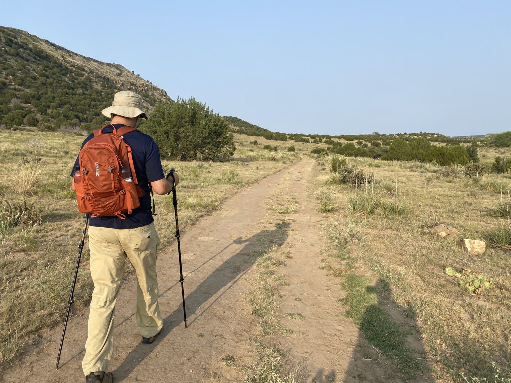
The trail was relatively easy (flat), with only a short “up” stint. The thing that may make this hard for some is the brutal sun, as there is no shade.

Reaching the Top

The trail is flat for the first 2.5 miles before you start a short .5-mile climb to the top of the plateau.

the trail at Black Mesa, Oklahoma high point

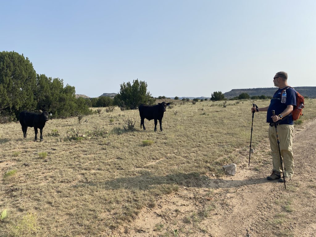
We ran across lots of cows (this is a working ranch that you hike through) that didn’t seem to mind we were there.

looking at the cows on Black Mesa, Oklahoma high point

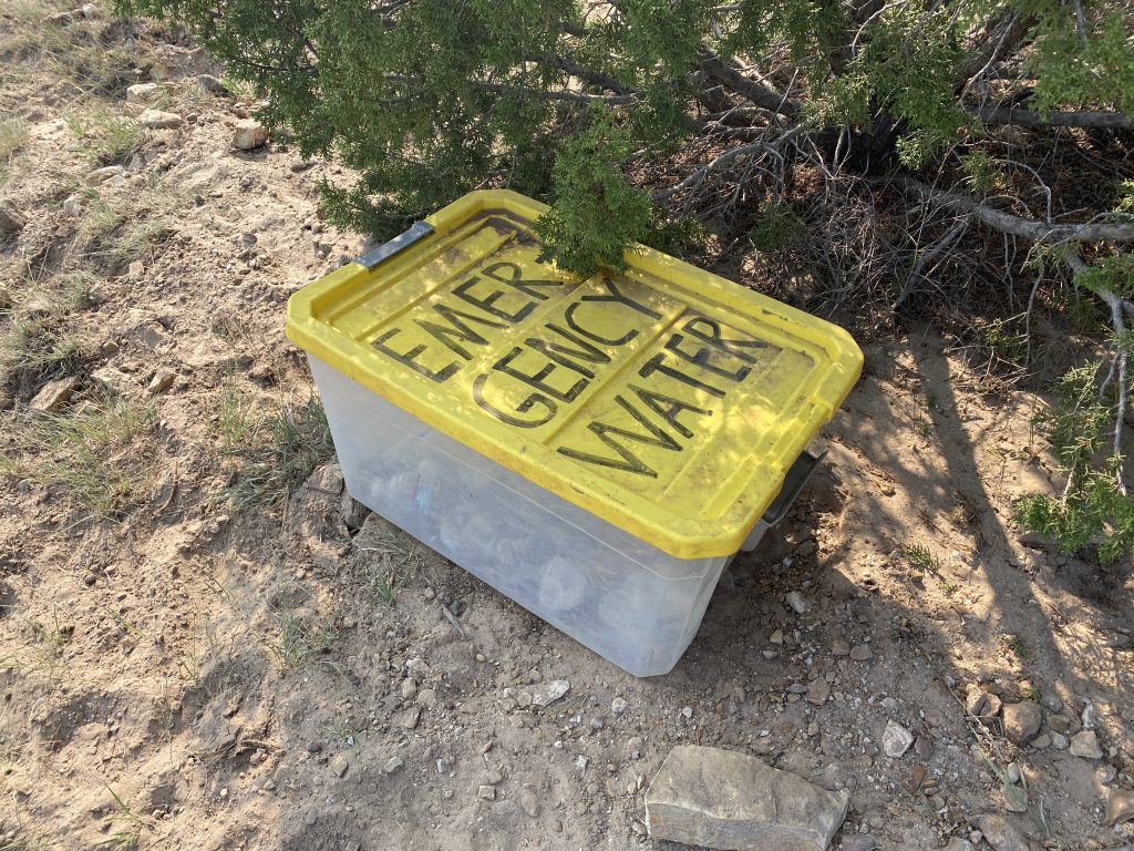
There was a water cache right before you start the climb, but I wouldn’t count on that being there, so make sure you bring enough water to get you to the high point and back.

water cache on Black Mesa, Oklahoma high point

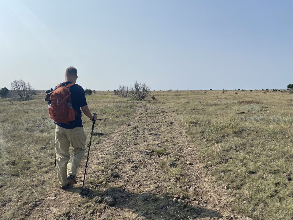
The temperature was just starting to rise as we made our climb in what was about to become the brutal sun. Once we reached the top, the trail seemed to never end. So much so that we thought we actually took a wrong turn somewhere.

hiking on top of Black Mesa, Oklahoma high point

But alas, the Oklahoma high point monument upon Black Mesa came into view.

standing next to the monument on Black Mesa, Oklahoma high point

We took some time to rest at the top before heading back down.

The trek down was horribly hot; thankfully, I brought my trekking umbrella, which provided me some shade. Jerry didn’t, so we ended up sharing it. He now travels with a trekking umbrella, lol.

Blazes Along the Way

There were no blazes along the way unless you count cow patties, and the trail is pretty obvious.

Highpoint Stats

STATE: OklahomaWHEN TO CLIMB: Any Time of the Year
WHEN TO CLIMB: Any Time of the YearPERMIT REQUIRED: No
TYPE: Hike – Round TripFEE: None
LENGTH: 8 milesHOURS OPEN: Dawn to Dusk
DIFFICULTY: ModerateELEVATION GAIN: 774 feet
TYPE OF TERRAIN: Dirt / GravelELEVATION: 4975 feet

More Information

Getting There

From Kenton: Head east on OK-325 E toward Newbert Ave. Turn left onto Black Mesa Rd and go about 4.9 miles. The entrance will be on the left.

Red Tape

  • Only hikers are allowed.
  • The trail is open from dusk until dawn.
  • BRING LOTS OF WATER, especially in the hotter months. The trail is completely open with no shade.

Parking Area

The parking area is located by the trailhead and features a vault toilet.

Accessibility

The road to the trailhead is paved.

Quick Facts

  • Black Mesa is named for the dark pumice found all over the terrain

Gear I Used/Took

BACKPACK: Osprey Manta AG 36TREKKING POLES: Black Diamond Alpine Carbon Cork
PHONE: iPhone 11 Pro PHONE TRIPOD: Joby Grip Tight One

Video


ADDITIONAL RESOURCES

  • Oklahoma Historical Society
  • The Nature Conservancy
  • State Park Website

Disclaimer: These articles are here to serve others as a guide on their own outdoor & travel adventures. You use any advice given on this site at your own risk. Exploring & Hiking Hiking can be risky activities; fatalities and injuries do occur. You assume responsibility when you decide to visit or hike in a particular location. Not all trails, attractions, and travels are safe for everyone. What works for me, may not work for you. Do your own research on gear and destinations before proceeding. Information is accurate at the time of posting and is subject to change at any time.

Filed Under: Oklahoma, Destinations Tagged With: Hiking Trails, State High Point

About Nutty Hiker

Bridget (known as Nutty Hiker on the trail) is a former journalist and newspaper editor turned professional wildlife/landscape photographer and outdoor adventure extraordinaire. She is also the face behind Nutty Hiker Adventures and has been a blogger since 2001! She loves to spend her time out on the trails racking up miles =) You can read more about her here.
FOLLOW: Facebook | TikTok | YouTube

Reader Interactions

Leave a Comment or Suggestion Cancel reply

Your email address will not be published. Required fields are marked *

Footer

FOLLOW

  • Facebook
  • Instagram
  • YouTube
  • RSS Feed
  • Amazon
  • Patreon

TIP JAR =)

This blog is my full-time job. I rely heavily on support from my readers. If you found my content useful and would like to help offset the cost of running this blog and my nutty adventures, please feel free to leave something in one of the tip jars below =)
PayPal
Cash App
Venmo

DISCLOSURE

Per the FTC, This website contains affiliate links, advertisements, and sponsored posts. For reviews, I was provided with a complimentary copy of the item unless otherwise stated. As an Amazon Associate, I earn from qualifying purchases using the amazon links located on my website. Read my full policy here.

AWARDS/ASSOCIATIONS

OWAA Member Logo
Best Outdoor Blogs Feedspot Best Hiking Blogs

Copyright © 2026 — Nutty Hiker Advenures | Bridget Carlson • All rights reserved.
The links on this website are solely for the convenience of our visitors. Nutty Hiker does not endorse, operate, or control external websites.
Terms of Use • Privacy Policy• Disclosure• Contest Rules

  • Home
  • About
  • Subscribe
  • ☕ Support
  • ✉ Contact
  • Blog Archives
  • Recommendations
  • >> Resources